Tulcán Canton

Last updated
Tulcán Canton
Canton
Ecuador Carchi province.svg
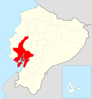
Location of Carchi Province in Ecuador.
Cantones de Carchi.png
Cantons of Carchi Province
Coordinates: 0°48′42″N77°43′7″W / 0.81167°N 77.71861°W / 0.81167; -77.71861
CountryFlag of Ecuador.svg  Ecuador
Province Carchi Province
Capital Tulcán
Time zone ECT (UTC-5)

Tulcán Canton is a canton of Ecuador, located in Carchi Province. Its capital is the city of Tulcán. The population of the canton in the 2001 census was 77,175 [1] and 86,498 in the 2010 census. [2] The area of the canton is 1,801 square kilometres (695 sq mi).

Cantons of Ecuador Ecuador territorial subdivision of a province

The Cantons of Ecuador are the second-level subdivisions of Ecuador, below the provinces. There are 221 cantons in the country, of which three are not in any province. The cantons are further sub-divided into parishes, which are classified as either urban or rural. Below is a list of cantons by province.

Ecuador Republic in South America

Christopher velez de CNCO es de ecuador

Carchi Province Province in Ecuador

Carchi is a province in Ecuador. The capital is Tulcán. The Carchi River rises on the slopes of Chiles volcano and forms the boundary between Colombia and Ecuador near Tulcan. Rumichaca Bridge is the most important land route between Colombia and Ecuador.

Most of the population of the canton is in the Andes, especially in the city and surroundings of Tulcán, but the land area stretches into the Andes foothills to the west. Tulcan has the highest elevation of any city in Ecuador, 2,950 metres (9,680 ft) above sea level. The northern limit of the canton is the border with Colombia with the most important land passage between the two countries at Rumichaca Bridge.

Colombia Country in South America

Colombia, officially the Republic of Colombia, is a sovereign state largely situated in the northwest of South America, with territories in Central America. Colombia shares a border to the northwest with Panama, to the east with Venezuela and Brazil and to the south with Ecuador and Peru. It shares its maritime limits with Costa Rica, Nicaragua, Honduras, Jamaica, Haiti, and the Dominican Republic. Colombia is a unitary, constitutional republic comprising thirty-two departments, with the capital in Bogota.

Rumichaca Bridge

The Rumichaca Bridge is the principal highway passage between Colombia and Ecuador. The bridge is located 3 kilometres (1.9 mi) from the city of Ipiales, Colombia and 7 kilometres (4.3 mi) from the city of Tulcán, Ecuador. The bridge is located in the Andes at an elevation of 2,763 metres (9,065 ft). The Pan-American Highway crosses the bridge.

The canton is sub-divided into ten parishes: El Carmelo (El Pun), El Chical, Julio Andrade (Orejuela), Maldonado, Pioter, Santa Martha de Cuba, Tobar Donoso (La Bocana de Camumbi), Tufiño, Tulcán, and Urbina (Taya). [3]

Demographics

Ethnic groups as of the Ecuadorian census of 2010: [4]

The Ecuadorian census is conducted by the governmental institution known as INEC, Instituto Nacional de Estadisticas y Censos. The census in Ecuador is conducted every 10 years, and its objective is to obtain the number of people residing within its borders. The current census now includes household information.

Mestizo race

Mestizo is a term traditionally used in Spain, Latin America and the Philippines that originally referred to a person of combined European and Indigenous American descent, regardless of where the person was born. The term was used as an ethnic/racial category in the casta system that was in use during the Spanish Empire's control of its American and Asian colonies. Nowadays though, particularly in Spanish America, mestizo has become more of a cultural term, with culturally mainstream Latin Americans regarded or termed as mestizos regardless of their actual ancestry and with the term Indian being reserved exclusively for people who have maintained a separate indigenous ethnic identity, language, tribal affiliation, etc. Consequently, today, the vast majority of Spanish-speaking Latin Americans are regarded as mestizos.

Indigenous peoples in Ecuador

Indigenous peoples in Ecuador, also Native Ecuadorians or Native Americans, are the groups of people who were present in what became Ecuador before the Spanish colonization of the Americas. The term also includes their descendants from the time of the Spanish conquest to the present. Their history, which encompasses the last 11,000 years, reaches into the present; 25 percent of Ecuador's population is of indigenous heritage, while another 70 percent is of mixed indigenous and European heritage.

Afro-Ecuadorians are an ethnic group in Ecuador who are descendants of formerly enslaved Africans brought by the Spanish during their conquest of Ecuador from the Incas. They make up from 7% to 10% of Ecuador's population.

Related Research Articles

Guayas Province Province in Ecuador

Guayas is a coastal province in Ecuador. It is bordered to the west by Manabí, Santa Elena, and the Pacific Ocean ; to the east by Los Ríos, Bolívar, Chimborazo, Cañar, and Azuay; to the north by Los Ríos and Bolívar; and to the south by El Oro and the Pacific Ocean.

La Esperanza is a town and parish in northern Ecuador in Imbabura Province, Ibarra Canton. It lies at the north-eastern foot of Mount Imbabura volcano about 7 kilometres (4.3 mi) in straight line distance south of the city of Ibarra.

Cotacachi Canton canton of Imbabura province, Ecuador

Cotacachi is a canton of Imbabura province of Ecuador in South America. The name also refers to the city which is the seat of that canton, one of Ecuador's leading artisanal manufacturers of leather goods, and to the dormant Cotacachi Volcano which overlooks the canton.

Tulcán Place in Carchi, Ecuador

Tulcán is the capital of the province of Carchi in Ecuador and the seat of Tulcán Canton. The population of the city of Tulcán was 47,359 in the 2001 cenesus and 53,558 in the 2010 census. Tulcán is known for its hot springs, deep wells, 3-acre topiary garden cemetery, the most elaborate topiary in the New World, created with Cupressus sempervirens by José Maria Azael Franco in 1936. The city is the highest in Ecuador, at 2,950 m (9,680 ft) above sea level.

Piñas is a canton in the El Oro Province, Ecuador. Its seat is Piñas. It is also known as the "Orchid of The Andes" because of the many orchids grown nearby. The town was named Piñas by Juan de Loayza, in honor of his homeland Piñas in Spain. It is located 1,126 metres above sea-level.

Pimampiro Place in Imbabura, Ecuador

Pimampiro, also Pimampiru, is the seat of Pimampiro Canton, Imbabura Province, Ecuador. The city is located at an elevation of 2,163 metres (7,096 ft). It had a population of 8,192 in the 2001 census and 9,077 in 2010.

San Gabriel, Ecuador Place in Carchi, Ecuador

San Gabriel is a name of the capital city of San Gabriel parish in Montúfar Canton in Carchi Province of Ecuador. The city and parish are located in the Andes. The city has an elevation of 2,878 metres (9,442 ft) above sea level.

Bolívar Canton, Carchi Canton in Carchi Province, Ecuador

Bolívar Canton is a canton of Ecuador, located in Carchi Province. Its capital is the town of Bolívar. Its population at the 2001 census was 13,898 and in 2010 was 14,347.

Espejo Canton Canton in Carchi, Ecuador

Espejo is a canton of Ecuador, located in Carchi Province. Its capital is the town of El Ángel. Its population in the 2001 census was 13,515 and in the 2010 census was 13,364. Espejo is in the Andes and El Angel has an elevation of 3,010 metres (9,880 ft) above sea level.

Mira Canton Canton in Carchi Province, Ecuador

Mira Canton is a canton of Ecuador, located in Carchi Province. Its capital is the town of Mira. Its population in the 2001 census was 12,919 and was 12,180 in the 2010 census. The area is 588 square kilometres (227 sq mi).

Montúfar Canton Canton in Carchi Province, Ecuador

Montúfar Canton is a canton of Ecuador, located in Carchi Province. Its capital is the city of San Gabriel. The canton's population in the 2001 census was 28,576 and was 30,511 in the 2010 census.

San Pedro de Huaca Canton Canton in Carchi Province, Ecuador

San Pedro de Huaca Canton is a canton of Ecuador, located in Carchi Province. Its capital is the town of Huaca. Its population in the 2001 census was 6,856 and in 2010 was 7,624. The area is 31 square kilometres (12 sq mi).

Antonio Ante Canton Canton in Imbabura Province, Ecuador

Antonio Ante Canton is a canton of Ecuador, located in Imbabura Province. Its population at the 2001 census was 36,053. and increased to 43,518 in the 2010 census. The canton has an area of 81 square kilometres (31 sq mi).

Ibarra Canton Canton in Imbabura Province, Ecuador

Ibarra Canton is a canton of Ecuador, located in Imbabura Province. Its capital is the town of Ibarra. Its population in the 2001 census was 153,256 and 181,175 in the 2010 census. The area of the canton is 1,093 square kilometres (422 sq mi).

Pimampiro Canton Canton in Imbabura Province, Ecuador

Pimampiro Canton is a canton of Ecuador, located in Imbabura Province. Its population in the 2001 census was 12,951 and 12,970 in the 2010 census.

San Miguel de Urcuquí Canton Canton in Imbabura Province, Ecuador

San Miguel de Urcuquí Canton, or Urkuki, is a canton of Ecuador, located in the Imbabura Province. Its seat is the town of Urcuquí. Its population in the 2001 census was 14,381 and was 15,671 in the 2010 census. The area of the canton is 779 square kilometres (301 sq mi).

Baños Canton Canton in Tungurahua Province, Ecuador

Baños Canton is a canton of Ecuador, located in the Tungurahua Province. Its capital is the town of Baños. Its population at the 2010 census was 20,018. The population of Banos in 2011 was 21,140

Saraguro city in Ecuador

Saraguro is the capital of Saraguro Canton in Loja Province, Ecuador. Saraguro parish has an area of 74.14 square kilometres (74,140,000 m2). The population of the parish increased from 7,346 in 2001 to 9,045 in 2010. Saraguro town had a population of 3,124 in 2001 and 4,031 in 2010 and hsd an elevation of 2,719 metres (8,921 ft).

References

  1. Cantons of Ecuador at statoids.com
  2. "Ecuador: Municipal Division", https://www.citypopulation.de/php/ecuador-parish-admin.php, accessed 13 Jul 2017
  3. "Ecuador: Municipal Division", https://www.citypopulation.de/php/ecuador-parish-admin.php, accessed 13 July 2017