El Empalme Canton

Last updated
El Empalme Canton
Canton
Ecuador Guayas province.svg
Location of Guayas in Ecuador.
MapaSageo-Guayas-02.png
Cantons of Guayas Province
CountryFlag of Ecuador.svg  Ecuador
Province Guayas Province
Capital El Empalme
Time zone ECT (UTC-5)

El Empalme Canton is a canton of Ecuador, located in the Guayas Province. Its capital is the town of El Empalme. Its population at the 2001 census was 64,789. [1]

Cantons of Ecuador Ecuador territorial subdivision of a province

The Cantons of Ecuador are the second-level subdivisions of Ecuador, below the provinces. There are 221 cantons in the country, of which three are not in any province. The cantons are further sub-divided into parishes, which are classified as either urban or rural. Below is a list of cantons by province.

Ecuador Republic in South America

Ecuador, officially the Republic of Ecuador, is a country in northwestern South America, bordered by Colombia on the north, Peru on the east and south, and the Pacific Ocean to the west. Ecuador also includes the Galápagos Islands in the Pacific, about 1,000 kilometres (620 mi) west of the mainland. The capital city is Quito and the largest city as well.

Guayas Province Province in Ecuador

Guayas is a coastal province in Ecuador. It is bordered to the west by Manabí, Santa Elena, and the Pacific Ocean ; to the east by Los Ríos, Bolívar, Chimborazo, Cañar, and Azuay; to the north by Los Ríos and Bolívar; and to the south by El Oro and the Pacific Ocean.

Demographics

Ethnic groups as of the Ecuadorian census of 2010: [2]

The Ecuadorian census is conducted by the governmental institution known as INEC, Instituto Nacional de Estadisticas y Censos. The census in Ecuador is conducted every 10 years, and its objective is to obtain the number of people residing within its borders. The current census now includes household information.

Mestizo race

Mestizo is a term traditionally used in Spain, Latin America and the Philippines that originally referred to a person of combined European and Indigenous American descent, regardless of where the person was born. The term was used as an ethnic/racial category in the casta system that was in use during the Spanish Empire's control of its American and Asian colonies. Nowadays though, particularly in Spanish America, mestizo has become more of a cultural term, with culturally mainstream Latin Americans regarded or termed as mestizos regardless of their actual ancestry and with the term Indian being reserved exclusively for people who have maintained a separate indigenous ethnic identity, language, tribal affiliation, etc. Consequently, today, the vast majority of Spanish-speaking Latin Americans are regarded as mestizos.

Montubio

Montubio are a mestizo people of the countryside of coastal Ecuador. The Montubio make up 7.4% of the country's population and were recognized as a distinct ethnicity by the government in the spring of 2001 after protests that included protracted hunger strikes. The Council for the Development of the Montubio People of the Ecuadorian Coast and Subtropical Zones of the Littoral Region (CODEPMOC) was granted official status and government funding.

Afro-Ecuadorians are an ethnic group in Ecuador who are descendants of formerly enslaved Africans brought by the Spanish during their conquest of Ecuador from the Incas. They make up from 7% to 10% of Ecuador's population.

Related Research Articles

El Oro Province Province in Ecuador

El Oro is the southernmost of Ecuador's coastal provinces. It was named for its historically important gold production. Today it is one of the world's major exporters of bananas. The capital is Machala.

Los Ríos Province Province in Ecuador

Los Ríos is a province in Ecuador. The capital is Babahoyo. The province was founded on October 6, 1860. Under legislative decree. Babahoyo was made its capital on September 30, 1948.

Balsas Canton canton of El Oro province, Ecuador

Balsas is a canton in El Oro Province, Ecuador. Its seat is Balsas.

Piñas is a canton in the El Oro Province, Ecuador. Its seat is Piñas. It is also known as the "Orchid of The Andes" because of the many orchids grown nearby. The town was named Piñas by Juan de Loayza, in honor of his homeland Piñas in Spain. It is located 1,126 metres above sea-level.

Celica Canton canton of Loja province, Ecuador

Celica is a canton in Loja Province, Ecuador. Its seat is Celica. The canton is located in the west of the province and is bordered by the cantons of Puyango and Paltas in the north, Sozoranga in the east, Macará in the south, and Pindal and Zapotillo in the west. It covers 517.8 km² at an altitude of 2500 m.

Chaguarpamba Canton canton of Loja province, Ecuador

Chaguarpamba is a canton in the Province of Loja Ecuador. Its seat is Chaguarpamba. The canton is located in the north of the province and is bordered by the cantons of Catamayo, Olmedo, Paltas, and the province of El Oro. The name is Quichua for "Valley of Jaguars." It occupies an area of 311.7 km² at an altitude of 1050 m, with a population of 10,403. Average temperature is between 18 and 24° C

Gonzanamá is a canton in the Province of Loja, Ecuador. It is located in the south-east of the province, bordered by the cantons of Catamayo, Loja, Quilanga, Calvas, and Paltas. It is the "agricultural, farming, and craftsmanship capital of Loja." Gonzanamá covers 1272 km² at an altitude of 2045 m, with a population of 17,276. The principal town is Gonzanama.

Daule Canton Canton in Bolívar Province, Ecuador

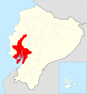
Daule, also known as Villa Daule, is a canton located in the Guayas province in Ecuador. Created in 1820, it is one of the most important parts of Guayas thanks to its rice production and other products such as corn and eggs.

Santa Elena Province Province in Ecuador

The Province of Santa Elena is a province of Ecuador in the coastal region. Created in 2007 from territory that belonged to the Guayas Province, it is one of the two newest provinces of Ecuador, along with Santo Domingo de Los Tsáchilas. Its capital city is Santa Elena, from which the province derives its name.

El Pan Canton Canton in Azuay Province, Ecuador

El Pan Canton is a canton of Ecuador, located in the Azuay Province. Its capital is the town of El Pan. Its population at the 2001 census was 3,075.

Pucará Canton Canton in Azuay Province, Ecuador

Pucará Canton is a canton of Ecuador, located in the Azuay Province. Its capital is the town of Pucará. Its population at the 2001 census was 20,382.

Santa Isabel Canton Canton in Azuay Province, Ecuador

Santa Isabel Canton is a canton of Ecuador, located in the Azuay Province. Its capital is the town of Santa Isabel. Its population at the 2001 census was 18,015.

Las Lajas Canton Canton in El Oro Province, Ecuador

Las Lajas Canton is a canton of Ecuador, located in the El Oro Province. Its capital is the town of La Victoria. Its population at the 2001 census was 4,781.

Portovelo Canton Canton in El Oro Province, Ecuador

Portovelo Canton is a canton of Ecuador, located in the El Oro Province. Its capital is the town of Portovelo. Its population at the 2001 census was 11,024.

Salitre Canton Canton in Guayas Province, Ecuador

Salitre Canton is a canton of Ecuador, located in the Guayas Province. Its capital is the town of Salitre. Its population at the 2001 census was 50,379.

Santa Lucía Canton Canton in Guayas Province, Ecuador

Santa Lucía Canton is a canton of Ecuador, located in the Guayas Province. Its capital is the town of Santa Lucía. Its population at the 2001 census was 33,868.

Simón Bolívar Canton Canton in Guayas Province, Ecuador

Simón Bolívar Canton is a canton of Ecuador, located in the Guayas Province. Its capital is the town of Simón Bolívar. Its population at the 2001 census was 20,385.

Macará Canton Canton in Loja Province, Ecuador

Macará Canton is a canton of Ecuador, located in the Loja Province. Its capital is the town of Macará. Its population at the 2001 census was 18,350.

Baba Canton Canton in Los Ríos Province, Ecuador

Baba Canton is a canton of Ecuador, located in the Los Ríos Province. Its capital is the town of Baba. Its population at the 2001 census was 35,185.

References

  1. Cantons of Ecuador at statoids.com

Coordinates: 1°02′46″S79°38′01″W / 1.04611°S 79.63361°W / -1.04611; -79.63361

Geographic coordinate system Coordinate system

A geographic coordinate system is a coordinate system that enables every location on Earth to be specified by a set of numbers, letters or symbols. The coordinates are often chosen such that one of the numbers represents a vertical position and two or three of the numbers represent a horizontal position; alternatively, a geographic position may be expressed in a combined three-dimensional Cartesian vector. A common choice of coordinates is latitude, longitude and elevation. To specify a location on a plane requires a map projection.