
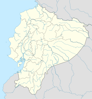
Ecuadorians are people identified with Ecuador, a country in South America, its citizens or their descendants abroad who identify with the Ecuadorian culture and descent. Ecuador is a multiethnic society, a home to people of various ethnic origins; as a result, Ecuadorians do not equate their nationality with their ethnicity, but rather their allegiance or affinity for Ecuador. Majority of Ecuadorians trace their origins to one or more of three geographical sources of human migrations to the territory of modern Ecuador: the pre-Hispanic indigenous populations who settled the region over 15,000 years ago, the Europeans who arrived over five centuries ago, and ultimately the sub-Saharan Africans who were imported to New Spain as slaves during the same period. The mixing of two or more of these three groups established other mixed ethnic groups.

Quito is the capital and the largest city of Ecuador, and at an elevation of 2,850 metres (9,350 ft) above sea level, it is the second-highest official capital city in the world, after La Paz, and the one which is closest to the equator. It is located in the Guayllabamba river basin, on the eastern slopes of Pichincha, an active stratovolcano in the Andes Mountains. With a population of 2,671,191 according to statistical projections (2019), Quito is the most populous city in Ecuador. It is also the capital of the Pichincha province and the seat of the Metropolitan District of Quito. The canton recorded a population of 2,239,191 residents in the 2010 national census. In 2008, the city was designated as the headquarters of the Union of South American Nations.

Colombia is a unitary republic made up of thirty-two departments and a Capital District. Each department has a Governor (gobernador) and a Department Assembly, elected by popular vote for a four-year period. The governor cannot be re-elected in consecutive periods. Departments are country subdivisions and are granted a certain degree of autonomy.
The Tsachila, also called the Colorados, are an indigenous people of the Ecuadorian province of Santo Domingo. Their native language is Tsafiki, a member of the Barbacoan linguistic family, and translates to mean "true word".

Salinas is a coastal city located in the Province of Santa Elena, Ecuador. It is the seat of the canton that bears its name. The westernmost city on mainland Ecuador, Salinas is an important tourist center. Salinas, Ecuador's largest coastal resort, offers one of the country's best real estate investment markets and most popular and most upscale beach lifestyle. Recently, Salinas was the center of controversy during the contentious "more fun, less sun," debate. It was the site of the ISA World Junior Surfing Games Ecuador in 2009. There are two major yacht clubs in Salinas, the first is Salinas Yacht Club, which is a good bit smaller than the Puerto Lucia Yacht Club, in Santa Elena, in an area known as 'La Libertad' which, in Spanish means; 'The Freedom Town'. Puerto Lucia boasts a hotel, several restaurants to eat, a private beach and apartment block buildings, as well as the large marina and port.

Mina, officially the Municipality of Mina, is a 5th class municipality in the province of Iloilo, Philippines. According to the 2015 census, it has a population of 23,546 people.
Babahoyo, founded September 30, 1948, by legislative decree, is the capital of the Los Ríos province of Ecuador. Its population is cited around 153,000. It is bordered by two rivers, the San Pablo and the Caracol, which join to form the Babahoyo River. This meets the Daule River to form the Guayas River, which runs to the Pacific Ocean at the Gulf of Guayaquil.

The territorial dispute between Ecuador and Peru was the source of the longest-running international armed conflict in the Western Hemisphere. This dispute was a consequence of each country's interpretation of what Real Cedulas Spain used to precisely define its colonial territories in the Americas. After independence all of Spain's colonial territories signed and agreed to proclaim their limits in the basis of the principle uti possidetis juris which accepts the Spanish colonial borders of 1810 as the borders of the new republics. Thus the borders of Gran Colombia which included Ecuador, Colombia and Venezuela would follow the borders of the Viceroyalty of New Granada, and Peru the Viceroyalty of Peru in 1810. However, Peru was not satisfied with this and tried to set the date of her Uti Possitedis to 1824- a time when Peru was officially independent with territories Peru militarily occupied since 1820. Tumbes and Jaen de Bracamoros, to which Peru had no colonial titles, were territories that declared their independence in 1820 and were militarily occupied by Peruvian patriot forces that convinced the people in these territories to join Peru. Because of this, Peru claims that part of its western territorial borders where it lacks title is derived from free determination of its people in the border areas after independence. In the eastern section known as Maynas or Mainas, which was the sparsely inhabited and entirely Amazon Basin, Peru bases its legal claims on the disputed Real Cedula of 1802. Gran Colombia which declared independence 2 years earlier in 1819 and helped to liberate Peru in the Battle of Junin and Ayacucho bases its rights on the clear and undisputed Real Cedulas of 1717, 1739 and 1740 and declares that the Real Cedula of 1802 is not political in nature, but was meant only for ecclesiastical and military jurisdiction.

The Diocese of Segorbe-Castellón is a Roman Catholic ecclesiastical territory located in north-eastern Spain, in the province of Castellón, part of the autonomous community of Valencia. The diocese forms part of the ecclesiastical province of Valencia, and is thus suffragan to the Archdiocese of Valencia.

Esparza is the second canton in the province of Puntarenas in Costa Rica. The canton covers an area of 216.80 km², and has a population of 34,291. Its capital city is also called Esparza.

Buena Fe a city in Los Ríos Province, Ecuador. Its history dates back to 1943 when settlers arrived and Medardo Rosa Espinoza Cabezas Figueroa Carrillo rented a village in what is now the Las Vegas, where they set up a shop which gave the name of Buena Fe . Over the years the name became generic, and others soon built their homes in the surrounding areas, gradually forming the village. Having reached a relative development, by decree No. 174 of October 11, 1979 Buena Fe was built as a rural parish of Quevedo Canton, to which it belonged until 1992, when a pro cantonization committee chaired by Gilberto Salinas got the Whole Standing Legislative Committees issued the decree in question, which after being signed by President Rodrigo Borja Cevallos was published in Official Gazette No. 995 of 7 August. Earnest jurisdiction extends in a very fertile and rich, which has taken a big boost agro-industry, especially in the production of beef, cocoa, coffee, oil palm and a variety of fruits. Buena Fe is the rural district of parish Patricia Pilar and sections of San Francisco, Cuatro Mangas, La Reserva, Fumisa, 24 de Mayo, Glance, La Catorce, Pechiche, Los Angeles and Zulema.

La Maná is a town in the Cotopaxi Province of Ecuador. It is the seat of the La Maná Canton.La Maná, is one of seven canton of the Cotopaxi Province in Ecuador. La Maná is not only a canton but also is the name the main town. It has a total area of 66,258 acres. It is the sixth canton of the province of Cotopaxi. The origin of La Mana has its mysteries and charms. La Mana, is derived from LANG MANA ATTI which means “mine of great king”. It is named that because of its abundance of gold and other minerals in the subsoil. The “Colorado” word (safiqui) MANA means “beautiful, big” which is attributed to the fertility of the land. La Mana was inhabited by the Tsachilas or “Los Colorados”. In the sector, many vestiges of their presence have been discovered, such as pieces of clay, zoomorphic statuettes with ornaments, and clay pots, where presumably, they melted metals like the gold that abounded in the mountains. The legislative Committee of Civil and Penal Law sent a bill for the creation of the canton La Maná, in the Cotopaxi Province. On May 19, 1986, under the government of León Febres Cordero, La Maná became a canton. In the canton, there is a monument to commemorate Carlos Lozada Quintana, who owned the La Merced Hacienda. He donated the lands for plazas, parks, streets, schools, and indispensable services for the community´s welfare. La Mana, unlike other towns, is a settlement town by people who came from different parts of the country. They all brought their customs and traditions with them. Its immense forests, its gigantic plantations of banana, orito, yucca, cocoa, tobacco and coffee, as well as its strategic geographic location and its auriferous wealth, confer special characteristics that favor its development and has a leading role in Ecuadorian economy.

Puyo, also known as El Puyo, is the capital of Pastaza, a province in Ecuador. Puyo is located at an altitude of approximately 950 AMSL by the Puyo River, a tributary of the Pastaza River, which eventually leads into the Amazon River. True to its name, derived from the Kichwa word for "cloudy", the local climate is a wet one and the weather is often overcast.
Chone is a town in the province of Manabi in Ecuador. Officially, La Real Santisíma Villa Rica de la Bendita Providencia de San Cayetano de Chone de esta nuestra Nueva Castilla in reference to Saint Cajetan and The City of Kings, called Pueblo Viejo de Chone or Señorío de Pechance was founded in the early days of the colonization. It's located in the Ecuador's low-lying coastal region and plays an important CHONE transportation hub. It is about 7 hours by bus from the capital city of Quito.

Canatlán is one of the 39 municipalities of Durango, in northwestern Mexico. The municipal seat lies at Ciudad Canatlán. The municipality covers an area of 4686.1 km².
Puchuncaví is a town and commune in the Valparaíso Province of central Chile's fifth region of Valparaíso. It spans a coastal area of 299.9 km2 (116 sq mi).
Gonzanamá is a small town and also part of one of the 16 cantons (Gonzanamá) in Loja Province, Ecuador.
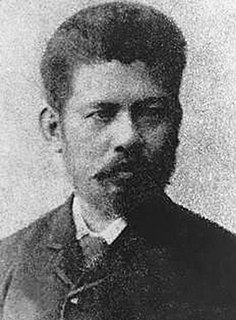
Marcelo H. del Pilar, better known by his pen name Plaridel, was a Filipino writer, lawyer, journalist, and freemason. Del Pilar, along with José Rizal and Graciano López Jaena, became known as the leaders of the Reform Movement in Spain.
Girón is a town and parish in Azuay Province, Ecuador. The town has 3,518 residents, and the Girón Canton as a whole has 12,583 residents.

Guachapala is a canton in the province of Azuay, Ecuador, was created in the presidency of the Architect Sixto Durán Ballén according to the Supplement to Official Gazette No. 623 of January 31, 1995. According to the last census conducted by the INEC, its population is approximately 3409 people, is famous for the religious shrine of Lord Andacocha, so many tourists get religious.
Canton in the province of Los Ríos. The history of this county dates back to 1943 when the purpose of settling in the area arrived and Mr. Medardo Rosa Espinoza Cabezas Figueroa Carrillo, who rented a villa in what is now the Las Vegas, where they set up shop which gave the name of Good Faith Over the years the name became generic and others were soon built their homes in the surrounding areas gradually formed the village. Having reached a relative development, by decree No. 174 of October 11, 1979 Buena Fe was built as a rural parish Quevedo Canton, to which it belonged until 1992, when a pro cantonization committee chaired by Mr. Gilberto Salinas got the Whole Standing Legislative Committees issued the decree in question, which after being signed by the President, Dr. Rodrigo Borja, was published in Official Gazette No. 995 of 7 August. Earnest jurisdiction extends in a very fertile and rich, which has taken a big boost agro-industry, especially in the production of beef, cocoa, coffee, oil palm and fruit variety. Buena Fe belong to the district rural parish Patricia Pilar and sections of San Francisco, Four Mangas, La Reserva, Fumisa, May 24, Glance, The Fourteen, Pechiche, Los Angeles and Zulema.


