
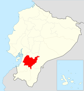
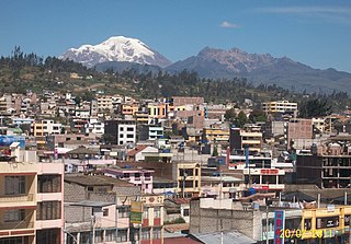
Chimborazo is a province in the central Ecuadorian Andes. It is a home to a section of Sangay National Park. The capital is Riobamba. The province contains Chimborazo, Ecuador's highest mountain.

Los Ríos is a province in Ecuador. The capital is Babahoyo. The province was founded on October 6, 1860. Under legislative decree. Babahoyo was made its capital on September 30, 1948.

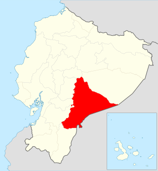
Pastaza is a province in the Oriente of Ecuador located in the eastern jungle. The capital is Puyo, founded on May 12, 1899, with a population of 33,325. The city is now accessible by paved roads, a recent development; the main road from Baños follows the Pastaza river into the province.

Arajuno is a jungle community in the Ecuadorian rainforest. It is also a Canton in the Pastaza Province. It is located on the Arajuno River, a tributary of the Curaray. The area is inhabited by Quichua Indians.

The Province of Santa Elena is a province of Ecuador in the coastal region. Created in 2007 from territory that belonged to the Guayas Province, it is one of the two newest provinces of Ecuador, along with Santo Domingo de Los Tsáchilas. Its capital city is Santa Elena, from which the province derives its name.
El Pan Canton is a canton of Ecuador, located in the Azuay Province. Its capital is the town of El Pan. Its population at the 2001 census was 3,075.
Sevilla de Oro Canton is a canton of Ecuador, located in the Azuay Province. Its capital is the town of Sevilla de Oro. Its population at the 2001 census was 5,234.

Bolívar Canton is a canton of Ecuador, located in Carchi Province. Its capital is the town of Bolívar. Its population at the 2001 census was 13,898 and in 2010 was 14,347.
San Pedro de Huaca Canton is a canton of Ecuador, located in Carchi Province. Its capital is the town of Huaca. Its population in the 2001 census was 6,856 and in 2010 was 7,624. The area is 31 square kilometres (12 sq mi).

El Empalme Canton is a canton of Ecuador, located in the Guayas Province. Its capital is the town of El Empalme. Its population at the 2001 census was 64,789.
Santa Lucía Canton is a canton of Ecuador, located in the Guayas Province. Its capital is the town of Santa Lucía. Its population at the 2001 census was 33,868.

Macará Canton is a canton of Ecuador, located in the Loja Province. Its capital is the town of Macará. Its population at the 2001 census was 18,350.

Baba Canton is a canton of Ecuador, located in the Los Ríos Province. Its capital is the town of Baba. Its population at the 2001 census was 35,185.

Chone Canton is a canton of Ecuador, located in the Manabí Province. Its capital is the town of Chone. Its population at the 2001 census was 117,634.
Jipijapa Canton is a canton of Ecuador, located in the Manabí Province. Its capital is the town of Jipijapa. Its population at the 2001 census was 65,796.

Montecristi Canton is a canton of Ecuador, located in the Manabí Province. Its capital is the town of Montecristi. Its population at the 2001 census was 43,400.
Huamboya Canton is a canton of Ecuador, located in the Morona-Santiago Province. Its capital is the town of Huamboya. Its population at the 2001 census was 5,965.

Pablo Sexto Canton is a canton of Ecuador, located in the Morona-Santiago Province. Its capital is the town of Pablo Sexto. Its population at the 2001 census was 1,188.
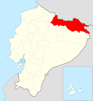
Cascales Canton is a canton of Ecuador, located in the Sucumbíos Province. Its capital is the town of Cascales. Its population at the 2001 census was 7,409.
Pelileo Canton is a canton of Ecuador, located in the Tungurahua Province. Its capital is the town of Pelileo. Its population at the 2001 census was 48,988.


