West Virginia is a state in the Appalachian, Mid-Atlantic and Southeastern regions of the United States. It is bordered by Pennsylvania to the northeast, Maryland to the east and northeast, Virginia to the southeast, Kentucky to the southwest, and Ohio to the northwest. West Virginia is the 41st-largest state by area and ranks 38th in population, with a population of 1,795,045 residents. The capital and largest city is Charleston.

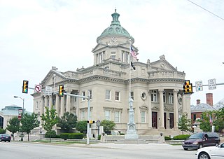
Somerset County is a county located in the U.S. state of Pennsylvania. As of the 2010 census, the population was 77,742. Its county seat is Somerset. The county was created from part of Bedford County on April 17, 1795, and named after the county of Somerset in England.

Davie County is a county located in the U.S. state of North Carolina. As of the 2010 census, the population was 41,240. Its county seat is Mocksville.

Scouting in West Virginia has a long history, from the 1910s to the present day, serving thousands of youth in programs that suit the environment in which they live.

Addison Township is a township in Somerset County, Pennsylvania, United States. The population was 1,019 at the 2000 census. It is part of the Johnstown, Pennsylvania, Metropolitan Statistical Area. The township is named for Alexander Addison, the first president judge overseeing Somerset County.

Lower Turkeyfoot Township is a township in Somerset County, Pennsylvania, United States. The population was 672 at the 2000 census. It is part of the Johnstown, Pennsylvania, Metropolitan Statistical Area.

Upper Turkeyfoot Township is a township in Somerset County, Pennsylvania, United States. The population was 1,232 at the 2000 census. It is part of the Johnstown, Pennsylvania, Metropolitan Statistical Area.

Romney is a city in and the county seat of Hampshire County, West Virginia, United States. The population was 1,848 at the 2010 census.

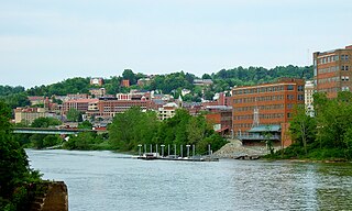
Morgantown is the county seat of Monongalia County, West Virginia, United States, situated along the Monongahela River. West Virginia University is located in the city. The population was 29,660 at the 2010 Census Bureau, making Morgantown the largest city in North-Central West Virginia. The Morgantown metropolitan area has a population of 138,176.

Lane Stadium is a college football stadium in the eastern United States, located on the campus of Virginia Polytechnic Institute and State University in Blacksburg, Virginia. The playing surface of the stadium is named Worsham Field. The home field of the Virginia Tech Hokies of the Atlantic Coast Conference (ACC), it was rated the number one home field advantage in all of college football in 2005 by Rivals.com. In 2007, it was ranked #2 on ESPN.com's "Top 10 Scariest Places To Play." The stadium is named for Edward Hudson Lane, a former student, local businessman, and Virginia Tech booster, while the playing surface is named for Wes Worsham, a university donor and booster.
Turkeyfoot is an unincorporated community in North Carolina, United States. It is located on the Davie County and Iredell County line.
Tearcoat Creek is an 18.3-mile-long (29.5 km) free-flowing tributary stream of the North River, itself a tributary of the Cacapon River, making it a part of the Potomac River and Chesapeake Bay watersheds. The creek is located in central Hampshire County, West Virginia. Its name is believed to have been derived from the tearing of the coats of British soldiers by low-hanging branches as they forded the stream during either the French and Indian or the American Revolutionary Wars.

The Casselman River is a 56.5-mile-long (90.9 km) tributary of the Youghiogheny River in western Maryland and Pennsylvania in the United States. The Casselman River drains an area of 576 square miles.
Pennsylvania Route 281 is a 45.8-mile-long (73.7 km) state highway located in Fayette and Somerset counties in Pennsylvania. The southern terminus is the West Virginia state line near Markleysburg, where the road becomes West Virginia Route 26. The northern terminus is at U.S. Route 30 in Stoystown.
Kentucky Route 1303 is a 6.397-mile-long (10.295 km) state highway in Kenton County, Kentucky. The southern terminus of the route is at KY 536 in Independence. The northern terminus is at U.S. Route 25, U.S. Route 42 and U.S. Route 127 in Lakeside Park. On its way to KY 536 it goes through many towns. These towns include Edgewood, Erlanger, and Florence. The southernmost segment of the route is named Bristow Road, a moniker carried by KY 536 east of KY 1303. At Richardson Road in Independence, KY 1303 becomes Turkeyfoot Road, a name the route retains to its northern terminus.

The 51st Pennsylvania House of Representatives District is in Southwest Pennsylvania and has been represented by Matt Dowling since 2016.

The Turkeyfoot Valley Area School District is a small, rural school district located in the Southwestern portion of Somerset County, Pennsylvania. The school district serves the municipalities of Addison, Addison Township, Confluence, Lower Turkeyfoot Township and Ursina. It encompasses approximately 102 square miles. According to 2000 federal census data, it serves a resident population of 3,093. As of 2009, the per capita income was $14,042 while the median family income was $31,825. Per school district officials, in school year 2007-08 the Turkey Valley Area School District provided basic educational services to 399 pupils through the employment of 39 teachers, 3 full-time and part-time support personnel, and 2 administrators.

The North River is a tributary of the Cacapon River, belonging to the Potomac River and Chesapeake Bay watersheds. The river is located in Hampshire and Hardy counties in the U.S. state of West Virginia's Eastern Panhandle. The mouth of the North River into the Cacapon is located at Forks of Cacapon. From its headwaters to its mouth, the North River spans 52.4 miles (84.3 km) in length.

Dante is a census-designated place in Russell and Dickenson counties, Virginia, in the United States. The population as of the 2010 Census was 649.
Turkeyfoot Valley Area Junior/Senior High School is one of two schools that are in the same building, which make up the Turkeyfoot Valley Area School District. The campus is located two miles south of Confluence on State Route 523 in the Lower Turkeyfoot Township community of Harnedsville.


