Marland Heights, West Virginia | |
|---|---|
 Marland Heights  Marland Heights | |
| Coordinates: 40°23′54″N80°36′19″W / 40.39833°N 80.60528°W | |
| Country | United States |
| State | West Virginia |
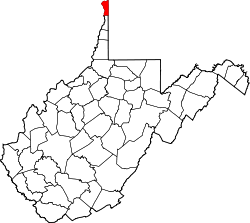
| County | Hancock |
| Elevation | 1,083 ft (330 m) |
| Time zone | UTC-5 (Eastern (EST)) |
| • Summer (DST) | UTC-4 (EDT) |
| GNIS ID | 1555050 [1] |
Marland Heights is an unincorporated community in Hancock County, West Virginia, United States. Marland Heights was incorporated in 1940, and was named for E. W. Marland, Governor of Oklahoma, who had resided nearby in Arroyo. [2]