Weircrest, West Virginia | |
|---|---|
 Weircrest  Weircrest | |
| Coordinates: 40°26′26″N80°35′57″W / 40.44056°N 80.59917°W | |
| Country | United States |
| State | West Virginia |
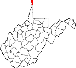
| County | Hancock |
| Elevation | 1,001 ft (305 m) |
| Time zone | UTC-5 (Eastern (EST)) |
| • Summer (DST) | UTC-4 (EDT) |
| GNIS ID | 1555931 [1] |
Weircrest is an unincorporated community in Hancock County, West Virginia, United States.