Arroyo, West Virginia | |
|---|---|
 Arroyo  Arroyo | |
| Coordinates: 40°34′12″N80°39′23″W / 40.57000°N 80.65639°W | |
| Country | United States |
| State | West Virginia |
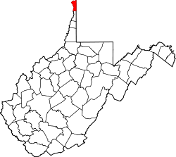
| County | Hancock |
| Elevation | 686 ft (209 m) |
| Time zone | UTC-5 (Eastern (EST)) |
| • Summer (DST) | UTC-4 (EDT) |
| GNIS ID | 1535027 [1] |
Arroyo is an unincorporated community in Hancock County, West Virginia, United States. It was also known as Brooklyn.
The community derives name from nearby Dry Creek, arroyo meaning "dry creek" in Spanish. [2]