Union Township, Erie County, Pennsylvania

Last updated

Union Township
Erie County Pennsylvania incorporated and unincorporated areas Union township highlighted.svg
Location in Erie County and the U.S. state of Pennsylvania
CountryUnited States
State Pennsylvania
County Erie
Area
[1]
  Total36.65 sq mi (94.91 km2)
  Land36.47 sq mi (94.45 km2)
  Water0.18 sq mi (0.47 km2)
Population
 (2020) [2]
  Total1,542
  Estimate 
(2022) [2]
1,543
  Density44.37/sq mi (17.13/km2)
Time zone UTC-4 (EST)
  Summer (DST) UTC-5 (EDT)
Area code 814

Union Township is a township in Erie County, Pennsylvania, United States. The population was 1,542 at the 2020 census, [2] down from 1,655 at the 2010 census. [3]

Contents

Geography

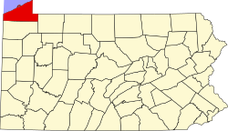
The township is in southeastern Erie County, bordered to the south by Crawford County. The township surrounds the borough of Union City, a separate municipality.

According to the United States Census Bureau, the township has a total area of 36.6 square miles (94.9 km2), of which 36.4 square miles (94.4 km2) is land and 0.2 square miles (0.5 km2), or 0.49%, is water. [3] The South Branch of French Creek flows from east to west across the center of the township and is the main drainage. Tributaries to South Branch French Creek in Union Township include Bentley Run, Hungry Run, Horton Run, and Pine Run. A small section in the southwestern part of the township is drained by East Shreve Run, a tributary of Oil Creek.

Demographics

Historical population
CensusPop.Note
2000 1,663
2010 1,655−0.5%
2020 1,542−6.8%
2022 (est.)1,543 [2] 0.1%
U.S. Decennial Census [4]

As of the census [5] of 2000, there were 1,663 people, 598 households, and 490 families residing in the township. The population density was 45.6 inhabitants per square mile (17.6/km2). There were 631 housing units at an average density of 17.3/sq mi (6.7/km2). The racial makeup of the township was 99.76% White, 0.06% African American, 0.06% from other races, and 0.12% from two or more races. Hispanic or Latino of any race were 0.12% of the population.

There were 598 households, out of which 32.6% had children under the age of 18 living with them, 69.4% were married couples living together, 7.4% had a female householder with no husband present, and 17.9% were non-families. 15.2% of all households were made up of individuals, and 8.0% had someone living alone who was 65 years of age or older. The average household size was 2.77 and the average family size was 3.06.

In the township the population was spread out, with 24.1% under the age of 18, 7.3% from 18 to 24, 25.9% from 25 to 44, 28.1% from 45 to 64, and 14.6% who were 65 years of age or older. The median age was 41 years. For every 100 females, there were 106.1 males. For every 100 females age 18 and over, there were 105.2 males.

The median income for a household in the township was $40,852, and the median income for a family was $43,563. Males had a median income of $31,346 versus $22,500 for females. The per capita income for the township was $18,488. About 4.8% of families and 8.1% of the population were below the poverty line, including 13.2% of those under age 18 and 7.1% of those age 65 or over.

Related Research Articles

<span class="mw-page-title-main">Bloomfield Township, Crawford County, Pennsylvania</span> Township in Pennsylvania, United States

Bloomfield Township is a township in Crawford County, Pennsylvania, United States. The population was 1,867 at the 2020 census.

<span class="mw-page-title-main">Cussewago Township, Crawford County, Pennsylvania</span> Township in Pennsylvania, United States

Cussewago Township is a township in Crawford County, Pennsylvania, United States. The population was 1,435 at the 2020 census.

<span class="mw-page-title-main">Hayfield Township, Crawford County, Pennsylvania</span> Township in Pennsylvania, United States

Hayfield Township is a township in Crawford County, Pennsylvania, United States. The population was 2,781 at the 2020 census, down from 2,940 at the 2010 census.

<span class="mw-page-title-main">Rockdale Township, Crawford County, Pennsylvania</span> Township in Pennsylvania, United States

Rockdale Township is a township in Crawford County, Pennsylvania, United States. The population was 1,367 at the 2020 census, down from 1,506 at the 2010 census.

<span class="mw-page-title-main">Sparta Township, Crawford County, Pennsylvania</span> Township in Pennsylvania, United States

Sparta Township is a township in Crawford County, Pennsylvania, United States. The population was 1,917 at the 2020 census, up from 1,832 at the 2010 census.

<span class="mw-page-title-main">Amity Township, Erie County, Pennsylvania</span> Township in Pennsylvania, United States

Amity Township is a township in Erie County, Pennsylvania, United States. The population was 982 at the 2020 census. There are no longer any boroughs or villages in the township, after the disappearance of Arbuckle and Hatch Hollow. The latter was the birthplace of famed muckraker Ida M. Tarbell, who was born in her grandfather's log cabin in Hatch Hollow in 1857.

<span class="mw-page-title-main">Concord Township, Erie County, Pennsylvania</span> Township in Pennsylvania, United States

Concord Township is a township in Erie County, Pennsylvania, United States. The population was 1,279 at the 2020 census,

<span class="mw-page-title-main">Conneaut Township, Erie County, Pennsylvania</span> Township in Pennsylvania, United States

Conneaut Township is a township in Erie County, Pennsylvania, United States. The population was 4,188 at the 2020 census, down from 4,290 at the 2010 census, up from 3,908 in 2000.

<span class="mw-page-title-main">Elgin, Pennsylvania</span> Borough in Pennsylvania, United States

Elgin is a borough in Erie County, Pennsylvania, United States. The population was 204 at the 2020 census. It is part of the Erie Metropolitan Statistical Area. Places of recreation include Elgin Community Park. Elgin is home to the oldest borough building in Erie County.

<span class="mw-page-title-main">LeBoeuf Township, Erie County, Pennsylvania</span> Township in Pennsylvania, United States

LeBoeuf Township is a township in Erie County, Pennsylvania, United States. The population was 1,657 at the 2020 census, down from 1,698 at the 2010 census.

<span class="mw-page-title-main">McKean Township, Erie County, Pennsylvania</span> Township in Pennsylvania, United States

McKean Township is a township in Erie County, Pennsylvania, United States. The population was 4,435 at the 2020 census, up from 4,409 at the 2010 census, down from 4,619 in 2000.

<span class="mw-page-title-main">Washington Township, Erie County, Pennsylvania</span> Township in Pennsylvania, United States

Washington Township is a township in Erie County, Pennsylvania, United States. The population was 4,395 at the 2020 census, down from 4,432 at the 2010 census. The township surrounds the borough of Edinboro.

<span class="mw-page-title-main">Wayne Township, Erie County, Pennsylvania</span> Township in Pennsylvania, United States

Wayne Township is a township in Erie County, Pennsylvania, United States. The population was 1,539 at the 2020 census, down from 1,659 at the 2010 census, down from 1,766 in 2000.

<span class="mw-page-title-main">South Union Township, Fayette County, Pennsylvania</span> Township in Pennsylvania, United States

South Union Township is a township in Fayette County, Pennsylvania, United States. The population was 10,895 at the 2020 census, an increase over the figure of 10,681 tabulated in 2010.

<span class="mw-page-title-main">Turbot Township, Northumberland County, Pennsylvania</span> Township in Pennsylvania, United States

Turbot Township is a township in Northumberland County, Pennsylvania, United States. The population at the 2010 Census was 1,806, an increase over the figure of 1,677 tabulated in 2000.

<span class="mw-page-title-main">Black Township, Somerset County, Pennsylvania</span> Township in Pennsylvania, United States

Black Township is a township in Somerset County, Pennsylvania, United States. The population was 899 at the 2020 census. It is part of the Johnstown, Pennsylvania, Metropolitan Statistical Area. The township was named for Jeremiah Sullivan Black, a native of Somerset County who became Chief Justice of the Supreme Court of Pennsylvania, U.S. Attorney General, and U.S Secretary of State.

<span class="mw-page-title-main">Upper Turkeyfoot Township, Somerset County, Pennsylvania</span> Township in Pennsylvania, United States

Upper Turkeyfoot Township is a township in Somerset County, Pennsylvania, United States. The population was 1,063 at the 2020 census. It is part of the Johnstown, Pennsylvania, Metropolitan Statistical Area.

<span class="mw-page-title-main">Middlebury Township, Tioga County, Pennsylvania</span> Township in Pennsylvania, United States

Middlebury Township is a township in Tioga County, Pennsylvania, United States. The population was 1,308 at the 2020 census.

<span class="mw-page-title-main">Scrubgrass Township, Venango County, Pennsylvania</span> Township in Pennsylvania, United States

Scrubgrass Township is a township in Venango County, Pennsylvania, United States. The population was 750 at the 2020 census.

<span class="mw-page-title-main">Conewango Township, Warren County, Pennsylvania</span> Township in Pennsylvania, United States

Conewango Township is a township in Warren County, Pennsylvania, United States. The population was 3,401 at the 2020 census, down from 3,594 at the 2010 census. 3,915 at the 2000 census.

References

  1. "2016 U.S. Gazetteer Files". United States Census Bureau. Retrieved August 13, 2017.
  2. 1 2 3 4 Bureau, US Census. "City and Town Population Totals: 2020-2022". Census.gov. US Census Bureau. Retrieved June 19, 2023.
  3. 1 2 "Geographic Identifiers: 2010 Demographic Profile Data (G001): Union township, Erie County, Pennsylvania". American Factfinder. U.S. Census Bureau. Archived from the original on February 13, 2020. Retrieved March 22, 2016.
  4. "Census of Population and Housing". Census.gov. Retrieved June 4, 2016.
  5. "U.S. Census website". United States Census Bureau . Retrieved January 31, 2008.

41°52′00″N79°47′59″W / 41.86667°N 79.79972°W / 41.86667; -79.79972