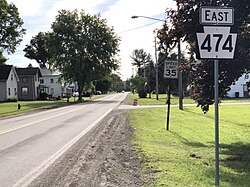
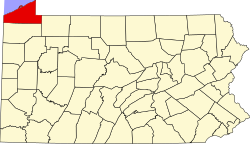
Wattsburg, Pennsylvania | |
---|---|
Coordinates: 42°0′10″N79°48′34″W / 42.00278°N 79.80944°W | |
Country | United States |
State | Pennsylvania |
County | Erie |
Area | |
• Total | 0.31 sq mi (0.80 km2) |
• Land | 0.30 sq mi (0.77 km2) |
• Water | 0.01 sq mi (0.03 km2) |
Elevation [2] (Borough benchmark) | 1,286 ft (392 m) |
Highest elevation [2] (northeast end of borough) | 1,300 ft (400 m) |
Lowest elevation | 1,278 ft (390 m) |
Population | |
• Total | 353 |
• Density | 1,184.56/sq mi (457.90/km2) |
Time zone | UTC-4 (EST) |
• Summer (DST) | UTC-5 (EDT) |
ZIP code | 16442 |
Area code | 814 |
Wattsburg is a borough in Erie County, Pennsylvania, United States. The population was 352 at the 2020 census. [4] It is part of the Erie Metropolitan Statistical Area.
Incorporated in 1833, Wattsburg was once a thriving stagecoach center.[ citation needed ]
Wattsburg is located in eastern Erie County at 42°0′10″N79°48′34″W / 42.00278°N 79.80944°W (42.002903, -79.809321). [5] It is bordered to the west, north, and east by Venango Township, and to the south by Amity Township. The New York state border is 2.5 miles (4.0 km) to the east.
According to the United States Census Bureau, the borough has a total area of 0.31 square miles (0.8 km2), of which 0.01 square miles (0.03 km2), or 3.72%, is water. [6] Wattsburg is at the junction of French Creek with its West Branch. The borough is in the Allegheny River watershed.
Census | Pop. | Note | %± |
---|---|---|---|
1840 | 131 | — | |
1850 | 227 | 73.3% | |
1860 | 329 | 44.9% | |
1870 | 286 | −13.1% | |
1880 | 389 | 36.0% | |
1890 | 382 | −1.8% | |
1900 | 351 | −8.1% | |
1910 | 283 | −19.4% | |
1920 | 232 | −18.0% | |
1930 | 256 | 10.3% | |
1940 | 290 | 13.3% | |
1950 | 343 | 18.3% | |
1960 | 401 | 16.9% | |
1970 | 453 | 13.0% | |
1980 | 513 | 13.2% | |
1990 | 486 | −5.3% | |
2000 | 378 | −22.2% | |
2010 | 403 | 6.6% | |
2020 | 352 | −12.7% | |
2021 (est.) | 349 | [4] | −0.9% |
U.S. Decennial Census [7] |
As of the census [8] of 2000, there were 378 people, 148 households, and 97 families residing in the borough. The population density was 1,160.8 inhabitants per square mile (448.2/km2). There were 166 housing units at an average density of 509.8 per square mile (196.8/km2). The racial makeup of the borough was 99.47% White, 0.26% from other races, and 0.26% from two or more races. Hispanic or Latino of any race were 0.53% of the population.
There were 148 households, out of which 30.4% had children under the age of 18 living with them, 45.9% were married couples living together, 14.2% had a female householder with no husband present, and 33.8% were non-families. 26.4% of all households were made up of individuals, and 8.8% had someone living alone who was 65 years of age or older. The average household size was 2.55 and the average family size was 3.13.
In the borough the population was spread out, with 24.6% under the age of 18, 10.6% from 18 to 24, 29.6% from 25 to 44, 23.8% from 45 to 64, and 11.4% who were 65 years of age or older. The median age was 35 years. For every 100 females there were 92.9 males. For every 100 females age 18 and over, there were 96.6 males.
The median income for a household in the borough was $32,500, and the median income for a family was $37,813. Males had a median income of $29,250 versus $25,156 for females. The per capita income for the borough was $14,830. About 17.6% of families and 17.9% of the population were below the poverty line, including 16.2% of those under age 18 and 51.4% of those age 65 or over.
Sparta Township is a township in Crawford County, Pennsylvania, United States. The population was 1,912 at the 2020 census, up from 1,832 at the 2010 census. The Township surrounds Spartansburg, a borough of a few hundred people.
Springboro is a borough in Crawford County, Pennsylvania, United States, located 35 miles southwest of Erie. The population was 376 at the 2020 census, down from 477 at the 2010 census.
Amity Township is a township in Erie County, Pennsylvania, United States. The population was 981 at the 2020 census. There are no longer any boroughs or villages in the township, after the disappearance of Arbuckle and Hatch Hollow. The latter was the birthplace of famed muckraker Ida M. Tarbell, who was born in her grandfather's log cabin in Hatch Hollow in 1857.
Conneaut Township is a township in Erie County, Pennsylvania, United States. The population was 4,190 at the 2020 census, down from 4,290 at the 2010 census, up from 3,908 in 2000.
Edinboro is a borough in Erie County, Pennsylvania, United States. It is part of the Erie Metropolitan Statistical Area. As home to Edinboro University of Pennsylvania, it is a small college town, as well as a resort community. The population was 4,920 at the 2020 census, down from 6,438 in 2010.
Elgin is a borough in Erie County, Pennsylvania, United States. The population was 204 at the 2020 census. It is part of the Erie Metropolitan Statistical Area. Places of recreation include Elgin Community Park. Elgin is home to the oldest borough building in Erie County.
Elk Creek Township is a township in Erie County, Pennsylvania, United States. The population was 1,785 at the 2020 census, down from 1,798 at the 2010 census.
Girard is a borough in Erie County, Pennsylvania, United States. The population was 2,994 at the 2020 census. It is part of the Erie Metropolitan Statistical Area.
Girard Township is a township in Erie County, Pennsylvania, United States. The population was 4,874 at the 2020 census, down from the population of 5,102 at the 2010 census.
Greenfield Township is a township in Erie County, Pennsylvania, United States. The population was 1,802 at the 2020 census,
LeBoeuf Township is a township in Erie County, Pennsylvania, United States. The population was 1,658 at the 2020 census, down from 1,698 at the 2010 census.
McKean is a borough in Erie County, Pennsylvania. The population was 475 at the time of the 2020 census. It is part of the Erie–Meadville combined statistical area. McKean was known as "Middleboro" until it officially changed its name in 1970.
McKean Township is a township in Erie County, Pennsylvania, United States. The population was 4,437 at the 2020 census, up from 4,409 at the 2010 census, down from 4,619 in 2000.
Mill Village is a borough in Erie County, Pennsylvania, United States. The population was 394 at the 2020 census, down from 412 during the 2010 census. It is part of the Erie Metropolitan Statistical Area.
North East is a borough in North East Township, Erie County, Pennsylvania, United States, 14 miles (23 km) northeast of Erie. Located in the county's northeastern corner, the name comes from the geographical location. The population was 4,114 at the 2020 census, down from 4,294 in 2010. Fruit growing was an early economic endeavor, and is still to this day, as this is a popular area especially for cherries and grapes. There is an annual Cherry Festival in the summer and an annual Wine Country Harvest Festival in autumn. It is part of the Erie Metropolitan Statistical Area. It is the northernmost town in Pennsylvania.
North East Township is a township in Erie County, Pennsylvania, United States. The population was 6,529 at the 2020 census, up from 6,315 at the 2010 census, down from 7,702 in 2000.
Platea is a borough in Erie County, Pennsylvania, United States. The population was 443 at the 2020 census.
Venango Township is a township in Erie County, Pennsylvania, United States. The population was 2,253 at the 2020 census,
Waterford is a borough in Erie County, Pennsylvania, United States. The population was 1,475 at the 2020 census. It is part of the Erie Metropolitan Statistical Area.
Wesleyville is a borough in Erie County, Pennsylvania, United States. The population was 3,229 at the 2020 census, down from 3,341 in 2010. It is part of the Erie Metropolitan Statistical Area.
{{cite web}}
: |last1=
has generic name (help)