Mill Village, Pennsylvania

Last updated
Mill Village, Pennsylvania
Site of Mill Village Station, Pennsylvania, July 2015.jpg
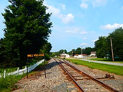
Site of the Mill Village station along the Erie Railroad
Erie County Pennsylvania incorporated and unincorporated areas Mill Village highlighted.svg
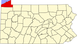
Location in Erie County and the U.S. state of Pennsylvania.
Coordinates: 41°52′34″N79°58′21″W / 41.87611°N 79.97250°W / 41.87611; -79.97250
CountryUnited States
State Pennsylvania
County Erie
Government
  MayorJoseph Sam
Area
[1]
  Total0.92 sq mi (2.38 km2)
  Land0.92 sq mi (2.38 km2)
  Water0.00 sq mi (0.00 km2)
Elevation
[2] (Borough benchmark)
1,206 ft (368 m)
Highest elevation
[2] (south borough boundary)
1,320 ft (400 m)
Lowest elevation
[2] (Tributary to French Creek)
1,160 ft (350 m)
Population
 (2020) [3]
  Total388
  Density422.20/sq mi (163.09/km2)
Time zone UTC-4 (EST)
  Summer (DST) UTC-5 (EDT)
ZIP code
16427
Area code 814
Website millvillageboro.org

Mill Village is a borough in Erie County, Pennsylvania, United States. The population was 394 at the 2020 census, [4] down from 412 during the 2010 census. It is part of the Erie Metropolitan Statistical Area.

Contents

Geography

Mill Village is located in southern Erie County at 41°52′34″N79°58′21″W / 41.87611°N 79.97250°W / 41.87611; -79.97250 (41.876050, -79.972607). [5] It is surrounded by LeBoeuf Township. U.S. Route 6 passes through the borough, leading east 7 miles (11 km) to Union City and southwest 8 miles (13 km) to Cambridge Springs. Erie is 19 miles (31 km) to the north.

According to the United States Census Bureau, Mill Village has a total area of 0.93 square miles (2.4 km2), all land. [6] It sits on the eastern edge of the valley of French Creek, part of the Allegheny River watershed.

Demographics

Historical population
CensusPop.Note
1880 388
1890 320−17.5%
1900 3210.3%
1910 290−9.7%
1920 247−14.8%
1930 233−5.7%
1940 25911.2%
1950 32425.1%
1960 3363.7%
1970 37210.7%
1980 42714.8%
1990 4290.5%
2000 412−4.0%
2010 4120.0%
2020 394−4.4%
2021 (est.)390 [4] −1.0%
Sources: [7] [8] [9] [3]

As of the census [8] of 2000, there were 412 people, 149 households, and 116 families residing in the borough. The population density was 452.6 inhabitants per square mile (174.7/km2). There were 162 housing units at an average density of 177.9 per square mile (68.7/km2). The racial makeup of the borough was 98.30% White, 0.24% African American, 0.97% from other races, and 0.49% from two or more races.

There were 149 households, out of which 38.3% had children under the age of 18 living with them, 66.4% were married couples living together, 5.4% had a female householder with no husband present, and 21.5% were non-families. 17.4% of all households were made up of individuals, and 8.7% had someone living alone who was 65 years of age or older. The average household size was 2.77 and the average family size was 3.11.

In the borough the population was spread out, with 29.9% under the age of 18, 6.8% from 18 to 24, 27.9% from 25 to 44, 23.5% from 45 to 64, and 11.9% who were 65 years of age or older. The median age was 37 years. For every 100 females there were 104.0 males. For every 100 females age 18 and over, there were 100.7 males.

The median income for a household in the borough was $34,375, and the median income for a family was $35,156. Males had a median income of $24,444 versus $20,625 for females. The per capita income for the borough was $12,529. About 7.2% of families and 9.4% of the population were below the poverty line, including 9.9% of those under age 18 and 12.2% of those age 65 or over.

Related Research Articles

<span class="mw-page-title-main">Blooming Valley, Pennsylvania</span> Borough in Pennsylvania, United States

Blooming Valley is a borough in Crawford County, Pennsylvania, United States. The population was 342 at the 2020 census, up from 337 at the 2010 census.

<span class="mw-page-title-main">Cambridge Springs, Pennsylvania</span> Home rule municipality in Pennsylvania, United States

Cambridge Springs is a borough with home rule status in Crawford County, Pennsylvania, United States. The population was 2,583 at the 2020 census, down from 2,595 at the 2010 census.

<span class="mw-page-title-main">Conneautville, Pennsylvania</span> Borough in Pennsylvania, United States

Conneautville is a borough in Crawford County, Pennsylvania, United States, situated along Conneaut Creek. The population was 736 at the 2020 census, down from 774 at the 2010 census.

<span class="mw-page-title-main">Saegertown, Pennsylvania</span> Borough in Pennsylvania, United States

Saegertown is a borough in Crawford County, Pennsylvania. The population was 869 at the time of the 2020 census, down from 997 at the 2010 census. It was established in 1824.

<span class="mw-page-title-main">Sparta Township, Crawford County, Pennsylvania</span> Township in Pennsylvania, United States

Sparta Township is a township in Crawford County, Pennsylvania, United States. The population was 1,910 at the 2020 census, up from 1,832 at the 2010 census.

<span class="mw-page-title-main">Spring Township, Crawford County, Pennsylvania</span> Township in Pennsylvania, United States

Spring Township is a township in Crawford County, Pennsylvania, United States. The population was 1,407 at the 2020 census, down from 1,548 at the 2010 census.

<span class="mw-page-title-main">Springboro, Pennsylvania</span> Borough in Pennsylvania, United States

Springboro is a borough in Crawford County, Pennsylvania, United States, located 35 miles southwest of Erie. The population was 376 at the 2020 census, down from 477 at the 2010 census.

<span class="mw-page-title-main">Concord Township, Erie County, Pennsylvania</span> Township in Pennsylvania, United States

Concord Township is a township in Erie County, Pennsylvania, United States. The population was 1,279 at the 2020 census,

<span class="mw-page-title-main">Edinboro, Pennsylvania</span> Borough in Pennsylvania, United States

Edinboro is a borough in Erie County, Pennsylvania, United States. It is part of the Erie Metropolitan Statistical Area. As home to Edinboro University of Pennsylvania, it is a small college town, as well as a resort community. The population was 4,920 at the 2020 census, down from 6,438 in 2010.

<span class="mw-page-title-main">Elgin, Pennsylvania</span> Borough in Pennsylvania, United States

Elgin is a borough in Erie County, Pennsylvania, United States. The population was 204 at the 2020 census. It is part of the Erie Metropolitan Statistical Area. Places of recreation include Elgin Community Park. Elgin is home to the oldest borough building in Erie County.

<span class="mw-page-title-main">Girard Township, Erie County, Pennsylvania</span> Township in Pennsylvania, United States

Girard Township is a township in Erie County, Pennsylvania, United States. The population was 4,872 at the 2020 census, down from the population of 5,102 at the 2010 census.

<span class="mw-page-title-main">Greene Township, Erie County, Pennsylvania</span> Township in Pennsylvania, United States

Greene Township is a township in Erie County, Pennsylvania, United States. The population was 4,487 at the 2020, down from 4,706 at the 2010 census.

<span class="mw-page-title-main">LeBoeuf Township, Erie County, Pennsylvania</span> Township in Pennsylvania, United States

LeBoeuf Township is a township in Erie County, Pennsylvania, United States. The population was 1,657 at the 2020 census, down from 1,698 at the 2010 census.

<span class="mw-page-title-main">McKean, Pennsylvania</span> Borough in Pennsylvania, United States

McKean is a borough in Erie County, Pennsylvania. The population was 475 at the time of the 2020 census. It is part of the Erie–Meadville combined statistical area. McKean was known as "Middleboro" until it officially changed its name in 1970.

<span class="mw-page-title-main">McKean Township, Erie County, Pennsylvania</span> Township in Pennsylvania, United States

McKean Township is a township in Erie County, Pennsylvania, United States. The population was 4,435 at the 2020 census, up from 4,409 at the 2010 census, down from 4,619 in 2000.

<span class="mw-page-title-main">Platea, Pennsylvania</span> Borough in Pennsylvania, United States

Platea is a borough in Erie County, Pennsylvania, United States. The population was 443 at the 2020 census.

<span class="mw-page-title-main">Union City, Pennsylvania</span> Borough in Pennsylvania, United States

Union City is a borough in Erie County, Pennsylvania, United States. It is located 22 miles (35 km) southeast of Erie. In the twentieth century, there were three large chair factories, planing and grist mills, a powdered milk plant, and several furniture factories. The population was 2,934 at the 2020 census. It is part of the Erie Metropolitan Statistical Area.

<span class="mw-page-title-main">Waterford, Pennsylvania</span> Borough in Pennsylvania, United States

Waterford is a borough in Erie County, Pennsylvania, United States. The population was 1,475 at the 2020 census. It is part of the Erie Metropolitan Statistical Area.

<span class="mw-page-title-main">Wattsburg, Pennsylvania</span> Borough in Pennsylvania, United States

Wattsburg is a borough in Erie County, Pennsylvania, United States. The population was 352 at the 2020 census. It is part of the Erie Metropolitan Statistical Area.

<span class="mw-page-title-main">Volant, Pennsylvania</span> Borough in Pennsylvania, United States

Volant is a borough in northern Lawrence County, Pennsylvania, United States. The population was 127 at the 2020 census. Volant is surrounded by Old Order Amish farms of the New Wilmington settlement. It is part of the Pittsburgh metropolitan area.

References

  1. "ArcGIS REST Services Directory". United States Census Bureau. Retrieved October 12, 2022.
  2. 1 2 3 "New Ireland Topo Map, Erie County PA (Waterford Area)". TopoZone. Locality, LLC. Retrieved 2 September 2019.
  3. 1 2 "Census Population API". United States Census Bureau. Retrieved Oct 12, 2022.
  4. 1 2 Bureau, US Census. "City and Town Population Totals: 2020-2021". Census.gov. US Census Bureau. Retrieved 19 July 2022.
  5. "US Gazetteer files: 2010, 2000, and 1990". United States Census Bureau. 2011-02-12. Retrieved 2011-04-23.
  6. "Geographic Identifiers: 2010 Demographic Profile Data (G001): Mill Village borough, Pennsylvania". American Factfinder. U.S. Census Bureau. Archived from the original on February 13, 2020. Retrieved March 15, 2016.
  7. "Census of Population and Housing". U.S. Census Bureau. Retrieved 11 December 2013.
  8. 1 2 "U.S. Census website". United States Census Bureau . Retrieved 2008-01-31.
  9. "Incorporated Places and Minor Civil Divisions Datasets: Subcounty Resident Population Estimates: April 1, 2010 to July 1, 2012". Population Estimates. U.S. Census Bureau. Archived from the original on 11 June 2013. Retrieved 11 December 2013.