Greenfield Township, Erie County, Pennsylvania

Last updated

Greenfield Township
Hornby School, July 2011.jpg
Hornby School (1873)
National Register of Historic Places
Erie County Pennsylvania incorporated and unincorporated areas Greenfield township highlighted.svg
Location in Erie County and the U.S. state of Pennsylvania
CountryUnited States
State Pennsylvania
County Erie
Area
[1]
  Total34.15 sq mi (88.45 km2)
  Land33.77 sq mi (87.47 km2)
  Water0.38 sq mi (0.99 km2)
Highest elevation
[2] (southeast end of township, east of Macedonia Road)
1,660 ft (510 m)
Lowest elevation
[2] (Eightmile Creek)
1,130 ft (340 m)
Population
 (2020) [3]
  Total1,802
  Estimate 
(2023) [3]
1,782
  Density56.76/sq mi (21.92/km2)
Time zone UTC-4 (EST)
  Summer (DST) UTC-5 (EDT)
Area code 814

Greenfield Township is a township in Erie County, Pennsylvania, United States. The population was 1,802 at the 2020 census, [3]

Contents

History

The Hornby School was listed on the National Register of Historic Places in 2008. [4]

Geography

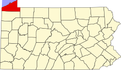
Greenfield Township is in eastern Erie County and is bordered to the east by Chautauqua County, New York. Interstate 86 crosses the township from east to west, with access from Exit 3 (Pennsylvania Route 89) in the north-central part of the township. I-86 has its western terminus in the northwest corner of the township, where it meets Interstate 90, 11 miles (18 km) east of Erie and 86 miles (138 km) southwest of Buffalo, New York.

According to the United States Census Bureau, Greenfield Township has a total area of 34.2 square miles (88.5 km2), of which 33.8 square miles (87.5 km2) is land and 0.39 square miles (1.0 km2), or 1.11%, is water. [5]

Greenfield Township is drained by West Branch French Creek and its tributaries, Townley Run and Darrow Brook and by Lake Erie tributaries including Twelvemile Creek, Eightmile Creek, and Sixmile Creek.

Demographics

Historical population
CensusPop.Note
2000 1,909
2010 1,9331.3%
2020 1,802−6.8%
2023 (est.)1,782 [3] −1.1%
U.S. Decennial Census [6]

As of the census [7] of 2000, there were 1,909 people, 666 households, and 534 families residing in the township. The population density was 56.4 inhabitants per square mile (21.8/km2). There were 699 housing units at an average density of 20.7/sq mi (8.0/km2). The racial makeup of the township was 97.85% White, 0.79% African American, 0.16% Native American, 0.10% Asian, 0.05% Pacific Islander, 0.16% from other races, and 0.89% from two or more races. Hispanic or Latino of any race were 0.42% of the population.

There were 666 households, out of which 40.7% had children under the age of 18 living with them, 68.8% were married couples living together, 5.4% had a female householder with no husband present, and 19.7% were non-families. 17.7% of all households were made up of individuals, and 4.7% had someone living alone who was 65 years of age or older. The average household size was 2.87 and the average family size was 3.22.

In the township the population was spread out, with 30.0% under the age of 18, 5.9% from 18 to 24, 30.8% from 25 to 44, 25.8% from 45 to 64, and 7.5% who were 65 years of age or older. The median age was 36 years. For every 100 females, there were 105.9 males. For every 100 females age 18 and over, there were 110.1 males.

The median income for a household in the township was $44,922, and the median income for a family was $50,352. Males had a median income of $33,750 versus $24,400 for females. The per capita income for the township was $17,569. About 4.3% of families and 5.3% of the population were below the poverty line, including 7.5% of those under age 18 and 3.4% of those age 65 or over.

Related Research Articles

<span class="mw-page-title-main">Madison Township, Columbia County, Pennsylvania</span> Township in Pennsylvania, United States

Madison Township is a township in Columbia County, Pennsylvania. It is part of Northeastern Pennsylvania. The population was 1,566 at the 2020 census.

<span class="mw-page-title-main">Cussewago Township, Crawford County, Pennsylvania</span> Township in Pennsylvania, United States

Cussewago Township is a township in Crawford County, Pennsylvania, United States. The population was 1,430 at the 2020 census.

<span class="mw-page-title-main">Hayfield Township, Crawford County, Pennsylvania</span> Township in Pennsylvania, United States

Hayfield Township is a township in Crawford County, Pennsylvania, United States. The population was 2,774 at the 2020 census, down from 2,940 at the 2010 census.

<span class="mw-page-title-main">Sparta Township, Pennsylvania</span> Township in Pennsylvania, United States

Sparta Township is a township in Crawford County, Pennsylvania, United States. The population was 1,912 at the 2020 census, up from 1,832 at the 2010 census. The Township surrounds Spartansburg, a borough of a few hundred people.

<span class="mw-page-title-main">Highland Township, Elk County, Pennsylvania</span> Township in Pennsylvania, United States

Highland Township is a township in Elk County, Pennsylvania, United States. The population was 398 at the 2020 census, down from 492 in 2010.

<span class="mw-page-title-main">Concord Township, Erie County, Pennsylvania</span> Township in Pennsylvania, United States

Concord Township is a township in Erie County, Pennsylvania, United States. The population was 1,281 at the 2020 census,

<span class="mw-page-title-main">Elgin, Pennsylvania</span> Borough in Pennsylvania, United States

Elgin is a borough in Erie County, Pennsylvania, United States. The population was 204 at the 2020 census. It is part of the Erie Metropolitan Statistical Area. Places of recreation include Elgin Community Park. Elgin is home to the oldest borough building in Erie County.

<span class="mw-page-title-main">Elk Creek Township, Pennsylvania</span> Township in Pennsylvania, United States

Elk Creek Township is a township in Erie County, Pennsylvania, United States. The population was 1,785 at the 2020 census, down from 1,798 at the 2010 census.

<span class="mw-page-title-main">Fairview Township, Erie County, Pennsylvania</span> Township in Pennsylvania, United States

Fairview Township is a township in Erie County, Pennsylvania, United States. Situated on the southern shore of Lake Erie, it was one of the county's sixteen original townships, and was founded in 1797.

<span class="mw-page-title-main">Girard Township, Erie County, Pennsylvania</span> Township in Pennsylvania, United States

Girard Township is a township in Erie County, Pennsylvania, United States. The population was 4,874 at the 2020 census, down from the population of 5,102 at the 2010 census.

<span class="mw-page-title-main">Greene Township, Erie County, Pennsylvania</span> Township in Pennsylvania, United States

Greene Township is a township in Erie County, Pennsylvania, United States. The population was 4,486 at the 2020, down from 4,706 at the 2010 census.

<span class="mw-page-title-main">Harborcreek Township, Pennsylvania</span> Township in Pennsylvania, United States

Harborcreek Township is a township in Erie County, Pennsylvania, United States. The population was 16,630 at the 2020 census, down from 17,234 at the 2010 census, up from 15,178 in 2000. It is part of the Erie Metropolitan Statistical Area.

<span class="mw-page-title-main">LeBoeuf Township, Pennsylvania</span> Township in Pennsylvania, United States

LeBoeuf Township is a township in Erie County, Pennsylvania, United States. The population was 1,658 at the 2020 census, down from 1,698 at the 2010 census.

<span class="mw-page-title-main">McKean Township, Pennsylvania</span> Township in Pennsylvania, United States

McKean Township is a township in Erie County, Pennsylvania, United States. The population was 4,437 at the 2020 census, up from 4,409 at the 2010 census, down from 4,619 in 2000.

<span class="mw-page-title-main">Mill Village, Pennsylvania</span> Borough in Pennsylvania, United States

Mill Village is a borough in Erie County, Pennsylvania, United States. The population was 394 at the 2020 census, down from 412 during the 2010 census. It is part of the Erie Metropolitan Statistical Area.

<span class="mw-page-title-main">Millcreek Township, Erie County, Pennsylvania</span> Township in Pennsylvania

Millcreek Township is a township in Erie County, Pennsylvania, United States. The population was 54,070 at the 2020 census, making it the 14th-largest municipality in the state. and the largest township in Western Pennsylvania.

<span class="mw-page-title-main">North East Township, Pennsylvania</span> Township in Pennsylvania, United States

North East Township is a township in Erie County, Pennsylvania, United States. The population was 6,529 at the 2020 census, up from 6,315 at the 2010 census, down from 7,702 in 2000.

<span class="mw-page-title-main">Venango Township, Erie County, Pennsylvania</span> Township in Pennsylvania, United States

Venango Township is a township in Erie County, Pennsylvania, United States. The population was 2,253 at the 2020 census,

<span class="mw-page-title-main">Wattsburg, Pennsylvania</span> Borough in Pennsylvania, United States

Wattsburg is a borough in Erie County, Pennsylvania, United States. The population was 352 at the 2020 census. It is part of the Erie Metropolitan Statistical Area.

<span class="mw-page-title-main">Newberry Township, Pennsylvania</span> Township in Pennsylvania, United States

Newberry Township is a township in York County, Pennsylvania, United States. The population was 15,657 at the 2020 census.

References

  1. "2016 U.S. Gazetteer Files". United States Census Bureau. Retrieved August 13, 2017.
  2. 1 2 "Eades Corners Topo Map, Erie County PA (Harborcreek Area)". TopoZone. Locality, LLC. Retrieved September 4, 2019.
  3. 1 2 3 4 Bureau, US Census. "City and Town Population Totals: 2020-2023". Census.gov. US Census Bureau. Retrieved July 1, 2024.
  4. "National Register Information System". National Register of Historic Places . National Park Service. July 9, 2010.
  5. "Geographic Identifiers: 2010 Demographic Profile Data (G001): Greenfield township, Erie County, Pennsylvania". American Factfinder. U.S. Census Bureau. Archived from the original on February 13, 2020. Retrieved March 17, 2016.
  6. "Census of Population and Housing". Census.gov. Retrieved June 4, 2016.
  7. "U.S. Census website". United States Census Bureau . Retrieved January 31, 2008.

42°08′00″N79°49′59″W / 42.13333°N 79.83306°W / 42.13333; -79.83306