Venango Township, Erie County, Pennsylvania

Last updated

Venango Township
PA 8-89 nb in Lowville, June 2024.jpg
PA 8/PA 89 in the Venango Township of Lowville
Erie County Pennsylvania incorporated and unincorporated areas Venango township highlighted.svg
Location in Erie County and the U.S. state of Pennsylvania
CountryUnited States
State Pennsylvania
County Erie
Area
[1]
  Total43.80 sq mi (113.44 km2)
  Land43.42 sq mi (112.46 km2)
  Water0.38 sq mi (0.97 km2)
Population
 (2020) [2]
  Total2,253
  Estimate 
(2023) [2]
2,225
  Density52.81/sq mi (20.39/km2)
Time zone UTC-4 (EST)
  Summer (DST) UTC-5 (EDT)
Area code 814

Venango Township is a township in Erie County, Pennsylvania, United States. The population was 2,253 at the 2020 census, [2]

Contents

Geography

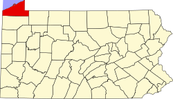
The township is on the eastern edge of Erie County, bordered to the east by Chautauqua County, New York. The borough of Wattsburg is along the southern edge of the township.

According to the United States Census Bureau, the township has a total area of 43.8 square miles (113.4 km2), of which 43.4 square miles (112.5 km2) is land and 0.39 square miles (1.0 km2), or 0.86%, water. [3] The West Branch French Creek flows from north to south across the center of the township, joining the main stem of French Creek, which crosses the southeastern corner of the township, at Wattsburg. Two tributaries to West Branch French Creek, Bailey Brook and Alder Brook begin in Venango Township and one, Townley Run, ends in the township. Lake Pleasant, a glacial lake, and its outlet are located in this township.

Demographics

Historical population
CensusPop.Note
2000 2,277
2010 2,2970.9%
2020 2,253−1.9%
2023 (est.)2,225 [2] −1.2%
U.S. Decennial Census [4]

As of the census [5] of 2000, there were 2,277 people, 771 households, and 637 families residing in the township. The population density was 52.3 inhabitants per square mile (20.2/km2). There were 821 housing units at an average density of 18.8/sq mi (7.3/km2). The racial makeup of the township was 98.99% White, 0.09% African American, 0.09% Native American, 0.44% Asian, and 0.40% from two or more races. Hispanic or Latino of any race were 0.22% of the population.

There were 771 households, out of which 43.5% had children under the age of 18 living with them, 72.2% were married couples living together, 5.1% had a female householder with no husband present, and 17.3% were non-families. 14.3% of all households were made up of individuals, and 5.3% had someone living alone who was 65 years of age or older. The average household size was 2.95 and the average family size was 3.26.

In the township the population was spread out, with 29.6% under the age of 18, 7.8% from 18 to 24, 30.1% from 25 to 44, 25.3% from 45 to 64, and 7.3% who were 65 years of age or older. The median age was 36 years. For every 100 females, there were 101.1 males. For every 100 females age 18 and over, there were 103.8 males.

The median income for a household in the township was $50,882, and the median income for a family was $55,357. Males had a median income of $39,022 versus $27,059 for females. The per capita income for the township was $18,653. About 2.5% of families and 3.7% of the population were below the poverty line, including 2.6% of those under age 18 and 9.9% of those age 65 or over.

Related Research Articles

<span class="mw-page-title-main">French Creek, New York</span> Town in New York, United States

French Creek is a town in Chautauqua County, New York, United States. The population was 997 at the 2020 census. The town is named after the stream flowing through it, which ultimately flows to the Allegheny River in Pennsylvania. The town of French Creek is located in the far southwestern corner of the state.

<span class="mw-page-title-main">Concord Township, Butler County, Pennsylvania</span> Township in Pennsylvania, United States

Concord Township is a township in Butler County, Pennsylvania, United States. The population was 1,411 at the 2020 census.

<span class="mw-page-title-main">Oil Creek Township, Crawford County, Pennsylvania</span> Township of Titusville Pennsylvania in the United States

Oil Creek Township is a township in Crawford County, Pennsylvania, United States. The population was 1,703 at the 2020 census, a decrease from 1,877 at the 2010 census.

<span class="mw-page-title-main">Venango Township, Crawford County, Pennsylvania</span> Township in Pennsylvania, United States

Venango Township is a township in Crawford County, Pennsylvania, United States. The population was 941 at the 2020 census, down from 997 at the 2010 census.

<span class="mw-page-title-main">Highland Township, Elk County, Pennsylvania</span> Township in Pennsylvania, United States

Highland Township is a township in Elk County, Pennsylvania, United States. The population was 398 at the 2020 census, down from 492 in 2010.

<span class="mw-page-title-main">Concord Township, Erie County, Pennsylvania</span> Township in Pennsylvania, United States

Concord Township is a township in Erie County, Pennsylvania, United States. The population was 1,281 at the 2020 census,

<span class="mw-page-title-main">Conneaut Township, Erie County, Pennsylvania</span> Township in Pennsylvania, United States

Conneaut Township is a township in Erie County, Pennsylvania, United States. The population was 4,190 at the 2020 census, down from 4,290 at the 2010 census, up from 3,908 in 2000.

<span class="mw-page-title-main">Elgin, Pennsylvania</span> Borough in Pennsylvania, United States

Elgin is a borough in Erie County, Pennsylvania, United States. The population was 204 at the 2020 census. It is part of the Erie Metropolitan Statistical Area. Places of recreation include Elgin Community Park. Elgin is home to the oldest borough building in Erie County.

<span class="mw-page-title-main">Greenfield Township, Erie County, Pennsylvania</span> Township in Pennsylvania, United States

Greenfield Township is a township in Erie County, Pennsylvania, United States. The population was 1,802 at the 2020 census,

<span class="mw-page-title-main">LeBoeuf Township, Pennsylvania</span> Township in Pennsylvania, United States

LeBoeuf Township is a township in Erie County, Pennsylvania, United States. The population was 1,658 at the 2020 census, down from 1,698 at the 2010 census.

<span class="mw-page-title-main">North East, Pennsylvania</span> Borough in Pennsylvania, United States

North East is a borough in Erie County, Pennsylvania, United States, 14 miles (23 km) northeast of Erie. Located in the county's northeastern corner, the name comes from the geographical location. The population was 4,114 at the 2020 census, down from 4,294 in 2010. Fruit growing was an early economic endeavor, and is still to this day, as this is a popular area especially for cherries and grapes. There is an annual Cherry Festival in the summer and an annual Wine Country Harvest Festival in autumn. It is part of the Erie Metropolitan Statistical Area. It is the northernmost town in Pennsylvania.

<span class="mw-page-title-main">North East Township, Pennsylvania</span> Township in Pennsylvania, United States

North East Township is a township in Erie County, Pennsylvania, United States. The population was 6,529 at the 2020 census, up from 6,315 at the 2010 census, down from 7,702 in 2000.

<span class="mw-page-title-main">Union Township, Erie County, Pennsylvania</span> Township in Pennsylvania, United States

Union Township is a township in Erie County, Pennsylvania, United States. The population was 1,542 at the 2020 census, down from 1,655 at the 2010 census.

<span class="mw-page-title-main">Wattsburg, Pennsylvania</span> Borough in Pennsylvania, United States

Wattsburg is a borough in Erie County, Pennsylvania, United States. The population was 352 at the 2020 census. It is part of the Erie Metropolitan Statistical Area.

<span class="mw-page-title-main">Wayne Township, Erie County, Pennsylvania</span> Township in Pennsylvania, United States

Wayne Township is a township in Erie County, Pennsylvania, United States. The population was 1,539 at the 2020 census, down from 1,659 at the 2010 census, down from 1,766 in 2000.

<span class="mw-page-title-main">Tionesta Township, Forest County, Pennsylvania</span> Township in Pennsylvania, United States

Tionesta Township is a township in Forest County, Pennsylvania, United States. The population was 670 at the time of the 2020 census, up from the total of 729 that was documented by the 2010, up from 610 at the 2000 census.

<span class="mw-page-title-main">Hamilton Township, McKean County, Pennsylvania</span> Township in Pennsylvania, United States

Hamilton Township is a township in McKean County, Pennsylvania, United States. The population was 553 at the 2020 census.

<span class="mw-page-title-main">Jefferson Township, Somerset County, Pennsylvania</span> Township in Pennsylvania, United States

Jefferson Township is a township in Somerset County, Pennsylvania, United States. The population was 1,428 at the 2020 census. It is part of the Johnstown, Pennsylvania, Metropolitan Statistical Area.

<span class="mw-page-title-main">Oil Creek Township, Venango County, Pennsylvania</span> Township in Pennsylvania, United States

Oil Creek Township is a township in Venango County, Pennsylvania, United States. The population was 753 at the 2020 census, a decrease from 854 in 2010, which was an increase over the 840 residents tabulated as of the 2000 census.

<span class="mw-page-title-main">Sandycreek Township, Pennsylvania</span> Township in Pennsylvania, United States

Sandycreek Township is a township that is located in Venango County, Pennsylvania, United States. The population was 2,058 at the time of the 2020 census.

References

  1. "2016 U.S. Gazetteer Files". United States Census Bureau. Retrieved August 13, 2017.
  2. 1 2 3 4 Bureau, US Census. "City and Town Population Totals: 2020-2023". Census.gov. US Census Bureau. Retrieved July 1, 2024.
  3. "Geographic Identifiers: 2010 Census Summary File 1 (G001): Venango township, Erie County, Pennsylvania". American Factfinder. U.S. Census Bureau. Archived from the original on February 13, 2020. Retrieved March 22, 2016.
  4. "Census of Population and Housing". Census.gov. Retrieved June 4, 2016.
  5. "U.S. Census website". United States Census Bureau . Retrieved January 31, 2008.

42°03′00″N79°49′59″W / 42.05000°N 79.83306°W / 42.05000; -79.83306