Waterford Township, Pennsylvania

Last updated

Waterford Township
Waterford Covered Bridge, June 2008.jpg
Waterford Covered Bridge (1875)
National Register of Historic Places
Erie County Pennsylvania incorporated and unincorporated areas Waterford township highlighted.svg
Location in Erie County and the U.S. state of Pennsylvania
CountryUnited States
State Pennsylvania
County Erie
Area
[1]
  Total50.28 sq mi (130.23 km2)
  Land49.95 sq mi (129.38 km2)
  Water0.33 sq mi (0.85 km2)
Population
 (2020) [2]
  Total3,910
  Estimate 
(2022) [2]
3,898
  Density76.89/sq mi (29.69/km2)
Time zone UTC-4 (EST)
  Summer (DST) UTC-5 (EDT)
Area code 814
Website www.waterfordtownship.net

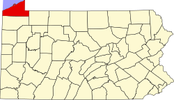
Waterford Township is a township in Erie County, Pennsylvania, United States. The population was 3,910 at the 2020 census, [2] down from 3,920 at the 2010 census. [3]

Contents

History

The Waterford Covered Bridge was listed on the National Register of Historic Places in 1980. [4]

Geography

The township is southeast of the center of Erie County and surrounds the borough of Waterford, a separate municipality. It is 14 miles (23 km) southeast of downtown Erie.

According to the United States Census Bureau, the township has a total area of 50.3 square miles (130.2 km2), of which 50.0 square miles (129.4 km2) is land and 0.35 square miles (0.9 km2), or 0.66%, is water. [3]

Demographics

Historical population
CensusPop.Note
1980 2,874
1990 3,40218.4%
2000 3,87814.0%
2010 3,9201.1%
2020 3,910−0.3%
2022 (est.)3,898 [2] −0.3%
U.S. Decennial Census [5] [6]

As of the census [7] of 2000, there were 3,878 people, 1,362 households, and 1,080 families residing in the township. The population density was 77.5 inhabitants per square mile (29.9/km2). There were 1,447 housing units at an average density of 28.9 per square mile (11.2/km2). The racial makeup of the township was 98.58% White, 0.15% African American, 0.05% Native American, 0.08% Asian, 0.05% from other races, and 1.08% from two or more races. Hispanic or Latino of any race were 0.52% of the population.

There were 1,362 households, out of which 40.7% had children under the age of 18 living with them, 64.2% were married couples living together, 10.1% had a female householder with no husband present, and 20.7% were non-families. 16.8% of all households were made up of individuals, and 4.6% had someone living alone who was 65 years of age or older. The average household size was 2.85 and the average family size was 3.18.

In the township the population was spread out, with 29.5% under the age of 18, 7.4% from 18 to 24, 31.0% from 25 to 44, 23.6% from 45 to 64, and 8.5% who were 65 years of age or older. The median age was 35 years. For every 100 females, there were 104.5 males. For every 100 females age 18 and over, there were 101.8 males.

The median income for a household in the township was $42,270, and the median income for a family was $46,076. Males had a median income of $33,993 versus $22,443 for females. The per capita income for the township was $16,229. About 9.4% of families and 10.8% of the population were below the poverty line, including 12.2% of those under age 18 and 9.8% of those age 65 or over.

Related Research Articles

<span class="mw-page-title-main">East Deer Township, Allegheny County, Pennsylvania</span> Township in Pennsylvania, United States

East Deer Township is a township in Allegheny County, Pennsylvania, United States. The population was 1,490 at the 2020 census.

<span class="mw-page-title-main">Amity Township, Erie County, Pennsylvania</span> Township in Pennsylvania, United States

Amity Township is a township in Erie County, Pennsylvania, United States. The population was 982 at the 2020 census. There are no longer any boroughs or villages in the township, after the disappearance of Arbuckle and Hatch Hollow. The latter was the birthplace of famed muckraker Ida M. Tarbell, who was born in her grandfather's log cabin in Hatch Hollow in 1857.

<span class="mw-page-title-main">Concord Township, Erie County, Pennsylvania</span> Township in Pennsylvania, United States

Concord Township is a township in Erie County, Pennsylvania, United States. The population was 1,279 at the 2020 census,

<span class="mw-page-title-main">Girard Township, Erie County, Pennsylvania</span> Township in Pennsylvania, United States

Girard Township is a township in Erie County, Pennsylvania, United States. The population was 4,872 at the 2020 census, down from the population of 5,102 at the 2010 census.

<span class="mw-page-title-main">Greene Township, Erie County, Pennsylvania</span> Township in Pennsylvania, United States

Greene Township is a township in Erie County, Pennsylvania, United States. The population was 4,487 at the 2020, down from 4,706 at the 2010 census.

<span class="mw-page-title-main">LeBoeuf Township, Erie County, Pennsylvania</span> Township in Pennsylvania, United States

LeBoeuf Township is a township in Erie County, Pennsylvania, United States. The population was 1,657 at the 2020 census, down from 1,698 at the 2010 census.

<span class="mw-page-title-main">Mill Village, Pennsylvania</span> Borough in Pennsylvania, United States

Mill Village is a borough in Erie County, Pennsylvania, United States. The population was 394 at the 2020 census, down from 412 during the 2010 census. It is part of the Erie Metropolitan Statistical Area.

<span class="mw-page-title-main">North East Township, Erie County, Pennsylvania</span> Township in Pennsylvania, United States

North East Township is a township in Erie County, Pennsylvania, United States. The population was 6,530 at the 2020 census, up from 6,315 at the 2010 census, down from 7,702 in 2000.

<span class="mw-page-title-main">Springfield Township, Erie County, Pennsylvania</span> Township in Pennsylvania, United States

Springfield Township is a township in Erie County, Pennsylvania, United States. The population was 3,077 at the 2020 census, down from 3,425 at the 2010 census.

<span class="mw-page-title-main">Waterford, Pennsylvania</span> Borough in Pennsylvania, United States

Waterford is a borough in Erie County, Pennsylvania, United States. The population was 1,475 at the 2020 census. It is part of the Erie Metropolitan Statistical Area.

<span class="mw-page-title-main">Wayne Township, Erie County, Pennsylvania</span> Township in Pennsylvania, United States

Wayne Township is a township in Erie County, Pennsylvania, United States. The population was 1,539 at the 2020 census, down from 1,659 at the 2010 census, down from 1,766 in 2000.

<span class="mw-page-title-main">Washington Township, Greene County, Pennsylvania</span> Township in Pennsylvania, United States

Washington Township is a township that is located in Greene County, Pennsylvania, United States. The population was 1,098 at the time of the 2010 census.

<span class="mw-page-title-main">Warsaw Township, Pennsylvania</span> Township in Pennsylvania, United States

Warsaw Township is a township in Jefferson County, Pennsylvania, United States. As of the 2020 census, the township population was 1,367.

<span class="mw-page-title-main">East Brunswick Township, Schuylkill County, Pennsylvania</span> Township in Pennsylvania, United States

East Brunswick Township is a township in Schuylkill County, Pennsylvania. Brunswick Township was formed in 1801 as one of the original townships of Schuylkill County, being named for Brunswick (Braunschweig), Germany. In 1834, Brunswick Township was divided into East and West Brunswick Townships. Today both townships are served by the Blue Mountain School District.

<span class="mw-page-title-main">Canal Township, Venango County, Pennsylvania</span> Township in Pennsylvania, United States

Canal Township is a township in Venango County, Pennsylvania, United States. The population was 927 at the 2020 census, a decrease from 1,203 in 2010, which was, in turn, an increase over the figure of 1,008 tabulated as of the 2000 census.

<span class="mw-page-title-main">Irwin Township, Venango County, Pennsylvania</span> Township in Pennsylvania, United States

Irwin Township is a township in Venango County, Pennsylvania, United States. The population was 1,253 at the 2020 census, a decrease from 1,319 in 2010, which represented, in turn, an increase from 1,309 as of the 2000 census.

<span class="mw-page-title-main">Freehold Township, Warren County, Pennsylvania</span> Township in Pennsylvania, United States

Freehold Township is a township in Warren County, Pennsylvania, United States. The population was 1,214 at the 2020 census, down from 1,510 at the 2010 census.

<span class="mw-page-title-main">Sugar Grove Township, Warren County, Pennsylvania</span> Township in Pennsylvania, United States

Sugar Grove Township is a township in Warren County, Pennsylvania, United States. The population was 1,613 at the 2020 census,Bureau, US Census. "City and Town Population Totals: 2020-2021". Census.gov. US Census Bureau. Retrieved June 25, 2022.</ref> down from 1,723 at the 2010 census.

<span class="mw-page-title-main">Monaghan Township, York County, Pennsylvania</span> Township in Pennsylvania, United States

Monaghan Township is a township in York County, Pennsylvania, United States. The population was 2,674 at the 2020 census.

<span class="mw-page-title-main">Warrington Township, York County, Pennsylvania</span> Township in Pennsylvania, United States

Warrington Township is a township in York County, Pennsylvania, United States. The population was 4,547 at the 2020 census. The township is named after Warrington, England, like many townships having English names in York County. Others dispute the origin, believing it may be named after Waringstown, County Down, now in Northern Ireland.

References

  1. "2016 U.S. Gazetteer Files". United States Census Bureau. Retrieved August 13, 2017.
  2. 1 2 3 4 Bureau, US Census. "City and Town Population Totals: 2020-2022". Census.gov. US Census Bureau. Retrieved June 19, 2023.
  3. 1 2 "Geographic Identifiers: 2010 Census Summary File 1 (G001): Waterford township, Erie County, Pennsylvania". American Factfinder. U.S. Census Bureau. Archived from the original on February 13, 2020. Retrieved March 22, 2016.
  4. "National Register Information System". National Register of Historic Places . National Park Service. July 9, 2010.
  5. United States Census Bureau. "Erie County Municipality Population Estimates" (PDF). Retrieved June 5, 2016.
  6. "Archived copy" (PDF). Archived from the original (PDF) on November 6, 2017. Retrieved June 5, 2016.{{cite web}}: CS1 maint: archived copy as title (link)
  7. "U.S. Census website". United States Census Bureau . Retrieved January 31, 2008.

41°58′00″N79°56′59″W / 41.96667°N 79.94972°W / 41.96667; -79.94972