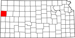
Wallace, Kansas

Last updated

Wallace, Kansas
FtWallaceMuseum.jpg
Barbed-wire buffalo sculpture stands in front of the Fort Wallace Museum (2006)
Wallace County Kansas Incorporated and Unincorporated areas Wallace Highlighted.svg
Location within Wallace County and Kansas
Map of Wallace Co, Ks, USA.png
Coordinates: 38°54′46″N101°35′35″W / 38.91278°N 101.59306°W / 38.91278; -101.59306 [1]
Country United States
State Kansas
County Wallace
Founded1870s
Incorporated 1887
Named for Fort Wallace
Area
[2]
  Total0.40 sq mi (1.04 km2)
  Land0.40 sq mi (1.04 km2)
  Water0.00 sq mi (0.00 km2)
Elevation
[1]
3,314 ft (1,010 m)
Population
 (2020) [3]
  Total41
  Density100/sq mi (39/km2)
Time zone UTC-7 (Mountain (MST))
  Summer (DST) UTC-6 (MDT)
ZIP code
67761
Area code 785
FIPS code 20-74750
GNIS ID 2397178 [1]
Website Info

Wallace is a city in Wallace County, Kansas, United States. [1] As of the 2020 census, the population of the city was 41. [3]

Contents

History

In the early 1870s, the city began after the establishment of Fort Wallace, ordered built by General William Tecumseh Sherman.

The first post office in Wallace was established in August 1872. [4]

Geography

According to the United States Census Bureau, the city has a total area of 0.40 square miles (1.04 km2), all land. [5]

Climate

According to the Köppen Climate Classification system, Wallace has a semi-arid climate, abbreviated "BSk" on climate maps. [6]

Climate data for Wallace, Kansas, 1991–2020 normals, extremes 1903–present
MonthJanFebMarAprMayJunJulAugSepOctNovDecYear
Record high °F (°C)80
(27)
86
(30)
98
(37)
96
(36)
102
(39)
112
(44)
112
(44)
108
(42)
106
(41)
99
(37)
89
(32)
79
(26)
112
(44)
Mean maximum °F (°C)69.0
(20.6)
72.3
(22.4)
82.8
(28.2)
89.0
(31.7)
95.4
(35.2)
102.9
(39.4)
104.1
(40.1)
102.4
(39.1)
98.4
(36.9)
90.9
(32.7)
79.5
(26.4)
67.9
(19.9)
105.6
(40.9)
Average high °F (°C)44.6
(7.0)
47.1
(8.4)
57.6
(14.2)
65.7
(18.7)
75.2
(24.0)
86.8
(30.4)
92.1
(33.4)
89.6
(32.0)
81.9
(27.7)
68.7
(20.4)
55.4
(13.0)
45.2
(7.3)
67.5
(19.7)
Daily mean °F (°C)29.9
(−1.2)
32.3
(0.2)
41.3
(5.2)
50.1
(10.1)
60.5
(15.8)
71.9
(22.2)
77.4
(25.2)
75.0
(23.9)
66.4
(19.1)
52.6
(11.4)
40.0
(4.4)
30.8
(−0.7)
52.4
(11.3)
Average low °F (°C)15.3
(−9.3)
17.5
(−8.1)
25.1
(−3.8)
34.6
(1.4)
45.7
(7.6)
57.1
(13.9)
62.6
(17.0)
60.4
(15.8)
51.0
(10.6)
36.6
(2.6)
24.7
(−4.1)
16.4
(−8.7)
37.2
(2.9)
Mean minimum °F (°C)−3.4
(−19.7)
−0.1
(−17.8)
8.8
(−12.9)
20.7
(−6.3)
31.1
(−0.5)
44.2
(6.8)
53.9
(12.2)
50.6
(10.3)
36.7
(2.6)
20.6
(−6.3)
8.0
(−13.3)
−3.4
(−19.7)
−8.9
(−22.7)
Record low °F (°C)−23
(−31)
−25
(−32)
−10
(−23)
8
(−13)
14
(−10)
32
(0)
42
(6)
37
(3)
23
(−5)
2
(−17)
−6
(−21)
−22
(−30)
−25
(−32)
Average precipitation inches (mm)0.37
(9.4)
0.54
(14)
0.97
(25)
1.79
(45)
2.88
(73)
2.65
(67)
3.93
(100)
3.49
(89)
1.52
(39)
1.49
(38)
0.55
(14)
0.55
(14)
20.73
(527.4)
Average snowfall inches (cm)2.9
(7.4)
5.4
(14)
3.1
(7.9)
1.8
(4.6)
1.0
(2.5)
0.0
(0.0)
0.0
(0.0)
0.0
(0.0)
0.0
(0.0)
0.9
(2.3)
2.7
(6.9)
5.4
(14)
23.2
(59.6)
Average extreme snow depth inches (cm)3.6
(9.1)
4.8
(12)
2.3
(5.8)
0.7
(1.8)
0.8
(2.0)
0.0
(0.0)
0.0
(0.0)
0.0
(0.0)
0.0
(0.0)
0.5
(1.3)
2.1
(5.3)
3.9
(9.9)
7.8
(20)
Average precipitation days (≥ 0.01 in)3.54.54.87.28.88.08.28.35.65.23.14.371.5
Average snowy days (≥ 0.1 in)2.63.62.21.20.10.00.00.00.00.71.73.315.4
Source 1: NOAA [7]
Source 2: National Weather Service [8]

Demographics

Historical population
CensusPop.Note
1880 173
1890 22027.2%
1940 102
1950 1118.8%
1960 110−0.9%
1970 1121.8%
1980 86−23.2%
1990 75−12.8%
2000 67−10.7%
2010 57−14.9%
2020 41−28.1%
U.S. Decennial Census

2010 census

As of the census [9] of 2010, there were 57 people, 24 households, and 16 families residing in the city. The population density was 142.5 inhabitants per square mile (55.0/km2). There were 32 housing units at an average density of 80.0 per square mile (30.9/km2). The racial makeup of the city was 100.0% White.

There were 24 households, of which 29.2% had children under the age of 18 living with them, 58.3% were married couples living together, 8.3% had a female householder with no husband present, and 33.3% were non-families. 29.2% of all households were made up of individuals, and 12.5% had someone living alone who was 65 years of age or older. The average household size was 2.38 and the average family size was 3.00.

The median age in the city was 49.6 years. 24.6% of residents were under the age of 18; 5.3% were between the ages of 18 and 24; 12.3% were from 25 to 44; 40.3% were from 45 to 64; and 17.5% were 65 years of age or older. The gender makeup of the city was 45.6% male and 54.4% female.

2000 census

As of the census [10] of 2000, there were 67 people, 30 households, and 17 families residing in the city. The population density was 166.7 inhabitants per square mile (64.4/km2). There were 35 housing units at an average density of 87.1 per square mile (33.6/km2). The racial makeup of the city was 100.00% White. Hispanic or Latino of any race were 1.49% of the population.

There were 30 households, out of which 33.3% had children under the age of 18 living with them, 43.3% were married couples living together, 13.3% had a female householder with no husband present, and 43.3% were non-families. 43.3% of all households were made up of individuals, and 23.3% had someone living alone who was 65 years of age or older. The average household size was 2.23 and the average family size was 3.06.

In the city, the population was spread out, with 26.9% under the age of 18, 3.0% from 18 to 24, 17.9% from 25 to 44, 25.4% from 45 to 64, and 26.9% who were 65 years of age or older. The median age was 48 years. For every 100 females, there were 91.4 males. For every 100 females age 18 and over, there were 88.5 males.

The median income for a household in the city was $13,125, and the median income for a family was $35,000. Males had a median income of $43,750 versus $33,750 for females. The per capita income for the city was $16,005. There were 28.6% of families and 29.3% of the population living below the poverty line, including 38.5% of under eighteens and 19.2% of those over 64.

Related Research Articles

<span class="mw-page-title-main">Bassett, Kansas</span> City in Allen County, Kansas

Bassett is a city in Allen County, Kansas, United States. It is situated along the Neosho River. As of the 2020 census, the population of the city was 20.

<span class="mw-page-title-main">Cedar Vale, Kansas</span> City in Chautauqua County, Kansas

Cedar Vale is a city in Chautauqua County, Kansas, United States. As of the 2020 census, the population of the city was 476.

<span class="mw-page-title-main">Waverly, Kansas</span> City in Coffey County, Kansas

Waverly is a city in Coffey County, Kansas, United States. As of the 2020 census, the population of the city was 574.

<span class="mw-page-title-main">Atlanta, Kansas</span> City in Cowley County, Kansas

Atlanta is a city in Cowley County, Kansas, United States. As of the 2020 census, the population of the city was 168.

<span class="mw-page-title-main">Gove City, Kansas</span> City in Gove County, Kansas

Gove City, more commonly known as Gove, is a city in and the county seat of Gove County, Kansas, United States. As of the 2020 census, the population of the city was 80.

<span class="mw-page-title-main">Virgil, Kansas</span> City in Greenwood County, Kansas

Virgil is a city in Greenwood County, Kansas, United States. As of the 2020 census, the population of the city was 48. It is located approximately 8 miles east of the city of Hamilton.

<span class="mw-page-title-main">Kingman, Kansas</span> City in Kingman County, Kansas

Kingman is a city in and the county seat of Kingman County, Kansas, United States. As of the 2020 census, the population of the city was 3,105.

<span class="mw-page-title-main">Norwich, Kansas</span> City in Kingman County, Kansas

Norwich is a city in Kingman County, Kansas, United States. As of the 2020 census, the population of the city was 444.

<span class="mw-page-title-main">Mound City, Kansas</span> City and County seat in Kansas, United States

Mound City is a city in and the county seat of Linn County, Kansas, United States. As of the 2020 census, the population of the city was 647.

<span class="mw-page-title-main">Neosho Rapids, Kansas</span> City in Lyon County, Kansas

Neosho Rapids is a city in Lyon County, Kansas, United States. As of the 2020 census, the population of the city was 229.

<span class="mw-page-title-main">Meade, Kansas</span> City in Meade County, Kansas

Meade is a city in and the county seat of Meade County, Kansas, United States. As of the 2020 census, the population of the city was 1,505.

<span class="mw-page-title-main">Galesburg, Kansas</span> City in Neosho County, Kansas

Galesburg is a city in Neosho County, Kansas, United States. As of the 2020 census, the population of the city was 149.

<span class="mw-page-title-main">Thayer, Kansas</span> City in Neosho County, Kansas

Thayer is a city in Neosho County, Kansas, United States. As of the 2020 census, the population of the city was 432.

<span class="mw-page-title-main">Lyndon, Kansas</span> City in Osage County, Kansas

Lyndon is a city in, and the county seat of Osage County, Kansas, United States. As of the 2020 census, the population of the city was 1,037.

<span class="mw-page-title-main">Ogden, Kansas</span> City in Riley County, Kansas

Ogden is a city in Riley County, Kansas, United States. As of the 2020 census, the population of the city was 1,661. It is located near Fort Riley between Manhattan and Junction City.

<span class="mw-page-title-main">Riley, Kansas</span> City in Riley County, Kansas

Riley is a city in Riley County, Kansas, United States. As of the 2020 census, the population of the city was 938.

<span class="mw-page-title-main">Liebenthal, Kansas</span> City in Rush County, Kansas

Liebenthal is a city in Rush County, Kansas, United States. As of the 2020 census, the population of the city was 92. It is located 8 miles north of La Crosse.

<span class="mw-page-title-main">Sharon Springs, Kansas</span> City in Wallace County, Kansas

Sharon Springs is a city in and the county seat of Wallace County, Kansas, United States. As of the 2020 census, the population of the city was 751.

<span class="mw-page-title-main">Benedict, Kansas</span> City in Wilson County, Kansas

Benedict is a city in Wilson County, Kansas, United States, along the Verdigris River. As of the 2020 census, the population of the city was 69.

<span class="mw-page-title-main">Coyville, Kansas</span> City in Wilson County, Kansas

Coyville is a city in Wilson County, Kansas, United States. As of the 2020 census, the population of the city was 60.

References

  1. 1 2 3 4 U.S. Geological Survey Geographic Names Information System: Wallace, Kansas
  2. "2019 U.S. Gazetteer Files". United States Census Bureau. Retrieved July 24, 2020.
  3. 1 2 "Profile of Wallace, Kansas in 2020". United States Census Bureau. Archived from the original on November 15, 2021. Retrieved November 14, 2021.
  4. "Kansas Post Offices, 1828-1961". Kansas Historical Society. Archived from the original on October 9, 2013. Retrieved June 27, 2014.
  5. "US Gazetteer files 2010". United States Census Bureau . Retrieved July 6, 2012.
  6. Climate Summary for Wallace, Kansas
  7. "U.S. Climate Normals Quick Access – Station: Wallace, KS". National Oceanic and Atmospheric Administration. Retrieved September 6, 2023.
  8. "NOAA Online Weather Data – NWS Goodland". National Weather Service. Retrieved September 6, 2023.
  9. "U.S. Census website". United States Census Bureau . Retrieved July 6, 2012.
  10. "U.S. Census website". United States Census Bureau . Retrieved January 31, 2008.

Further reading