Washington Township | |
|---|---|
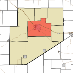 Location of Washington Township in Decatur County | |
| Coordinates: 39°20′13″N85°28′22″W / 39.33694°N 85.47278°W | |
| Country | United States |
| State | Indiana |
| County | Decatur |
| Government | |
| • Type | Indiana township |
| • Township Trustee | Beverly Rivera |
| Area | |
• Total | 55.24 sq mi (143.1 km2) |
| • Land | 55.07 sq mi (142.6 km2) |
| • Water | 0.17 sq mi (0.44 km2) |
| Elevation | 955 ft (291 m) |
| Population (2020) | |
• Total | 14,053 |
| • Density | 255.2/sq mi (98.53/km2) |
| Time zone | EST |
| Area code | 812 |
| FIPS code | 18-80558 [2] |
| GNIS feature ID | 453992 |
Washington Township is one of nine townships in Decatur County, Indiana. As of the 2020 census, its population was 14,053 (up from 13,304 at 2010 [3] ) and it contained 6,177 housing units. [4]
Contents
- History
- Geography
- Cities and towns
- Unincorporated towns
- Adjacent townships
- Major highways
- Cemeteries
- References
- External links
| Census | Pop. | Note | %± |
|---|---|---|---|
| 1890 | 5,518 | — | |
| 1900 | 6,604 | 19.7% | |
| 1910 | 6,828 | 3.4% | |
| 1920 | 6,791 | −0.5% | |
| 1930 | 7,182 | 5.8% | |
| 1940 | 7,495 | 4.4% | |
| 1950 | 8,256 | 10.2% | |
| 1960 | 9,379 | 13.6% | |
| 1970 | 11,112 | 18.5% | |
| 1980 | 11,346 | 2.1% | |
| 1990 | 11,330 | −0.1% | |
| 2000 | 12,206 | 7.7% | |
| 2010 | 13,304 | 9.0% | |
| 2020 | 14,053 | 5.6% | |
| Source: US Decennial Census [5] | |||
