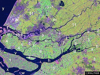
IJsselmonde is a river island in the Netherlands, between the Nieuwe Maas, Noord and Oude Maas branches rivers of the Rhine-Meuse delta in the province of South Holland. The city of Rotterdam now occupies most of the northern part of the island and includes the eponymous former village of IJsselmonde, once a separate community. The island was once a rich agricultural region but is mostly suburbs today. Only the mid-south parts of the island have retained their agricultural character.
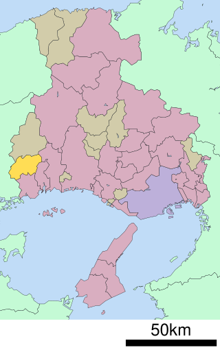
Akō is a district located in Hyōgo Prefecture, Japan.
This is a list of the extreme points of the United Kingdom: the points that are farther north, south, east or west than any other location. Traditionally the extent of the island of Great Britain has stretched "from Land's End to John o' Groats".

Voorne-Putten is an island between the North Sea, the Brielse Meer and the rivers Oude Maas, Spui and Haringvliet in the province of South Holland. Voorne-Putten consists of the two former islands Voorne and Putten. It used to be separated by the river Bernisse which silted up, uniting the two islands. It has 160,000 inhabitants (2008). Recently the riverbed has been dredged, and the two islands have been reformed.
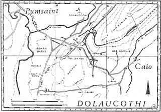
The Afon Cothi in Carmarthenshire is the largest tributary of the River Tywi in south Wales. From its source at Blaen Cothi in the north of the county, north of Pumsaint, it flows south-east and then turns south-west to flow past Cwrt-y-cadno, Pumsaint, Abergorlech and Pont-ar-Gothi before joining the River Tywi west of the village of Llanarthney.

Hoogvliet is a borough of Rotterdam, Netherlands. As of 1 January 2023, it had 35,885 inhabitants. There is also a national chain of Dutch supermarkets with the same name.

The Molucca Sea is located in the western Pacific Ocean, around the vicinity of Indonesia, specifically bordered by the Indonesian Islands of Celebes (Sulawesi) to the west, Halmahera to the east, and the Sula Islands to the south. The Molucca Sea has a total surface area of 77,000 square miles. The Molucca Sea is rich in coral and has many diving sites due to the deepness of its waters. The deepness of the water explains the reasoning behind dividing the sea into three zones, which functions to transport water from the Pacific Ocean to the shallower seas surrounding it. The deepest hollow in the Molucca Sea is the 15,780-foot (4,810-meter) Batjan basin. This region is known for its periodic experiences of earthquakes, which stems from the sea itself being a micro plate, in which the Molucca Sea is being subducted in two opposite directions: one in the direction of the Eurasian Plate to the west and the other in the direction of the Philippine Sea Plate to the east.
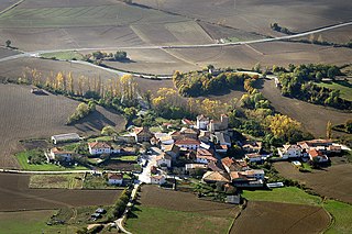
Ollo or Ollaran is a town and municipality located in the province and autonomous community of Navarre, northern Spain.
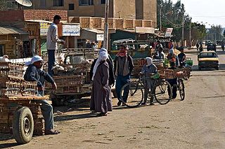
El-Bawiti is a town in the Western desert in Egypt. With 30,000 inhabitants, it is the largest settlement in the Bahariya Oasis.
Harz is a district in Saxony-Anhalt, Germany. Its area is 2,104.9 km2 (812.7 sq mi).

Los Barrios de Luna is a municipality located in the province of León, Castile and León, Spain. According to the 2010 census (INE), the municipality has a population of 309 inhabitants.

Ledigos is a municipality located in the province of Palencia, Castile and León, Spain. According to the 2021 census (INE), the municipality has a population of 66 inhabitants.

Villalba de los Alcores is a municipality located in the province of Valladolid, Castile and León, Spain.
This is a list of the extreme points and extreme elevations in Wales.
Gotheye is a village and rural commune in Niger. Gotheye is situated in Tillaberi, Tillabery, Niger, its geographical coordinates are 13° 51' 26" North, 1° 33' 55" East.
Ploča is a village in the municipality of Aleksandrovac, Serbia. According to the 2002 census, the village has a population of 400 people.
Vrba is a village in the municipality of Tutin, Serbia. According to the 2002 census, the village has a population of 196 people.
Udarny, Udarnaya, or Udarnoye is the name of several inhabited localities in Russia.
Stepanovsky, Stepanovskaya, or Stepanovskoye is the name of several rural localities in Russia.
This page is based on this
Wikipedia article Text is available under the
CC BY-SA 4.0 license; additional terms may apply.
Images, videos and audio are available under their respective licenses.


