Westville, Florida | |
---|---|
Coordinates: 30°46′4″N85°51′8″W / 30.76778°N 85.85222°W | |
Country | United States |
State | Florida |
County | Holmes |
Incorporated | 1970 [1] |
Government | |
• Type | Mayor-Council |
• Mayor [2] | Stephen Herrington III |
• Councilmembers | Susan Bergeron, Brittney Simmons, Jason Stafford, Paul Sasnett, and Samanatha Webster |
• Town Clerk | Tammy Bowers |
Area | |
• Total | 7.48 sq mi (19.37 km2) |
• Land | 7.22 sq mi (18.69 km2) |
• Water | 0.26 sq mi (0.68 km2) |
Elevation | 69 ft (21 m) |
Population (2020) | |
• Total | 261 |
• Density | 36.17/sq mi (13.96/km2) |
Time zone | UTC-6 (Central (CST)) |
• Summer (DST) | UTC-5 (CDT) |
ZIP code | 32464 |
Area code | 850 |
FIPS code | 12-76975 [4] |
GNIS feature ID | 0293152 [5] |
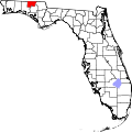
Westville is a town in Holmes County, Florida, United States. Westville is part of the Florida Panhandle in North Florida. As of the 2020 census, the town had a population of 261, down from 289 at the 2010 census. From 2010 to 2020, Westville's population growth percentage was -9.7%.
Westville is located in southern Holmes County at 30°46′4″N85°51′8″W / 30.76778°N 85.85222°W (30.767681, –85.852302), [6] on the west side of the Choctawhatchee River. To the east across the river is the town of Caryville in Washington County.
U.S. Route 90 passes through Westville, leading east through Caryville 11 miles (18 km) to Bonifay, the Holmes County seat, and west 18 miles (29 km) to DeFuniak Springs. Interstate 10 passes through the southern part of the town limits, but the closest access is from Exit 104 in Caryville.
According to the United States Census Bureau, Westville has a total area of 7.5 square miles (19.4 km2), of which 7.2 square miles (18.7 km2) are land and 0.3 square miles (0.7 km2), or 3.53%, are water.
The climate in this area is characterized by hot, humid summers and generally mild winters. According to the Köppen climate classification, the Town of Westville has a humid subtropical climate zone (Cfa).
Census | Pop. | Note | %± |
---|---|---|---|
1980 | 343 | — | |
1990 | 257 | −25.1% | |
2000 | 221 | −14.0% | |
2010 | 289 | 30.8% | |
2020 | 261 | −9.7% | |
U.S. Decennial Census [7] |
Race | Pop 2010 [8] | Pop 2020 [9] | % 2010 | % 2020 |
---|---|---|---|---|
White (NH) | 274 | 247 | 94.81% | 94.64% |
Black or African American (NH) | 1 | 0 | 0.35% | 0.00% |
Native American or Alaska Native (NH) | 0 | 0 | 0.00% | 0.00% |
Asian (NH) | 0 | 1 | 0.00% | 0.38% |
Pacific Islander or Native Hawaiian (NH) | 0 | 0 | 0.00% | 0.00% |
Some other race (NH) | 0 | 0 | 0.00% | 0.00% |
Two or more races/Multiracial (NH) | 9 | 9 | 3.11% | 3.45% |
Hispanic or Latino (any race) | 5 | 4 | 1.73% | 1.53% |
Total | 289 | 261 | 100.00% | 100.00% |
As of the 2020 United States census, there were 261 people, 137 households, and 97 families residing in the town. [10]
For the period 2011-2015, the estimated median annual income for a household in the town was $34,375, and the median income for a family was $38,750. [11]
As of the 2010 United States census, there were 289 people, 103 households, and 91 families residing in the town. [12]
Of the 110 households in 2010, 37.3% had children under the age of 18 living with them, 55.5% were headed by married couples living together, 11.8% had a female householder with no husband present, and 26.4% were non-families. 20.0% of all households were made up of individuals, and 11.8% were someone living alone who was 65 years of age or older. The average household size was 2.63, and the average family size was 3.04. There were 137 housing units, of which 80.3% were occupied. [13]
In 2010, 26.0% of the town's population were under the age of 18, 8.6% were from age 18 to 24, 25.9% were from 25 to 44, 23.5% were from 45 to 64, and 15.9% were 65 years of age or older. The median age was 38.1 years. For every 100 females, there were 92.7 males. For every 100 females age 18 and over, there were 103.8 males. [13]
As of the census of 2000, there were 221 people, 94 households, and 64 families residing in the town. The population density was 30.4 people per square mile (11.7/km2). There were 107 housing units at an average density of 14.7/sq mi (5.7/km2). The racial makeup of the town was 98.64% White, 0.45% Asian, and 0.90% from two or more races. Hispanic or Latino of any race were 2.26% of the population.
In 2000, there were 94 households out of which 30.9% had children under the age of 18 living with them, 50.0% were married couples living together, 13.8% had a female householder with no husband present, and 31.9% were non-families. 29.8% of all households were made up of individuals and 14.9% had someone living alone who was 65 years of age or older. The average household size was 2.35 and the average family size was 2.91.
In 2000, in the town, the population was spread out with 24.0% under the age of 18, 10.4% from 18 to 24, 27.1% from 25 to 44, 23.5% from 45 to 64, and 14.9% who were 65 years of age or older. The median age was 35 years. For every 100 females there were 82.6 males. For every 100 females age 18 and over, there were 78.7 males.
In 2000, the median income for a household in the town was $27,000, and the median income for a family was $34,375. Males had a median income of $25,625 versus $20,500 for females. The per capita income for the town was $11,415. About 9.2% of families and 13.9% of the population were below the poverty line, including 9.5% of those under the age of eighteen and 22.2% of those sixty five or over.
Penney Farms is a town in Clay County, Florida, United States. It is part of the Jacksonville, Florida Metropolitan Statistical Area. The population was 821 at the 2020 census, up from 749 at the 2010 census.
Bell is a town in Gilchrist County, Florida, United States. The Town of Bell is situated in the northern part of the county, and located in North Florida. The population was 518 at the 2020 US Census, up from 456 at the 2010 US Census. It is part of the Gainesville, Florida Metropolitan Statistical Area.
Bascom is a town in Jackson County, Florida, United States. The town is located on the Florida Panhandle in North Florida, and is 5 miles (8 km) south of the Alabama border. The population was 121 at the 2020 census.
Redington Beach is a town in Pinellas County, Florida, United States. It is part of the Tampa–St. Petersburg–Clearwater Metropolitan Statistical Area, more commonly called the Tampa Bay Area. The population was 1,376 at the 2020 census.
Pierson is a town in Volusia County, Florida, United States. The town is part of the Deltona–Daytona Beach–Ormond Beach, Florida Metropolitan Statistical Area. The population was 1,542 as of the 2020 census.
Paxton is a town in Walton County, Florida, United States. Located near Britton Hill on the Alabama–Florida state line, it has the highest elevation of any in Florida. The Town of Paxton is located on the Florida Panhandle, and is part of the Crestview–Fort Walton Beach–Destin, Florida Metropolitan Statistical Area. The population was 556 as of the 2020 census, down from 644 at the 2010 census.
Caryville is a town in Washington County, Florida, United States located along the Choctawhatchee River. The Caryville is part of the Florida Panhandle in North Florida. The population was 301 at the 2020 census, down from 411 at the 2010 census. It is part of the Panama City—Panama City Beach, Florida Metropolitan Statistical Area.
Ingalls is a city in Gray County, Kansas, United States. As of the 2020 census, the population of the city was 252. It is located along Highway 50.
Walnut Grove is a city in Redwood County, Minnesota, United States. The population was 871 at the 2010 census. Another name formerly associated with the area is Walnut Station.
Mansfield is a city in Wright County, Missouri, United States. The population was 1,296 at the 2010 census.
Indian River Shores is a town in Indian River County, Florida, United States. As of the 2020 census, the town has a population of 4,241. Located on Orchid Island, Indian River Shores is bordered by the Atlantic Ocean to the east and the Indian River Lagoon to the west.
De Smet is a city in and the county seat of Kingsbury County, South Dakota, United States. The population was 1,056 at the 2020 census.
Lake Preston is a city in Kingsbury County, South Dakota, United States. The population was 599 at the 2010 census.
Keystone is a town in the Black Hills region of Pennington County, South Dakota, United States. The population was 240 at the 2020 census. It had its origins in 1883 as a mining town, and has since transformed itself into a resort town, serving the needs of the millions of visitors to the Mount Rushmore National Memorial, which is located just beyond the town limits. Keystone was heavily damaged in the 1972 Black Hills flood.
Caryville is a town in Campbell County, Tennessee, United States. The population was 2,297 at the 2010 census.
Rome is a census-designated place (CDP) in the town of Sullivan in Jefferson County, Wisconsin, United States, along the Bark River. The population was 752 at the 2020 census.
Linn is a town in Walworth County, Wisconsin, United States. The population was 2,687 at the 2020 census. The unincorporated communities of Linton and Zenda are located within the town.
Holland is a town in Erie County, New York, United States. The population was 3,401 at the 2010 census. The name is derived from the Holland Land Company, the original title-holder to most of the land of Western New York.
Pepin is a town in Pepin County, Wisconsin, United States. The population was 580 at the 2000 census. The unincorporated communities of Barry Corner, Devils Corner, Hawkins Corner, and Lakeport are located in the town. The unincorporated community of Lund is also partially located within the town.
Pepin is a village in Pepin County, Wisconsin, United States. The population was 837 at the 2010 census. The village is located within the Town of Pepin.