Widener, Arkansas | |
---|---|
Coordinates: 35°01′25″N90°40′55″W / 35.02361°N 90.68194°W | |
Country | United States |
State | Arkansas |
County | St. Francis |
Area | |
• Total | 0.55 sq mi (1.41 km2) |
• Land | 0.55 sq mi (1.41 km2) |
• Water | 0.00 sq mi (0.00 km2) |
Elevation | 200 ft (60 m) |
Population (2020) | |
• Total | 212 |
• Density | 388.99/sq mi (150.23/km2) |
Time zone | UTC-6 (Central (CST)) |
• Summer (DST) | UTC-5 (CDT) |
FIPS code | 05-75560 |
GNIS feature ID | 2406885 [2] |
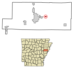
Widener is a town in St. Francis County, Arkansas, United States. The population was 212 at the 2020 census, a decline from 273 in 2010.
According to the United States Census Bureau, the town has a total area of 1.3 km2 (0.5 mi2), all land.
Census | Pop. | Note | %± |
---|---|---|---|
1910 | 245 | — | |
1920 | 449 | 83.3% | |
1930 | 235 | −47.7% | |
1940 | 225 | −4.3% | |
1950 | 187 | −16.9% | |
1960 | 203 | 8.6% | |
1970 | 292 | 43.8% | |
1980 | 316 | 8.2% | |
1990 | 381 | 20.6% | |
2000 | 335 | −12.1% | |
2010 | 273 | −18.5% | |
2020 | 212 | −22.3% | |
U.S. Decennial Census [3] |
Race | Number | Percentage |
---|---|---|
White (NH) | 66 | 31.13% |
Black or African American (NH) | 136 | 64.15% |
Asian (NH) | 3 | 1.42% |
Mixed/Multi-Racial (NH) | 5 | 2.36% |
Hispanic or Latino | 2 | 0.94% |
Total | 212 |
As of the 2020 United States census, there were 212 people, 90 households, and 58 families residing in the town.
As of the census [7] of 2000, there were 335 people, 111 households, and 81 families residing in the town. The population density was 258.7/km2 (663.9/mi2). There were 129 housing units at an average density of 99.6/km2 (255.7/mi2). The racial makeup of the town was 31.94% White, 67.16% Black or African American, 0.30% Asian, 0.60% from other races. 2.39% of the population were Hispanic or Latino of any race.
There were 111 households, out of which 39.6% had children under the age of 18 living with them, 42.3% were married couples living together, 22.5% had a female householder with no husband present, and 27.0% were non-families. 20.7% of all households were made up of individuals, and 6.3% had someone living alone who was 65 years of age or older. The average household size was 3.02 and the average family size was 3.65.
In the town, the population was spread out, with 36.7% under the age of 18, 9.3% from 18 to 24, 26.9% from 25 to 44, 16.1% from 45 to 64, and 11.0% who were 65 years of age or older. The median age was 28 years. For every 100 females, there were 92.5 males. For every 100 females age 18 and over, there were 91.0 males.
The median income for a household in the town was $20,833, and the median income for a family was $24,375. Males had a median income of $23,929 versus $20,625 for females. The per capita income for the town was $12,135. About 34.2% of families and 38.7% of the population were below the poverty line, including 41.1% of those under age 18 and 34.1% of those age 65 or over.
Forrest City School District operates public schools serving the community. [8] Forrest City High School is the local high school.
Edmondson is a town in Crittenden County, Arkansas, United States. The population was 427 at the 2010 census.
Jennette is a town in Crittenden and St. Francis counties, Arkansas, United States. The population was 118 at the 2020 census.
Grubbs is a city in Jackson County, Arkansas, United States. The population was 386 at the 2010 census.
Wickes is a city in Polk County, Arkansas, United States. The population was 754 at the 2010 census.
Fredonia (Biscoe) is a city in Prairie County, Arkansas, United States. The population was 363 at the 2010 census.
Traskwood is a city in Saline County, Arkansas, United States. The population was 518 at the 2010 census. It is part of the Little Rock–North Little Rock–Conway Metropolitan Statistical Area.
Caldwell is a town in St. Francis County, Arkansas, United States. The population was 555 at the 2010 census, an increase from 465 in 2000.
Plantation Mobile Home Park is a census-designated place (CDP) in Palm Beach County, Florida, United States. It is part of the Miami metropolitan area of South Florida. The population was 1,462 at the 2020 US census.
Pierson is a town in Volusia County, Florida, United States. The town is part of the Deltona–Daytona Beach–Ormond Beach, Florida Metropolitan Statistical Area. The population was 1,542 as of the 2020 census.
Dumas is a town in Tippah County, Mississippi. The population was 470 at the 2010 census.
Newport East is a census-designated place (CDP) in the town of Middletown, Newport County, Rhode Island, United States. The CDP encompasses the portion of the urban area of the city of Newport that extends beyond the municipal boundaries. The population of the CDP was 11,769 at the 2010 census.
Greenville is a village and census-designated place (CDP) in the town of Smithfield in Providence County, Rhode Island, United States. The population was 8,658 at the 2010 census. The CDP is centered on the village of Greenville but also encompasses the nearby villages of West Greenville and Spragueville, as well as the Mountaindale Reservoir and beach.
Harrisville is a census-designated place (CDP) and village in the town of Burrillville in Providence County, Rhode Island, United States. The population was 1,605 at the 2010 census. Much of the community composes a historic district listed on the National Register of Historic Places. The village was named after nineteenth century manufacturer Andrew Harris. Previously, the village was named Rhodesville, after Captain William Rhodes, an eighteenth century privateer.
Valley Falls is a village and census-designated place (CDP) in the town of Cumberland, Providence County, Rhode Island, United States. The population was 12,094 at the 2020 census.
Ashaway is an unincorporated village and census-designated place (CDP) in the town of Hopkinton, Rhode Island, USA. It is a principal village of Hopkinton, along with Hope Valley, although it is the smaller of the two. The population was 1,485 at the 2010 census. The name Ashaway is derived from the American Indian name for the river that runs through the village, the Ashawague or Ashawaug, which means "land in the middle" or "land between" in the Niantic and Mohegan languages. The name "Ashawague River" appears as late as 1832 on the Findley map of Rhode Island published in Philadelphia.
Hope Valley is a village and census-designated place (CDP) in the town of Hopkinton, Rhode Island, United States. The population of the CDP was 1,612 at the 2010 census. Hope Valley is the largest village in Hopkinton, and the town's principal commercial center. While the village of Hope Valley is located in Hopkinton, its zip code, 02832, extends into the neighboring town of Richmond.
Wakefield-Peacedale is a census-designated place (CDP) in the town of South Kingstown in Washington County, Rhode Island, United States that includes the villages of Peace Dale and Wakefield. The population was 8,487 at the 2010 census.
Waelder is a city in Gonzales County, Texas, United States and is also part of the Texas-German belt. The population was 933 at the 2020 census.
Camp Wood is a city in Real County, Texas, United States, in the Texas Hill Country, which is part of the Edwards Plateau. The population was 706 at the 2010 census.
La Pryor is a census-designated place (CDP) in Zavala County, Texas, United States. Its population was 1,643 at the 2010 census.