Woodsboro, Texas

Last updated

Woodsboro, Texas
Eagle Dome - Woodsboro, Texas (8296432480).jpg
A hurricane shelter/high school gym in Woodsboro, Texas
TXMap-doton-Woodsboro.PNG
Location of Woodsboro, Texas
Refugio County Woodsboro.svg
Coordinates: 28°14′16″N97°19′30″W / 28.23778°N 97.32500°W / 28.23778; -97.32500
Country United States
State Texas
County Refugio
Area
[1]
  Total0.76 sq mi (1.96 km2)
  Land0.76 sq mi (1.96 km2)
  Water0.00 sq mi (0.00 km2)
Elevation
43 ft (13 m)
Population
 (2010)
  Total1,512
  Estimate 
(2019) [2]
1,410
  Density1,862.62/sq mi (719.37/km2)
Time zone UTC-6 (Central (CST))
  Summer (DST) UTC-5 (CDT)
ZIP code
78393
Area code 361
FIPS code 48-80176 [3]
GNIS feature ID1350565 [4]
Website www.woodsborotx.net

Woodsboro is a town in Refugio County, Texas, United States. The population was 1,512 at the 2010 census.

Contents

Geography

Woodsboro is located at 28°14′16″N97°19′30″W / 28.23778°N 97.32500°W / 28.23778; -97.32500 (28.237826, –97.325068). [5]

According to the United States Census Bureau, the town has a total area of 0.8 square miles (2.1 km2), all land.

Climate

The climate in this area is characterized by hot, humid summers and generally mild to cool winters. According to the Köppen Climate Classification system, Woodsboro has a humid subtropical climate, abbreviated "Cfa" on climate maps. [6]

Demographics

Historical population
CensusPop.Note
1930 1,286
1940 1,42610.9%
1950 1,83628.8%
1960 2,08113.3%
1970 1,839−11.6%
1980 1,9747.3%
1990 1,731−12.3%
2000 1,685−2.7%
2010 1,512−10.3%
2019 (est.)1,410 [2] −6.7%
U.S. Decennial Census [7]

2020 census

Woodsboro racial composition [8]
(NH = Non-Hispanic) [lower-alpha 1]
RaceNumberPercentage
White (NH)54541.32%
Black or African American (NH)544.09%
Native American or Alaska Native (NH)10.08%
Asian (NH)100.76%
Some Other Race (NH)10.08%
Mixed/Multi-Racial (NH)161.21%
Hispanic or Latino 69252.46%
Total1,319

As of the 2020 United States census, there were 1,319 people, 489 households, and 311 families residing in the town.

2000 census

As of the census [3] of 2000, there were 1,685 people, 613 households, and 446 families residing in the town. The population density was 2,218.6 inhabitants per square mile (856.6/km2). There were 705 housing units at an average density of 928.3 per square mile (358.4/km2). The racial makeup of the town was 77.51% White, 3.62% African American, 0.47% Native American, 0.12% Asian, 0.06% Pacific Islander, 15.07% from other races, and 3.15% from two or more races. Hispanic or Latino of any race were 53.89% of the population.

There were 613 households, out of which 34.1% had children under the age of 18 living with them, 56.0% were married couples living together, 13.1% had a female householder with no husband present, and 27.1% were non-families. 23.5% of all households were made up of individuals, and 11.1% had someone living alone who was 65 years of age or older. The average household size was 2.74 and the average family size was 3.28.

In the town, the population was spread out, with 28.1% under the age of 18, 8.2% from 18 to 24, 26.9% from 25 to 44, 22.7% from 45 to 64, and 14.1% who were 65 years of age or older. The median age was 36 years. For every 100 females, there were 92.6 males. For every 100 females age 18 and over, there were 86.7 males.

The median income for a household in the town was $27,875, and the median income for a family was $33,456. Males had a median income of $26,292 versus $16,875 for females. The per capita income for the town was $14,133. About 14.7% of families and 17.1% of the population were below the poverty line, including 20.3% of those under age 18 and 18.1% of those age 65 or over.

Education

The City of Woodsboro is served by the Woodsboro Independent School District and home to the Woodsboro High School Eagles.

History

Woodsboro is located in southwestern Refugio County, five miles southwest of the city of Refugio at the intersection of U.S. Highway 77 (Future Interstate 69E) and Farm to Market Road 2441. The town began as part of a land development project organized in 1906 by W. C. Johnson and George P. Pugh, experienced developers from Danville, Illinois. The town was originally called Church because it was located just north of the Church siding on the St. Louis, Brownsville and Mexico Railway, which built through the area in 1906. The town site was laid out in November and December 1906, and by February 1907 Johnson and Pugh had completed the town's first structure, a wooden hotel built to house prospective land buyers. ("This is the Real Garden of the Lord," a large sign painted on the side of the hotel advised visitors.) A post office was established in the hotel later that year, and the town's name was changed to Woodsboro after Captain Tobias D. Wood, who had sold the Bonnie View Ranch to the developers. The surrounding farmlands were praised in advertisements distributed across Texas and midwestern states, and a number of settlers began to move into the area. By 1908, when Woodsboro was officially platted, a school had been established, and the town already had grown to include about twenty-five buildings, including the hotel, a cotton gin, a lumberyard, and a number of dwellings. Other stores and a Masonic temple were quickly added, and in 1910 the town's first newspaper, the Woodsboro Hustler, began publication. The Bank of Refugio opened a branch in Woodsboro in 1912, and in 1913 a contract was awarded to install electrical power and lights in the community. By 1914 there were about 500 people living in Woodsboro. The Commercial Club, a group of local businessmen organized soon after the town's creation, actively worked to improve the community. The club organized the town's first water works, which were turned over to the local government when Woodsboro incorporated in 1928.

An estimated 450 people lived in Woodsboro in 1925, but the town experienced a small boom after 1928, when oil was discovered nearby. As construction and oilfield workers moved into the area, Woodsboro's population rapidly increased, rising to 1,286 by 1930. Though the town was touched by the Great Depression in the early 1930s, by the late 1930s oil activity had revived in the area, and the town continued to grow. By 1941 Woodsboro had thirty-five businesses and a population of 1,426. Though the number of farms in the area surrounding the city declined after World War II, the oil and gas industry helped to sustain the local economy until the county's petroleum production dropped significantly during the 1980s. Woodsboro's population was 1,829 in 1950 and 2,081 in 1960, then declined to 1,839 in 1970 before rising slightly to 1,974 in 1980. Woodsboro had fifty-two businesses in 1980, but by 1988 only thirty-three were reported in the town. In 1990 there were 1,731 residents.

Related Research Articles

<span class="mw-page-title-main">Refugio County, Texas</span> County in Texas, United States

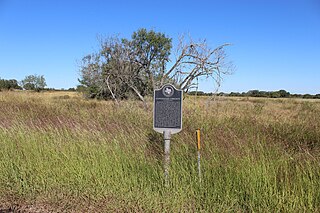
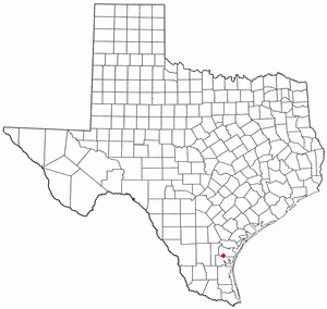
Refugio County is a county located in the U.S. state of Texas. As of the 2020 census, its population was 6,741. Its county seat is Refugio. The county originated as a municipality of Mexico in 1834 and was classified as a county in 1837.

<span class="mw-page-title-main">Goliad County, Texas</span> County in Texas, United States

Goliad County is a county located in the U.S. state of Texas. As of the 2020 census, the population is 7,012. Its county seat is Goliad. The county is named for Father Miguel Hidalgo; "Goliad" is an anagram, minus the silent H. The county was created in 1836 and organized the next year.

<span class="mw-page-title-main">Woodsboro, Maryland</span> Town in Maryland

Woodsboro is a town in Frederick County, Maryland, United States that was granted to Joseph Wood in 1693. The population was 1,092 at the 2020 census.

<span class="mw-page-title-main">Troy, Texas</span> City in Texas, United States

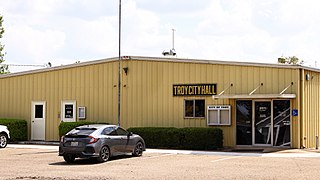
Troy is a city in Bell County, Texas, United States. The population was 2,375 at the 2020 census. It is part of the Killeen–Temple–Fort Hood Metropolitan Statistical Area.

<span class="mw-page-title-main">Meridian, Texas</span> City in Texas, United States

Meridian is a city and the county seat of Bosque County in central Texas, United States. It is forty-seven miles northwest of Waco. The population was 1,493 at the 2010 census.

<span class="mw-page-title-main">Santa Rosa, Texas</span> Town in Texas, United States

Santa Rosa is a town in Cameron County, Texas, United States. The population was 2,873 at the 2010 census. It is part of the Brownsville–Harlingen–Raymondville and the Matamoros–Brownsville metropolitan areas.

<span class="mw-page-title-main">Muenster, Texas</span> City in Texas, United States

Muenster is a city in western Cooke County, Texas, United States, along U.S. Route 82. The population was 1,544 at the 2010 census. Muenster is a primarily German-Texan city.

<span class="mw-page-title-main">Paducah, Texas</span> Town in Texas, United States

Paducah is a town in Cottle County, Texas, United States. The population was 1,186 at the 2010 census, down from 1,498 in 2000. It is the county seat of Cottle County. It is just south of the Texas Panhandle and east of the Llano Estacado.

<span class="mw-page-title-main">Waelder, Texas</span> City in Texas, United States

Waelder is a city in Gonzales County, Texas, United States and is also part of the Texas-German belt. The population was 933 at the 2020 census.

<span class="mw-page-title-main">Itasca, Texas</span> City in Texas, United States

Itascaeye-TAS-kə is a city in Hill County in Northern Central Texas, United States. As of the 2010 census, the city population was 1,644.

<span class="mw-page-title-main">Karnes City, Texas</span> City in Texas, United States

Karnes City is a city in and county seat of Karnes County, Texas, United States. The population was 3,111 at the 2020 census, up from 3,042 at the 2010 census. The town was named after Henry Karnes of the Texas Revolution. Karnes is 24 miles (39 km) southeast of Floresville and 54 miles (87 km) southeast of San Antonio on U.S. Highway 181.

<span class="mw-page-title-main">Runge, Texas</span> Town in Texas, United States

Runge is a town in Karnes County, Texas, United States. The town is pronounced "Run-Gee". The population was 892 at the 2020 census.

<span class="mw-page-title-main">Bishop, Texas</span> City in Texas, United States

Bishop is a city in Nueces County, Texas, United States. The population was 3,134 in the 2010 census, down from 3305 at the 2000 census.

<span class="mw-page-title-main">Strawn, Texas</span> City in Texas, United States

Strawn is a city in Palo Pinto County, Texas, United States. The population was 653 at the 2010 census. Strawn, on State Highway 16 and 108, Farm to Market Road 2372, and the Missouri Pacific Railroad in southwestern Palo Pinto County, was one of several towns developed about 1880 when the Texas and Pacific Railway began service. The site, known earlier as North Fork for its location on Palo Pinto Creek, was laid out on the land of two early ranchers, Stephen Bethel Strawn and James N. Stuart. Stuart built the area's first house in 1875. A community to the west, Russell's Pocket, and one to the east, Davidsonville, were merged to form Strawn.

<span class="mw-page-title-main">Friona, Texas</span> City in Texas, United States

Friona is a city in Parmer County, Texas, United States. The population was 4,171 at the 2020 census. Friona was established as a small community in 1898 by XIT Ranch, originally called Frio, which is also the word for "cold" in Spanish.

<span class="mw-page-title-main">Bayside, Texas</span> Town in Texas, United States

Bayside is a town in southern Refugio County, in the U.S. state of Texas. The population was 325 at the 2010 census.

<span class="mw-page-title-main">Refugio, Texas</span> Town in Texas, United States

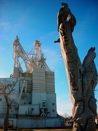
Refugio is a town in Refugio County, of which it is the county seat, in the U.S. state of Texas. The population was 2,890 as of the 2010 Census. Refugio is the birthplace of Baseball Hall of Fame member Nolan Ryan.

<span class="mw-page-title-main">San Augustine, Texas</span> City in Texas, United States

San Augustine is the county seat city of San Augustine County, Texas, in East Texas, United States. The population was 1,920 at the 2020 census.

<span class="mw-page-title-main">Taft, Texas</span> City in Texas, United States

Taft is a city in San Patricio County, Texas, United States. The population was 3,048 at the 2010 census.

<span class="mw-page-title-main">Stockdale, Texas</span> City in Texas, United States

Stockdale is a city in Wilson County, Texas, United States. The population was 1,413 at the 2020 census. It is part of the San Antonio Metropolitan Statistical Area.

References

  1. "2019 U.S. Gazetteer Files". United States Census Bureau. Retrieved August 7, 2020.
  2. 1 2 "Population and Housing Unit Estimates". United States Census Bureau. May 24, 2020. Retrieved May 27, 2020.
  3. 1 2 "U.S. Census website". United States Census Bureau . Retrieved January 31, 2008.
  4. "US Board on Geographic Names". United States Geological Survey. October 25, 2007. Retrieved January 31, 2008.
  5. "US Gazetteer files: 2010, 2000, and 1990". United States Census Bureau. February 12, 2011. Retrieved April 23, 2011.
  6. Climate Summary for Woodsboro, Texas
  7. "Census of Population and Housing". Census.gov. Retrieved June 4, 2015.
  8. "Explore Census Data". data.census.gov. Retrieved May 21, 2022.
  9. https://www.census.gov/ [ not specific enough to verify ]
  10. "About the Hispanic Population and its Origin". www.census.gov. Retrieved May 18, 2022.
  1. Note: the US Census treats Hispanic/Latino as an ethnic category. This table excludes Latinos from the racial categories and assigns them to a separate category. Hispanics/Latinos can be of any race. [9] [10]