Youngsville, North Carolina

Last updated

Youngsville, North Carolina
Youngsville, North Carolina.jpg
NCMap-doton-Youngsville.PNG
Location of Youngsville, North Carolina
Coordinates: 36°01′27″N78°28′54″W / 36.02417°N 78.48167°W / 36.02417; -78.48167
Country United States
State North Carolina
County Franklin
Established1839
IncorporatedMarch 17, 1875 [1]
Named for John "Jack" Young
Government
  Type Board of Commissioners
   Mayor Fonzie A. Flowers (R)
Area
[2]
  Total1.86 sq mi (4.82 km2)
  Land1.85 sq mi (4.80 km2)
  Water0.01 sq mi (0.02 km2)
Elevation
[3]
436 ft (133 m)
Population
 (2020)
  Total2,016
  Density1,087.97/sq mi (420.17/km2)
Time zone UTC-5 (Eastern (EST))
  Summer (DST) UTC-4 (EDT)
ZIP code
27596
Area code(s) 919 and 984
FIPS code 37-76200 [4]
GNIS feature ID2406927 [3]
Website http://townofyoungsville.org/

Youngsville is a town in Franklin County, North Carolina, United States. The population was 2,016 at the 2020 census.

Contents

History

The settlement was originally established as Pacific around 1839 on land owned by John "Jack" Young. It was renamed Youngsville in his honor when the town was incorporated in 1875. [5] [6]

Notable area residents include country music singer Jason Michael Carroll.

William A. Jeffreys House was listed on the National Register of Historic Places in 1976. [7]

Geography

Youngsville is located near Raleigh. According to the United States Census Bureau, the town has a total area of 1.6 square miles (4.1 km2), all land.

A railway operated by CSX Transportation currently passes through Youngsville, which is part of the old Seaboard Coast Line Railroad "S-Line". [8]

Demographics

Historical population
CensusPop.Note
1880 117
1890 20575.2%
1900 34568.3%
1910 43124.9%
1920 414−3.9%
1930 395−4.6%
1940 55340.0%
1950 61911.9%
1960 596−3.7%
1970 555−6.9%
1980 486−12.4%
1990 424−12.8%
2000 65153.5%
2010 1,15777.7%
2020 2,01674.2%
U.S. Decennial Census [9]

2020 census

Youngsville racial composition [10]
RaceNumberPercentage
White (non-Hispanic)1,19059.03%
Black or African American (non-Hispanic)49024.31%
Native American 70.35%
Asian 170.84%
Other/Mixed 1205.95%
Hispanic or Latino 1929.52%

As of the 2020 United States census, there were 2,016 people, 809 households, and 529 families residing in the town.

2010 census

As of the census [4] of 2010, there were 1,157 people, 522 households, and 294 families residing in the town. The population density was 723.1 inhabitants per square mile (279.2/km2). The racial makeup of the town was 69.3% White, 25.1% African American, 0.3% Native American, 0.8% Asian, 0.0% Pacific Islander, 2.9% from other races, and 1.6% from two or more races. Hispanic or Latino of any race were 4.8% of the population.

There were 522 households, out of which 28.9% had children under the age of 18 living with them, 35.8% were married couples living together, 15.5% had a female householder with no husband present, and 43.7% were non-families. 35.1% of all households were made up of individuals, and 7.0% had someone living alone who was 65 years of age or older. The average household size was 2.22 and the average family size was 2.89.

In the town, the population was spread out, with 26.8% under the age of 20, 8.5% from 20 to 24, 31.8% from 25 to 44, 24.1% from 45 to 64, and 8.8% who were 65 years of age or older. The median age was 32.5 years. For every 100 females, there were 92.5 males. For every 100 females age 18 and over, there were 89.9 males.

The median income for a household in the town was $34,795, and the median income for a family was $43,250. Males had a median income of $32,500 versus $33,125 for females. The per capita income for the town was $21,927. About 8.2% of families and 9.3% of the population were below the poverty line, including 9.1% of those under age 18 and 2.9% of those age 65 or over.

Housing

There were 562 housing units at an average density of 351.3 per square mile (135.6/km2). 7.1% of housing units were vacant.

There were 522 occupied housing units in the town. 203 were owner-occupied units (38.9%), while 319 were renter-occupied (61.1%). The homeowner vacancy rate was 7.7% of total units. The rental unit vacancy rate was 3.6%. [4]

Government

Youngsville is governed by a mayor and five-member Board of Commissioners, who are elected in staggered four-year terms. [11] [12]

Related Research Articles

<span class="mw-page-title-main">Franklin County, North Carolina</span> County in North Carolina, United States

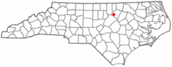
Franklin County is a county located in the U.S. state of North Carolina. As of the 2020 census, the population was 68,573. Its county seat is Louisburg.

<span class="mw-page-title-main">Elberfeld, Indiana</span> Town in Indiana, United States

Elberfeld is a town in Greer Township, Warrick County, in the U.S. state of Indiana. The population was 625 as of the 2010 census.

<span class="mw-page-title-main">Lambert, Mississippi</span> Town in Mississippi, United States

Lambert is a town in Quitman County, Mississippi. The population was 1,638 at the 2010 census.

<span class="mw-page-title-main">Moorhead, Mississippi</span> City in Mississippi, United States

Moorhead is a city in Sunflower County, Mississippi, United States. As of the 2010 census, the city population was 2,405.

<span class="mw-page-title-main">Mooresboro, North Carolina</span> Town in North Carolina, United States

Mooresboro is a town in Cleveland County, North Carolina, United States. The population was 311 at the 2010 census.

<span class="mw-page-title-main">Bunn, North Carolina</span> Town in North Carolina, United States

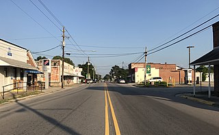
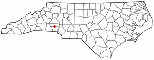
Bunn is a town in Franklin County, North Carolina, United States. The population was 327 at the 2020 census.

<span class="mw-page-title-main">Centerville, North Carolina</span> Census-designated place in North Carolina, United States

Centerville is a census-designated place (CDP) in the rural northeastern corner of Franklin County, North Carolina, United States. The population was 149 at the 2020 census. It was an incorporated town from 1965 to 2017.

<span class="mw-page-title-main">Franklinton, North Carolina</span> Town in North Carolina, United States

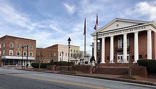
Franklinton is a town in Franklin County, North Carolina, United States. The population was 2,456 at the 2020 census.
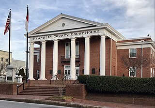
<span class="mw-page-title-main">Louisburg, North Carolina</span> Town in North Carolina, United States

Louisburg is a town in Franklin County, North Carolina, United States. As of the 2020 census, the town population was 3,064. It is the county seat of Franklin County. The town is located approximately 29 miles northeast of the state capital, Raleigh, and located about 31 miles south of the Virginia border. It is also the home of Louisburg College, the oldest two-year coeducational college in the United States.

<span class="mw-page-title-main">High Shoals, North Carolina</span> City in North Carolina, United States

High Shoals is a city in Gaston County, North Carolina, United States, named for the high rocky shoal across the Catawba River. The population was 696 at the 2010 census.

<span class="mw-page-title-main">Troutman, North Carolina</span> Town in North Carolina, United States

Troutman is a town in Iredell County, North Carolina, United States. The town is located roughly 35 miles (56 km) north of Charlotte. As of the 2020 census the town's population was 3,698. Due to substantial residential growth in the area, as well as neighborhood annexation, the town is experiencing dramatic population growth. Approved residential developments, when completed, are forecast to increase town population to more than 11,000 residents.

<span class="mw-page-title-main">Bethel, North Carolina</span> Town in North Carolina, United States

Bethel is a town in Pitt County, North Carolina, United States. The population was 1,577 at the 2010 census. The town is a part of the Greenville Metropolitan Area located in North Carolina's Inner Banks region. Confusingly, there are three other towns in the state named "Bethel." One is between Edenton and Hertford in the "Finger Counties" region in the northeastern corner of the state, another is in the north-central part, in Caswell County and the third is located in the Mountain Region of North Carolina, in Haywood County. There is also a community named Bethel located in Watauga County.

<span class="mw-page-title-main">Boonville, North Carolina</span> Town in North Carolina, United States

Boonville is a town in Yadkin County, North Carolina, United States. The population was 1,222 at the 2010 census.

<span class="mw-page-title-main">Triumph Township, Pennsylvania</span> Township in Pennsylvania, United States

Triumph Township is a township in Warren County, Pennsylvania, United States. The population was 276 at the 2020 census, down from 316 at the 2010 census.

<span class="mw-page-title-main">Youngsville, Pennsylvania</span> Borough in Pennsylvania, United States

Youngsville is a borough in Warren County, Pennsylvania, United States. The population was 1,729 at the 2010 census.

<span class="mw-page-title-main">Dugway, Utah</span> CDP in Utah, United States

Dugway is a census-designated place (CDP) in southeastern Tooele County, Utah, United States. The population was 2,016, at the 2000 census, a modest increase over the 1990 figure of 1,761. The town is located inside the United States Army's large weapons testing facility, Dugway Proving Ground, making it a closed city, as the only roads leading to the town pass through military checkpoints at the boundaries of the base. Non-resident civilians must request advance authorization to enter the town. The housing area designated for military and civilian personnel is referred to as "English Village."

<span class="mw-page-title-main">Virgilina, Virginia</span> Town in Virginia, United States

Virgilina is a town in Halifax County, Virginia, United States. The population was 154 at the 2010 census. Virgilina was once a copper mining town. It was a stop on the Atlantic and Danville Railway as recently as the 1950s. It is named "Virgilina" because it is located on the Virginia and North Carolina border.

<span class="mw-page-title-main">Pennsboro, West Virginia</span> City in West Virginia, United States

Pennsboro is a city in Ritchie County, West Virginia, United States. The population was 1,050 at the 2020 census. The city is located at the junction of U.S. Route 50 and West Virginia Route 74; the North Bend Rail Trail also passes through the city.

<span class="mw-page-title-main">Weddington, North Carolina</span> Town in North Carolina, United States

Weddington is a suburban town in Union County, North Carolina, United States. A small portion of the town extends into Mecklenburg County. The population was 9,459 at the 2010 census. It is a suburb in the Charlotte metropolitan area. The current mayor of Weddington is Craig Horn.

<span class="mw-page-title-main">Callicoon, New York</span> Town in New York, United States

Callicoon is a town in Sullivan County, New York, United States. The population was 2,989 at the 2020 census. The town is in the northwestern part of the county.

References

  1. Code of General Ordinances of the Town of Youngsville, North Carolina, Youngsville Board of Commissioners, December 1952 (Resubmitted April 1999), page 16 (town charter), Retrieved Jul. 24, 2017.
  2. "ArcGIS REST Services Directory". United States Census Bureau. Retrieved September 20, 2022.
  3. 1 2 U.S. Geological Survey Geographic Names Information System: Youngsville, North Carolina
  4. 1 2 3 "U.S. Census website". United States Census Bureau . Retrieved January 16, 2015.
  5. Town of Youngsville, A Brief History of the Town of Youngsville, Retrieved Jan. 15, 2015.
  6. William S. Powell, The North Carolina Gazetteer: A Dictionary of Tar Heel Places, 1968, The University of North Carolina Press at Chapel Hill, ISBN   0-8078-1247-1, Library of Congress Catalog Card #28-25916, page 548. Retrieved Jan. 15, 2015.
  7. "National Register Information System". National Register of Historic Places . National Park Service. July 9, 2010.
  8. North Carolina Railroad Company, NC Rail Map, Retrieved Nov. 10, 2022.
  9. "Census of Population and Housing". Census.gov. Retrieved June 4, 2015.
  10. "Explore Census Data". data.census.gov. Retrieved December 23, 2021.
  11. Town of Youngsville - Board of Commissioners, Retrieved Nov. 9, 2022.
  12. Town of Youngsville - Administration, Retrieved Jan. 6, 2020.