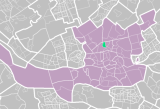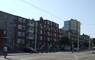
Pernis is a neighborhood and submunicipality of Rotterdam, Netherlands. The district has a population of 4,845 (2018) on a total area size of 1.60 km2. Pernis is thus a full submunicipality of Rotterdam, but the former independent municipality had its own district council already. Although surrounded by ports, Pernis has preserved its village-like atmosphere very well.

The Waalhaven is a harbour in Rotterdam, Netherlands. It is one of the excavated harbors on the south bank of the Maas in Rotterdam. With an area of 3.1 square kilometers, it is one of the larger dug harbor basins in the world.

Kralingen-Crooswijk is a township of the city of Rotterdam, Netherlands. It is located at the immediate east of the city's centre. As of 2005 it has about 52,379 inhabitants and has a territory of about 1,286 ha. It consists of the two boroughs Kralingen and Crooswijk, the former being a village itself until it was incorporated in the city of Rotterdam in the late 19th century.

Katendrecht is a neighbourhood of Rotterdam, on the south bank of the Nieuwe Maas. It is located between the Rijnhaven and the Maashaven. Katendrecht was a separate municipality from 1817 to 1874, when it merged with Charlois.

Overschie is a neighborhood of Rotterdam, Netherlands, formerly a separate village with its own municipality.

Rotterdam Centrum is a borough of Rotterdam. It was established on March 3, 2010. The center has 33,983 inhabitants.

Bergpolder is a neighborhood of Rotterdam, Netherlands in Rotterdam-Noord. Since November 5, 2014, the district is part of the protected historic area "Rijksbeschermd gezicht Blijdorp/Bergpolder".

Crooswijk is a neighborhood of Rotterdam, Netherlands. Crooswijk lies between the districts Kralingen, Oude Noorden and Centrum. Crooswijk was once known for its Marines barracks. Many streets bear witness to a military history of the Marine Corps: Tamboerstraat, Pijperstraat, Schuttersveld, Excercitiestraat, Vaandrigstraat. Crooswijk also has an industrial past. Jamin, Heineken Brewery and many abattoirs were established there. These industries have given way to housing. On the Crooswijksesingel is only the monumental building of Heineken still standing. Crooswijk is one of the original people's neighborhoods of Rotterdam and the district is strongly associated with the 'real' Rotterdammer. The Crooswijk is sometimes called: "The poorest part of the Netherlands", or: "The poorest part of Rotterdam". This is because the average income of the people living there is lower than other places.

Afrikaanderwijk is a neighborhood of Rotterdam, Netherlands. It lies in the Feijenoord district of the city, and is traditionally a working-class neighborhood. The neighborhood was one of the first in the Netherlands to have a majority of residents with a foreign background, primarily consisting of Turks, Moroccans, Surinamese, and Antilleans.
C.S. kwartier is the central neighborhood of Rotterdam, Netherlands, immediately surrounding Rotterdam Centraal Station. The neighborhood has access to a major harbor in Rotterdam, and is also called the Central District of Rotterdam.

Cool is a neighborhood of Rotterdam, Netherlands in the Centrum borough. It is enclosed by the Weena in the north, the Mauritsweg and Eendrachtsweg in the west, Vasteland in the south and the Coolsingel and Schiedamse Vest in the east.

Kleiwegkwartier is a neighbourhood quarter in Rotterdam, Netherlands. It is in the southern part of Hillegersberg with origins dating from the early 1600s.

Noordereiland is a neighborhood of Rotterdam, Netherlands. The Noordereiland owes its name to the Noorderhaven which, under the leadership of C.B. van der Tak was dug between 1872 and 1874. By digging the Noorderhaven, the Noordereiland was separated from the former island of Fijenoord and is now an island between the central parts of the North and South side of the city. Until the end of the 20th century the island was inhabited by a large population of inland skippers. Part of the neighborhood is a protected cityscape.

Oude Westen is a neighborhood of Rotterdam, Netherlands adjacent to the city center.
Reyeroord is a neighborhood of Rotterdam, Netherlands. Constructed in the post-war period, it is located in Rotterdam west of A16, north of A15, east of Hordijkerveld. It is part of the IJsselmonde burrough. It has been the site of urban innovation and development. It shares the public park Oeverloos with Hordijkerveld.

Schiemond is a neighborhood of Rotterdam, Netherlands.
Terbregge is a neighborhood of Rotterdam, Netherlands.

Zweth or De Zweth is a hamlet in the western Netherlands. It is located about halfway between Delft and Rotterdam, where the small river Berkelsche Zweth joins the Schie river, around a bridge across the Berkelsche Zweth.

The Rotterdam tramway network is a key element of the overall public transport arrangements in Rotterdam, Netherlands.
Sportpark Laag Zestienhoven is a cricket ground in Rotterdam, the Netherlands. The first recorded match on the ground came in 1963 when RG Inglese's XI played The Forty Club. The ground later held six matches in the 1990 ICC Trophy. The ground held a single Women's One Day International in 2003 when Ireland Women played Pakistan Women.


