
The following list includes settlements, geographic features, and political subdivisions of Colorado whose names are derived from Native American languages.
The following list includes settlements, geographic features, and political subdivisions of Colorado whose names are derived from Native American languages.

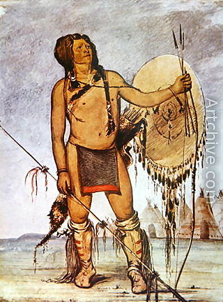
The Arapaho are a Native American people historically living on the plains of Colorado and Wyoming. They were close allies of the Cheyenne tribe and loosely aligned with the Lakota and Dakota.

The Cheyenne are an Indigenous people of the Great Plains. Their Cheyenne language belongs to the Algonquian language family. Today, the Cheyenne people are split into two federally recognized nations: the Southern Cheyenne, who are enrolled in the Cheyenne and Arapaho Tribes in Oklahoma, and the Northern Cheyenne, who are enrolled in the Northern Cheyenne Tribe of the Northern Cheyenne Indian Reservation in Montana. The Cheyenne comprise two Native American tribes, the Só'taeo'o or Só'taétaneo'o and the Tsétsêhéstâhese. The tribes merged in the early 19th century.
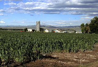
The Eastern Plains of Colorado refers to a region of the U.S. state of Colorado east of the Rocky Mountains and east of the population centers of the Front Range.

The Dog Soldiers or Dog Men are historically one of six Cheyenne military societies. Beginning in the late 1830s, this society evolved into a separate, militaristic band that played a dominant role in Cheyenne resistance to the westward expansion of the United States in the area of present-day Kansas, Nebraska, Colorado, and Wyoming, where the Cheyenne had settled in the early nineteenth century.

Ute are the Indigenous people of the Ute tribe and culture among the Indigenous peoples of the Great Basin. They had lived in sovereignty in the regions of present-day Utah and Colorado.
Comanche history is the story of the Native American (Indian) tribe which lived on the Great Plains of the present-day United States. In the 17th century the Eastern Shoshone people who became known as the Comanche migrated southward from Wyoming. In the 18th and 19th centuries the Comanche became the dominant tribe on the southern Great Plains. The Comanche are often characterized as "Lords of the Plains." They presided over a large area called Comancheria which they shared with allied tribes, the Kiowa, Kiowa-Apache, Wichita, and after 1840 the southern Cheyenne and Arapaho. Comanche power and their substantial wealth depended on horses, trading, and raiding. Adroit diplomacy was also a factor in maintaining their dominance and fending off enemies for more than a century. They subsisted on the bison herds of the Plains which they hunted for food and skins.

The Indian Peaks Wilderness is a wilderness area in north central Colorado managed jointly by the United States Forest Service and the National Park Service within the Arapaho and Roosevelt National Forests and small parts of the southern section of Rocky Mountain National Park. It borders the James Peak Wilderness to the south, and straddles the Continental Divide. The area receives high visitation due to its proximity to the Denver metropolitan area.
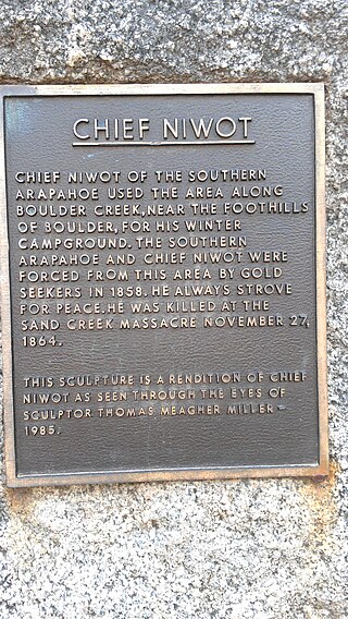
Chief Niwot or Left Hand(-ed) was a Southern Arapaho chief, diplomat, and interpreter who negotiated for peace between white settlers and the Cheyenne and Arapaho tribes during the Pike's Peak Gold Rush and Colorado War.
White River Utes are a Native American band, made of two earlier bands, the Yampa from the Yampa River Valley and the Parianuche Utes who lived along the Grand Valley in Colorado and Utah.

Chipeta or White Singing Bird was a Native American leader, and the second wife of Chief Ouray of the Uncompahgre Ute tribe. Born a Kiowa Apache, she was raised by the Utes in what is now Conejos, Colorado. An advisor and confidant of her husband, Chipeta continued as a leader of her people after his death in 1880.

The following outline is provided as an overview of and topical guide to the prehistoric people of Colorado, which covers the period of when Native Americans lived in Colorado prior to contact with the Domínguez–Escalante expedition in 1776. People's lifestyles included nomadic hunter-gathering, semi-permanent village dwelling, and residing in pueblos.
Colorow was a Ute chief of the Ute Mountain Utes, skilled horseman, and warrior. He was involved in treaty negotiations with the U.S. government. In 1879, he fought during the Meeker Massacre. Eight years later, his family members were attacked during Colorow's War. He was placed in the Jefferson County Hall of Fame in recognition of for the contributions that "he made to our county and, indeed, our state and nation."
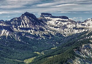
Coxcomb Peak is a 13,656-foot-elevation (4,162-meter) mountain summit located on the common boundary of Hinsdale County and Ouray County, in Colorado, United States. It is situated nine miles northeast of the community of Ouray, in the Uncompahgre Wilderness, on land managed by Uncompahgre National Forest. It is part of the San Juan Mountains which are a subset of the Rocky Mountains, and is situated west of the Continental Divide. Coxcomb ranks as the 171st-highest peak in Colorado, and topographic relief is significant as the south aspect rises 2,000 feet above Wetterhorn Basin in approximately one mile, and 4,400 feet above Cow Creek in three miles. Neighbors include Precipice Peak 2.7 miles to the north, Redcliff one-half mile north, Matterhorn Peak 2.3 miles to the east-southeast, and nearest higher neighbor Wetterhorn Peak 1.8 mile to the southeast. The mountain's descriptive name, which has been officially adopted by the United States Board on Geographic Names, was in use since at least 1906 when Henry Gannett published it in the Gazetteer of Colorado.
| Overview | |||||||||
|---|---|---|---|---|---|---|---|---|---|
| Contemporary peoples native to Colorado |
| ||||||||
| Prehistoric cultures in Colorado |
| ||||||||
| Related articles | |||||||||