Downsview is a neighbourhood in the north end of Toronto, Ontario, Canada, located in the district of North York. The area takes its name from the Downs View farm established around 1842 near the present-day intersection of Keele Street and Wilson Avenue. It now extends beyond the intersection of Sheppard Avenue and Dufferin Street, though it is popularly seen as including the areas to the north right up to the Toronto city limit at Steeles Avenue. The area includes several large post-World War II subdivisions. Within the area is Downsview Airport, the former site of Canadian Forces Base Downsview, which has since been largely converted following the end of the Cold War into an urban park known as Downsview Park. The airport is still used as a manufacturing and testing facility for Bombardier Aerospace. As of the 2021 census, the Downsview-Roding-CFB neighbourhood was split into the two neighbourhoods of Downsview and Oakdale–Beverley Heights.

Davenport is a federal electoral district in Toronto, Ontario, Canada, that has been represented in the House of Commons of Canada since 1935.

Parkdale—High Park is a federal electoral district in Ontario, Canada, that has been represented in the House of Commons of Canada since 1979. It was created during the 1976 electoral boundaries redistribution from parts of Parkdale, High Park—Humber Valley, Davenport and Spadina districts. As of the October 19, 2015, Canadian general election, the current Member of Parliament (MP) is Liberal member Arif Virani. According to the 2016 Census, Parkdale—High Park has the lowest percentage of visible minorities (26.2%) among all City of Toronto ridings; it also has the highest percentage of people of Irish (20.0%), German (9.8%), and French (8.9%) ethnic origin of all City of Toronto ridings.

Jane and Finch is a neighbourhood located in the northwest end of Toronto, Ontario, Canada, in the district of North York. Centred at the intersection of Jane Street and Finch Avenue West, the area is roughly bounded by Highway 400 to the west, Black Creek to the east, Sheppard Avenue to the south, and Steeles Avenue to the north. Two city neighbourhoods cover the area commonly known as Jane and Finch. From Finch north to Steeles is considered part of the Black Creek community while from Finch south to Sheppard is called Glenfield-Jane Heights.
The Demographics of Montreal concern population growth and structure for Montreal, Quebec, Canada. The information is analyzed by Statistics Canada and compiled every five years, with the most recent census having taken place in 2021.
The demographics of Toronto, Ontario, Canada make Toronto one of the most multicultural and multiracial cities in the world. In 2021, 57.0 percent of the residents of the metropolitan area belonged to a visible minority group, compared with 51.4 percent in 2016, and 13.6 percent in 1981. Toronto also has established ethnic neighbourhoods such as the multiple Chinatowns, Corso Italia, Little Italy, Little India, Greektown, Koreatown, Little Tokyo, Little Jamaica, Little Portugal, Little Malta, Roncesvalles (Polish), Bloor West Village (Ukrainian), which celebrate the city's multiculturalism. Data from the suburban municipalities are also included for some metrics as most of these municipalities are part of the Toronto CMA.

The cuisine of Toronto reflects Toronto's size and multicultural diversity. Ethnic neighbourhoods throughout the city focus on specific cuisines, such as authentic Chinese and Vietnamese found in the city's Chinatowns, Korean in Koreatown, Greek on The Danforth, Italian cuisine in Little Italy and Corso Italia, Bangladeshi cuisine in southwest Scarborough and East York, and Indian/Pakistani in Little India. Other world cuisines available in the city include Portuguese, Hungarian, Japanese, and Caribbean. Toronto's large Jewish population has given rise to many Jewish restaurants and delis, with varying adherence to kosher rules.
Earlscourt is a neighbourhood in Toronto, Ontario, Canada. It is centred on St. Clair Avenue West, with Dufferin Street, Davenport Road, and Old Weston Road forming its boundaries. It is contained within the larger city-recognized neighbourhood of Corso Italia-Davenport.

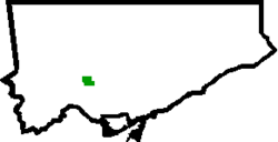
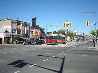
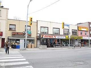
Corso Italia is a neighbourhood in Toronto, Ontario, Canada, situated on St. Clair Avenue West, between Westmount Avenue and Lansdowne Avenue. It is contained within the larger city-recognized neighbourhood of Corso Italia-Davenport.

Humber Summit is a neighbourhood in Toronto, Ontario, Canada. It is one of the northernmost neighbourhoods in Toronto, located in the North York district of the city. It is bounded by Steeles Avenue to the north, Highway 400 to the east, Finch Avenue to the south, and follows the Humber River to the west.

Pelmo Park-Humberlea is a neighbourhood in Toronto, Ontario, Canada. It is located north-west of the central core, in the former suburb of North York. Many of the neighbourhoods in this quadrant of the city can aptly be described as family neighbourhoods with access to parks, green space and a slower pace than found closer to downtown.
Rustic is a neighbourhood in the city of Toronto, Ontario, Canada. It is located in the southwest of the North York district. Its approximate borders are Lawrence Avenue to the south, Jane Street to the west, Highway 401 to the north, and Culford Road to the east.

Yorkdale–Glen Park is a neighbourhood in the city of Toronto, Ontario, Canada, located in the former suburb of North York. It is bounded by Highway 401 to the north, Allen Road to the east, a line south of Stayner Avenue to the south, and the CNR tracks to the west.
Fairbank is a neighbourhood in Toronto, Ontario, Canada. The area is centred on the intersection of Dufferin Street and Eglinton Avenue West. Fairbank includes the neighbourhoods of Briar Hill–Belgravia and Caledonia–Fairbank. The western border is the CNR lines. The northern and southern borders are the former borders of the City of York and the eastern border is Dufferin Street.

Palmerston-Little Italy is a neighbourhood in central Toronto, Ontario, Canada. Its boundaries, according to the City of Toronto, are by Bathurst Street to the east, Bloor Street to the north, Dovercourt Road to the west and College Street to the south. It is a mature downtown neighbourhood. Within this official neighbourhood of the City of Toronto are two neighbourhoods, Palmerston and Little Italy and the commercial enclave of Mirvish Village.
Davenport is a neighbourhood northwest of downtown in Toronto, Ontario, Canada. It is north of the Canadian Pacific Railway tracks and Dupont Avenue and south of Davenport Road and the ridge that is the former Lake Iroquois coastline. Its eastern boundary is Bathurst Street and it stretches west to Lansdowne Avenue. It is contained within the larger city-recognized neighbourhood of Corso Italia-Davenport.

Maple Leaf is a neighbourhood in the city of Toronto, Ontario, Canada. It is located in the southwest of the North York district. Its approximate borders are Lawrence Avenue to the south, Culford Road to the west, Highway 401 to the north, and the CNR rail lines east of Keele Street to the east.

Wallace Emerson is a neighbourhood in Toronto, Ontario, Canada situated north of Bloor Street between Dufferin Street to the east, the CPR railway lines to the north and the CPR railway lines to the west.

Oakwood Village, formerly known as Oakwood–Vaughan, is a neighbourhood in Toronto, Ontario, Canada. Located in the former suburb of York, the neighbourhood is a Business Improvement Area (BIA); it has an annual arts festival and a public library built in 1997.
Toronto has a large Italian Canadian community, with 30.3 per cent of the ethnic Italians in Canada living in the Greater Toronto Area (GTA) as of 2021. Toronto is home to the fourth largest population of people of Italian descent after Buenos Aires, São Paulo and New York City, respectively. As of the Canada 2021 Census, there were 468,970 Italian Canadians located in the Greater Toronto Area, with 444,755 located within the Toronto CMA.