Parkway Forest

Last updated

Parkway Forest
Parkway Forest Aerial view 2023.jpg
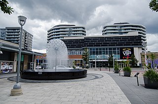
Emerald City Condominiums and apartment towers of Parkway Forest
Toronto map.png
Red pog.svg
Parkway Forest
Location in Toronto
Coordinates: 43°46′20″N79°20′34″W / 43.7721°N 79.3427°W / 43.7721; -79.3427
CountryFlag of Canada (Pantone).svg  Canada
ProvinceFlag of Ontario.svg  Ontario
City Toronto
Municipality established1850 York Township
Changed municipality1922 North York from York Township
Changed municipality1998 Toronto from North York
Time zone UTC−5 (EST)
  Summer (DST) UTC−4 (EDT)
Area codes 416, 647

Parkway Forest is a neighbourhood in Toronto, Ontario, Canada. It is located in the north of the city, in the former suburb of North York. Parkway Forest is bounded on the west by Don Mills Road, on the north by Sheppard Avenue, on the east by the Don Valley Parkway, and on the south by Highway 401. It is contained within the city's officially designated neighbourhood of Henry Farm, although it is distinct in character from the residential community of that same name west of Don Mills Road. Parkway Forest is part of Ward 17 in the Toronto City Council, part of the new Don Valley North federal electoral district, and part of the Don Valley East provincial electoral district.

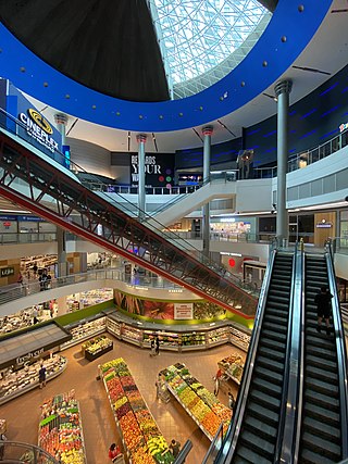
Parkway Forest is primarily residential, with luxury condominiums, high-rise rental apartment buildings, low-rise rental apartment buildings and townhouse complexes. The community has a large open park (Parkway Forest Park), a firehouse, a community center with outdoor pool, a shopping plaza (Parkway Forest Plaza) consisting of the neighbourhood's main grocery store (Foodland), and a public school (Forest Manor Public School) which goes from junior kindergarten to Grade 5. During the summer months, you can find many families with children playing in the large open park.

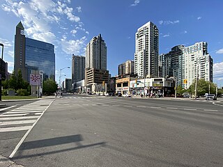
It sits directly to the south of the Fairview Mall shopping centre, and is served by the Don Mills subway station on the Toronto Transit Commission's Sheppard subway line.

Parkway Forest was initially developed as a "garden city" beginning in the late 1960s, with a mix of high- and low-rise apartments and townhouses. [1] The majority of the neighbourhood's high-rise buildings were constructed between 1966 and 1972. [2] An additional "affordable-housing development" was constructed at 121 Parkway Forest Drive in 2006, occupying what was previously the heavily wooded Forest Manor Park.

In early 2005, the North York Community Council committee of the Toronto City Council rejected a proposal to replace many of the low-rise apartment buildings and townhouses by seven high-rise condominium towers ranging in height from 39 to 49 storeys. A more modest proposal for neighbourhood redevelopment was later accepted as a new development called Emerald City. [3] This plan included the demolition of mid-rise apartment buildings and townhouses with replacement units built as in-fill developments elsewhere in Parkway Forest. New condominium units were to be built to a maximum height of 36 storeys. [4] In July 2009, construction of two 9-storey replacement rental towers began at the corner of Parkway Forest Drive and Sheppard Avenue. Construction has continued since that time; primarily with the addition of new townhouse, mid-rise, and high-rise residential buildings, but also with a new community centre, [5] and public art. [6]

Parkway Forest has a community association called the Parkway Forest Community Association, which represents local residents and seeks to address issues and opportunities within the neighbourhood. [7]

Related Research Articles

<span class="mw-page-title-main">Don Mills</span> Neighbourhood in Toronto, Ontario, Canada

Don Mills is a mixed-use neighbourhood in Toronto, Ontario, Canada. It was developed in the 1950s and 1960s to be a self-supporting "new town" and was at the time located outside Toronto proper in the suburb of North York. Consisting of residential, commercial and industrial sub-districts, it was planned and developed by private enterprise.

<span class="mw-page-title-main">North Toronto</span> Place in Ontario, Canada

North Toronto is a former town and informal district located in the northern part of the Old Toronto district in Toronto, Ontario, Canada. Currently occupying a geographically central location within the city of Toronto, the Town of North Toronto was incorporated in 1890, when much of the area was still farmland, and annexed by Toronto in 1912. The name is still used to refer to the area in general, although Yonge–Eglinton and Midtown Toronto are officially used.

<span class="mw-page-title-main">North York City Centre</span> Business district

North York City Centre is a central business district in Toronto, Ontario, Canada in the administrative district of North York. It is located along Yonge Street, between just south of Sheppard Avenue northward to Finch Avenue with its focus around Mel Lastman Square, a civic square, and spreads eastwards and westwards a few blocks, generally as far as Doris Avenue and Beecroft Road. The district is a high-density district of condominium and office towers with ground-floor commercial uses along the wide six lanes of Yonge Street.

<span class="mw-page-title-main">Willowdale, Toronto</span> Neighbourhood in Toronto, Ontario, Canada

Willowdale is a neighbourhood in the city of Toronto, Ontario, Canada, located in the district of North York. It developed from three postal villages: Newtonbrook, Willowdale and Lansing.

<span class="mw-page-title-main">Henry Farm</span> Neighbourhood in Toronto, Ontario, Canada

Henry Farm is a neighbourhood in the City of Toronto, Ontario, Canada. It is located in the north central part of the city within the former city of North York.

<span class="mw-page-title-main">Bayview Village</span> Neighbourhood in Toronto, Ontario, Canada

Bayview Village is a neighbourhood in Toronto, Ontario, Canada. It is part of the federal Don Valley North riding and the provincial Don Valley North electoral district, and Toronto electoral Ward 17: Don Valley North. In 2006, it had a population of 15,370.

<span class="mw-page-title-main">Bessarion station</span> Toronto subway station

Bessarion is a station on Line 4 Sheppard of the Toronto subway. Opened in 2002, it was consistently ranked the least-used station on the heavy-rail portion of the subway system, until being displaced by Downsview Park station in 2018. Wi-Fi service is available at this station.

<span class="mw-page-title-main">Bloor Street</span> Major thoroughfare in Toronto

Bloor Street is a major east–west residential and commercial thoroughfare in Toronto, Ontario, Canada. Bloor Street runs from the Prince Edward Viaduct, which spans the Don River Valley, westward into Mississauga where it ends at Central Parkway. East of the viaduct, Danforth Avenue continues along the same right-of-way. The street, approximately 25 kilometres (16 mi) long, contains a significant cross-sample of Toronto's ethnic communities. It is also home to Toronto's famous shopping street, the Mink Mile.

<span class="mw-page-title-main">Centrepointe</span> Neighbourhood in Ottawa, Ontario, Canada

Centrepointe is a neighbourhood in College Ward in the west end of the city of Ottawa, Ontario, Canada. It was formerly part of the city of Nepean. It is a newer residential subdivision in the west/central part of Ottawa, developed from 1984 onwards, and is informally bounded by Baseline Road to the north, Woodroffe Avenue to the east, the CN railroad to the south, and the Briargreen subdivision and Forest Ridge Apartments to the west. The housing stock includes approximately 1,000 detached homes, with the remainder mostly townhomes and terrace homes.

<span class="mw-page-title-main">Empress Walk</span> Condominium and retail complex in Toronto, Ontario

Empress Walk is a large Canadian condominium and retail complex in Toronto, Ontario, Canada. It is located at the intersection of Yonge Street and Empress Avenue in the North York Centre area of the North York district It was developed by Canadian-developers Menkes Developments Ltd. Phase 1 was completed in 1997 and Phase 2 was completed in 2000. It became an important retail complex in North York following its construction.

<span class="mw-page-title-main">Imperial Oil Building</span>

The Imperial Oil Building, now known as Imperial Plaza, is a skyscraper located at 111 St. Clair Avenue West in Toronto, Ontario, Canada. The 21-storey building was completed in 1957 as the headquarters of Imperial Oil, Canada's largest oil company. The building's design had previously been rejected for a proposed new Toronto City Hall. After several decades of use as the head office of Imperial Oil, the building was sold in 2010 and converted into a condominium apartment building.

<span class="mw-page-title-main">Flemingdon Park</span> Neighbourhood in Toronto, Ontario, Canada

Flemingdon Park is a neighbourhood in Toronto, Ontario, Canada, located in the city's North York district. It is part of the Don Valley East federal and provincial electoral districts, and Ward 26: Don Valley East (South) municipally. In 2011, its population was 22,205. The average income was $66,784.

<span class="mw-page-title-main">Markland Wood</span> Neighbourhood in Toronto, Ontario, Canada

Markland Wood is a residential neighbourhood in Toronto, Ontario, Canada. It is located west of the central core, in the former suburb of Etobicoke and is the westernmost residential community in Toronto along Bloor Street West. It's located on the border of Mississauga and bounded by Etobicoke Creek to the west, Elmcrest Creek to the east, Burnhamthorpe to the North, and surrounded by the Markland Wood Golf Club; approximately 2/3 is north of Bloor Street, and 1/3 south. Markland Wood is part of the Etobicoke Centre riding for federal and provincial governments and Ward 2 for the municipal council.

<span class="mw-page-title-main">Pleasant View, Toronto</span> Neighbourhood in Toronto, Ontario, Canada

Pleasant View is a neighbourhood in the city of Toronto, Ontario, Canada that is located in the district of North York at the northern end of the city. It is bordered by Victoria Park to the East, Sheppard Avenue to the South, Highway 404 to the west and the Finch hydro corridor to the north. The neighbourhood is home to several high-rise apartment and condominium buildings, such as The Clippers.

<span class="mw-page-title-main">Don Valley Village</span> Neighbourhood in Toronto, Ontario, Canada

Don Valley Village is a neighbourhood in the city of Toronto, Ontario, Canada. It is located in the former suburb of North York. Located north of Highway 401 and bisected by Don Mills Road, it is bounded by Sheppard Avenue to the south, Leslie Street to the west, Finch Avenue to the north and Highway 404 to the east. Like the nearby Don River Valley, the neighbourhood has hill and dale topography.

<span class="mw-page-title-main">Architecture of Toronto</span> Overview of the architecture of Toronto

The architecture of Toronto is an eclectic combination of architectural styles, ranging from 19th century Georgian architecture to 21st century postmodern architecture and beyond.

<span class="mw-page-title-main">Concord Park Place</span> Development in Toronto, Ontario, Canada

Concord Park Place is a 45-acre (18 ha) multi-tower condominium complex under construction by developer Concord Adex in Toronto, Ontario.

<span class="mw-page-title-main">High Park North</span> Neighbourhood in Toronto, Ontario, Canada

High Park North, or often simply High Park, after the park, is a neighbourhood in Toronto, Ontario, Canada. It is bounded on the south by Bloor Street, on the west by Runnymede Road, on the north by Annette Street, Quebec Avenue and Humberside Avenue, and on the east by the GO Transit Weston Subdivision rail tracks. It is located in the Parkdale—High Park provincial and federal electoral districts. The area east of Keele Street is also known informally as the "West Bend" neighbourhood.

<span class="mw-page-title-main">BDP Quadrangle (architecture firm)</span> Canadian architecture and interior design firm

BDP Quadrangle is the North American studio of UK-based global architecture, design, and urbanism firm, BDP.

References

  1. Jason Allen, "Parkway Forest: Urban Thinking in the Suburbs", Urban Toronto, September 20, 2013
  2. TO Built, "Brief Search Results: Henry Farm" Archived 2013-01-19 at the Wayback Machine
  3. Urban Toronto, "Emerald City Phases 1 to 3 including Dream Tower"
  4. Thomsa C. Keefe, "Staff Report for Action - Draft Plan of Subdivision Application – Parkway Forest", June 12, 2007
  5. Lucas, "Parkway Forest Community Centre at Emerald City", Toronto Star: newinhomes.com news blog, June 24, 2013
  6. Jason Allen, "Parkway Forest: Urban Thinking in the Suburbs", Urban Toronto, September 20, 2013
  7. "Archived copy". Archived from the original on 2015-10-11. Retrieved 2014-06-25.{{cite web}}: CS1 maint: archived copy as title (link)