The Don River is a watercourse in southern Ontario that empties into Lake Ontario, at Toronto Harbour. Its mouth was just east of the street grid of the town of York, Upper Canada, the municipality that evolved into Toronto, Ontario. The Don is one of the major watercourses draining Toronto that have headwaters in the Oak Ridges Moraine.

Riverdale is a large neighbourhood in Toronto, Ontario, Canada. It is bounded by the Don River Valley to the west, Danforth Avenue and Greektown to the north, Jones Avenue, the CN/GO tracks, Leslieville to the east, and Lake Shore Boulevard to the south.

Queen Street is a major east–west thoroughfare in Toronto, Ontario, Canada. It extends from Roncesvalles Avenue and King Street in the west to Victoria Park Avenue in the east. Queen Street was the cartographic baseline for the original east–west avenues of Toronto's and York County's grid pattern of major roads. The western section of Queen is a centre for Canadian broadcasting, music, fashion, performance, and the visual arts. Over the past twenty-five years, Queen West has become an international arts centre and a tourist attraction in Toronto.
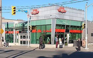
Pape is a subway station on Line 2 Bloor–Danforth in Toronto, Ontario, Canada. The station opened in 1966 and is located in Toronto's Greektown neighbourhood at the northeast corner of Pape Avenue and Lipton Avenue, just north of Danforth Avenue. Wi-Fi service is available at this station. It is located at the site of the former Lipton loop.

Bloor Street is a major east–west residential and commercial thoroughfare in Toronto, Ontario, Canada. Bloor Street runs from the Prince Edward Viaduct, which spans the Don River Valley, westward into Mississauga where it ends at Central Parkway. East of the viaduct, Danforth Avenue continues along the same right-of-way. The street, approximately 25 kilometres (16 mi) long, contains a significant cross-sample of Toronto's ethnic communities. It is also home to Toronto's famous shopping street, the Mink Mile.

Danforth Avenue and Danforth Road are two historically-related arterial streets in Toronto, Ontario, Canada. Danforth Avenue is an east-west street that begins in Old Toronto at the Prince Edward Viaduct as a physical continuation of Bloor Street and continues for about 6 kilometres (3.7 mi) east through old Toronto, about 350 metres (1,150 ft) of old East York, and a further 5 kilometres (3.1 mi) in Scarborough until it intersects with Kingston Road via a ramped interchange. Danforth Road splits off the Avenue west of Warden Avenue and runs diagonally northeast until south of Lawrence Avenue, where it continues as McCowan Road.
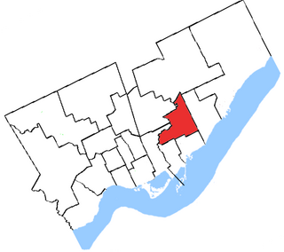
York East was a federal electoral district represented in the House of Commons of Canada at different times. It was located in the province of Ontario.
The Relief Line was a proposed rapid transit line for the Toronto subway system, intended to provide capacity relief to the Yonge segment of Line 1 and Bloor–Yonge station and extend subway service coverage in the city's east end. Several plans for an east–west downtown subway line date back to the early 20th century, most of which ran along Queen Street.

Todmorden Mills was a small settlement located in the Don River valley in Toronto, Ontario. It started out as a lumber mill in the 1790s. Originally known as "Don Mills", it grew into a small industrial complex and village before becoming part of East York in the 20th century. Currently the valley site is occupied by the Todmorden Mills Heritage Museum and Arts Centre, which includes the museum, art gallery, a theatre and a forest preserve.

Islington-City Centre West is a commercial and residential neighbourhood in Toronto, Ontario, Canada. One of four central business districts outside Downtown Toronto, it is bounded by Rathburn Road to the north, Islington Avenue to the east, Bloor Street to the south, Mimico Creek to the west.

Old East York is a district of the city of Toronto, Ontario, Canada. It consists of the southern, urban, portion of the former borough of East York. Old East York is continuous and functionally integrated with the old City of Toronto, bounded by the old municipal boundary between East York and Old Toronto on the south, by the Don River Valley on the west and northwest, by Taylor-Massey Creek on the north, and Victoria Park Avenue in the east.

East Toronto was an incorporated community, currently part of Toronto, Ontario, Canada. It covered much of the present day neighbourhood of the Upper Beaches, stretching up to Danforth Avenue in the north, part of it stretching to Lake Ontario in the south a portion of the present-day neighbourhood, The Beaches. The central street in East Toronto was Main Street, running between Danforth Avenue to Kingston Road. The commercial centre of the town was located at the intersection of Main Street and Lake View Avenue. Following the annexation of East Toronto into Toronto, Main Street retained its name despite Toronto's conceptual Main Street being historically designated to be Yonge Street.

Bloor West Village is a residential neighbourhood and shopping district in Toronto, Ontario, Canada. Bordered on the south by Bloor Street, it encompasses all businesses along Bloor Street between South Kingsway and Ellis Park Road, consisting of more than 400 shops, restaurants and services, plus the residential neighbourhood to the north. The official City of Toronto name of the neighbourhood is Runneymede-Bloor West Village.

East Danforth, also known as Danforth Village, is a neighbourhood in the east end of Toronto, Ontario, Canada. It is located on the eastern part of Danforth Avenue in the old city of Toronto. It stretches from the eastern edge of Greektown by Greenwood Avenue to the boundary of Scarborough at Victoria Park Avenue. The area is covered by two business improvement associations, Danforth Village and Danforth Mosaic. To the north of the neighbourhood is Old East York, once a separate municipality, but today closely integrated into the area. The southern border is the railway tracks, beyond which is Leslieville and the Upper Beaches. According to the 2006 census the area has a population of 14,629.
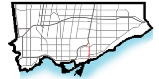
Woodbine Avenue is a north–south arterial road consisting of two sections in Toronto and York Region in Ontario, Canada.
The Ontario Line is an under-construction rapid transit line in Toronto, Ontario, Canada. Its northern terminus will be at Eglinton Avenue and Don Mills Road, at Science Centre station, where it will connect with Line 5 Eglinton. Its southern terminus will be at the existing Exhibition GO Station on the Lakeshore West line. The Ontario Line was announced by the Government of Ontario on April 10, 2019. As of November 2022, the estimated cost for the 15.6-kilometre (9.7 mi) line is CA$17 to $19 billion with an estimated completion in 2031. Originally, the cost was estimated at $10.9 billion with completion by 2027. A groundbreaking ceremony for the project took place on March 27, 2022. Upon opening, the plan is for the line to assume the "Line 3" name which was used by Line 3 Scarborough until its closure in July 2023.