Eglinton East

Last updated

Eglinton East
Neighbourhood
Eglinton East 2023.jpg
Aerial view of Eglinton East in 2023
Eglinton East map.png
CountryFlag of Canada (Pantone).svg  Canada
Province Flag of Ontario.svg  Ontario
City Toronto
Established municipality1850 Scarborough Township
Changed municipality1998 Toronto from City of Scarborough
Storefronts on Eglinton and Midland Avenue Cho's Wok Restaurant (23710373298).jpg
Storefronts on Eglinton and Midland Avenue

Eglinton East, historically known as Knob Hill, is a residential and commercial neighbourhood in Toronto, Ontario, Canada. It is bounded by Stansbury Crescent, Citadel Drive, and West Highland Creek to the north, Midland Avenue to the west, the CNR rail line, Brimley Road, and Eglinton Avenue to the south, and Bellamy Road North to the east.

Contents

Eglinton East is a working-class neighbourhood with a high percentage of immigration to the area. Sri Lanka has produced the most immigration to the area over the past decade, and correspondingly the most spoken (non-English) language is Tamil. There are many East Indian, Filipino and Jamaican people living in this neighbourhood. While there is an equal number of Chinese, the other figures are above average. Prior to the arrival, Macedonians and Bulgarians dominated the neighborhood, emigrating from Eastern Bloc countries after World War II.

The residents of this neighbourhood primarily live in high-rise buildings, with only 22% of people owning their place of residence.

Education

Three public school boards operate schools in Eglinton East, the Conseil scolaire catholique MonAvenir (CSCM), Toronto Catholic District School Board (TCDSB), and the Toronto District School Board (TDSB). CSCM and TCDSB are separate public school boards, the former being French-based, whereas the latter is English-based. TDSB is a secular English-based public school board.

CSCM operates one secondary school in the neighbourhood, École secondaire catholique Père-Philippe-Lamarche . Established in 2017, the secondary school is located on 2850 Eglinton Avenue East. [1]

St. Joan of Arc Catholic Academy is a public separate secondary school located in Eglinton East. Tabor Park Vocational School.JPG
St. Joan of Arc Catholic Academy is a public separate secondary school located in Eglinton East.

TCDSB operates two schools in the neighbourhood, including one secondary school, St. Joan of Arc Catholic Academy (formerly Jean Vanier Catholic Secondary School). The secondary school was Central Scarborough's first Catholic secondary school, established to ease overcrowding at St. John Henry Newman Catholic High School, a TCDSB secondary school in the adjacent neighbourhood of Cliffcrest. The school was named after the son of Georges Vanier, Jean Vanier. The founder of the L'Arche communities worldwide. TCDSB also operates one elementary school, St. Nicholas Catholic School. St. Nicholas Catholic School is located on 33 Amarillo Drive. It was built in 1965 and was officially opened and blessed in 1966. The building was replaced with a new, modern three-storey school in 2013. St. Nicholas serves as the school's namesake.

TDSB operates three elementary schools in Eglinton East. Junior public schools (schools offering JK6), Glen Ravine Junior Public School was opened in 1956, while Lord Roberts Junior Public School was opened in 1958. Lord Roberts was named after Frederick Roberts, 1st Earl Roberts. Both schools were originally opened as JK-8 schools, however they were reorganized into junior schools after the Charles Gordon Senior Public School, and Robert Service Senior Public School were opened in 1971.

John McCrae Public School is one of several public elementary schools situated in the neighbourhood. John McCrae PS.jpg
John McCrae Public School is one of several public elementary schools situated in the neighbourhood.

John McCrae Public School is a public school opened in 1959. The building was designed by Raymond Moriyama, while the school was named after John McCrae, the composer of the poem In Flanders Fields . The motto of the school, "The Torch - Be Yours to Hold It High," comes from said poem. McCrae became a JK-8 school in September 2011 following the closures of two feeder schools, McCowan Road Junior Public School (opened in 1954 as a JK-8 school; became JK-6) in 2011 and Pringdale Gardens Junior Public School (opened in 1963 as a JK-8 school; became JK-6) in 2013. The property for Pringdale was later sold, and the building demolished.

In addition to elementary schools, the Scarborough Board of Education (a predecessor of TDSB) operated one secondary school in the area, Tabor Park Vocational School. The secondary school was a former technical school built in 1964 and established on 7 September 1965 to meet the needs of the large baby boom generation in the newly and rapidly developing area of Scarborough. The school was closed in 1986, with the building re-purposed for the Scarborough Centre for Alternative Studies. The building was later transferred to the Metropolitan Separate School Board (now TCDSB) and has been used by Jean Vanier Catholic Secondary School since 1989.

In addition to public schools, the neighbourhood is also home to an Islamic private school, Wali ul asr East Campus. The school presently occupies the building formerly used as McCowan Road Junior Public School, leasing the property from the TDSB.

Transportation

Public transportation is provided by two public services, the Toronto Transit Commission (TTC), and GO Transit. TTC provides local bus routes throughout then neighbourhood. Access to GO Transit commuter rail and bus services can be accessed from Eglinton GO Station, situated near the eastern boundary of the neighbourhood.

Related Research Articles

<span class="mw-page-title-main">Bendale</span> Neighbourhood in Toronto, Ontario, Canada

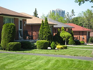
Bendale, also called Cedarbrae and Midland Park, is a residential neighbourhood in the eastern part of Toronto, Ontario, Canada. It is located in the former suburb of Scarborough. It is centred on the intersection of Lawrence Avenue East and Brimley Road. Its boundaries, as defined by the City, are Midland Avenue from Lawrence, north to Highway 401, east to McCowan, south to Lawrence, east to West Highland Creek, south-west along West Highland Creek, then follow several side streets parallel to the Creek, north to Midland Avenue. The area north of Ellesmere is typically considered the Scarborough City Centre district, and is not considered in this neighbourhood article.

<span class="mw-page-title-main">Agincourt, Toronto</span> Neighbourhood in Toronto, Ontario, Canada

Agincourt is a neighbourhood and former village in Toronto, Ontario, Canada. Agincourt is located in northeast Toronto, along Sheppard Avenue between Kennedy and Markham Roads. Before the creation of the "megacity" of Toronto in 1998, the area was part of Scarborough. It is officially recognized by the City of Toronto as occupying the neighbourhoods of Agincourt South–Malvern West and Agincourt North.

<span class="mw-page-title-main">Port Union, Toronto</span> Neighbourhood in Toronto, Ontario, Canada

Port Union, also known as Centennial Scarborough is a neighbourhood in Toronto, Ontario, Canada. It is located in the south-east corner of Toronto, within the former suburb of Scarborough. The neighbourhood is bounded by Kingston Road to the north, Port Union Road to the east, the Lake Ontario shoreline to the south, and Highland Creek to the west.

<span class="mw-page-title-main">Newtonbrook</span> Neighbourhood of Toronto

Newtonbrook is a neighbourhood in Toronto, Ontario, Canada. It is located in the area around Yonge Street and Finch Avenue in the district of North York between the east and west branches of the Don River. Officially, the area is divided into two neighbourhoods; Newtonbrook West and Newtonbrook East.

<span class="mw-page-title-main">Malvern, Toronto</span> Neighbourhood in Toronto, Ontario, Canada

Malvern is a neighbourhood in the city of Toronto, Ontario, Canada, with a population of 44,315. It is located in the northeast corner of the city.

<span class="mw-page-title-main">Scarborough Village</span> Neighbourhood in Toronto, Ontario, Canada

Scarborough Village is a neighbourhood in Toronto, Ontario, Canada, located in the Scarborough district. It was one of the earliest settlements in the former township of Scarborough with the distinction of being the site of the township's first post office. Today, the neighbourhood is composed of private and public housing, apartment complexes, schools, a few condominiums, and strip mall plazas. The neighbourhood lies along the Scarborough Bluffs escarpment.

<span class="mw-page-title-main">Richview, Toronto</span> Neighbourhood in Toronto, Ontario, Canada

Richview, formally known as Willowridge-Martingrove-Richview, is a neighbourhood in the city of Toronto, Ontario, Canada. It is bounded on the west by Highway 401 and on the north by the highway and by Dixon Road, Royal York Road on the east, and Eglinton Avenue West along the south. Richview was originally established as a postal village within the then-agricultural Etobicoke Township, which later became the suburb of Etobicoke.

<span class="mw-page-title-main">Humber Summit</span> Neighbourhood in Toronto, Ontario, Canada

Humber Summit is a neighbourhood in Toronto, Ontario, Canada. It is one of the northernmost neighbourhoods in Toronto, located in the North York district of the city. It is bounded by Steeles Avenue to the north, Highway 400 to the east, Finch Avenue to the south, and follows the Humber River to the west.

<span class="mw-page-title-main">Yorkdale–Glen Park</span> Neighbourhood in Toronto, Ontario, Canada

Yorkdale–Glen Park is a neighbourhood in the city of Toronto, Ontario, Canada, located in the former suburb of North York. It is bounded by Highway 401 to the north, Allen Road to the east, a line south of Stayner Avenue to the south, and the CNR tracks to the west.

<span class="mw-page-title-main">Lawrence Manor</span> Neighbourhood in Toronto, Ontario, Canada

Lawrence Manor is a neighbourhood in the city of Toronto, Ontario, Canada. This neighbourhood is bounded by Bathurst Street on the east, Highway 401 to the north, the Allen to the west, and Lawrence Avenue to the south. The western side of the area borders along Bathurst Heights and the large public housing project.

<span class="mw-page-title-main">Victoria Village</span> Neighbourhood in Toronto, Ontario, Canada

For the settlement established by former slaves in Guyana known as Victoria Village see Victoria, Guyana

<span class="mw-page-title-main">Pleasant View, Toronto</span> Neighbourhood in Toronto, Ontario, Canada

Pleasant View is a neighbourhood in the city of Toronto, Ontario, Canada that is located in the district of North York at the northern end of the city. It is bordered by Victoria Park to the East, Sheppard Avenue to the South, Highway 404 to the west and the Finch hydro corridor to the north. The neighbourhood is home to several high-rise apartment and condominium buildings, such as The Clippers.

<span class="mw-page-title-main">Don Valley Village</span> Neighbourhood in Toronto, Ontario, Canada

Don Valley Village is a neighbourhood in the city of Toronto, Ontario, Canada. It is located in the former suburb of North York. Located north of Highway 401 and bisected by Don Mills Road, it is bounded by Sheppard Avenue to the south, Leslie Street to the west, Finch Avenue to the north and Highway 404 to the east. Like the nearby Don River Valley, the neighbourhood has hill and dale topography.

<span class="mw-page-title-main">Clairlea</span> Neighbourhood in Toronto, Ontario, Canada

Clairlea is a safe, quiet, middle to upper-middle income neighbourhood in Toronto, Ontario, Canada that features well treed streets and detached homes with large backyards. The neighbourhood is located in east Toronto just east of Victoria Park Avenue.

<span class="mw-page-title-main">Scarborough Junction</span> Neighbourhood in Toronto, Ontario, Canada

Scarborough Junction is a small neighbourhood in the Scarborough district of Toronto, Ontario, Canada. It is bordered by Birchmount Road, Brimley Road, Eglinton Avenue, and St. Clair Avenue. Scarbrough Junction has an approximated population of 20,000. The population consists of 1/4 Caucasian, 2/4 Asian and 1/4 other

<span class="mw-page-title-main">Dorset Park</span> Neighbourhood in Toronto, Ontario, Canada

Dorset Park is a neighbourhood in Toronto, Ontario, Canada. It is located in the western part of the district of Scarborough. The neighbourhood is bordered by Highway 401 to the north, Midland Avenue to the east, Lawrence Avenue to the south, and Birchmount Road to the west. Kennedy Road runs along the neighbourhood's centre north and south and Ellesmere Road runs along the centre east and west. The area south of Lawrence Avenue, north of the hydro corridor, is known as McGregor Park and is often included as part of Dorset Park.

<span class="mw-page-title-main">Morningside, Toronto</span> Neighbourhood in Toronto, Ontario, Canada

Morningside, also known as Seven Oaks, is a suburban neighbourhood in the city of Toronto, Ontario, Canada. It is located to the north-east of downtown Toronto, in the suburb of Scarborough. Morningside is bordered by Highway 401 to the north, Morningside Avenue to the east, West Highland Creek and Lawrence Avenue to the south and Scarborough Golf Club Road to the west.

<span class="mw-page-title-main">Morningside Heights, Toronto</span> Neighbourhood in Toronto, Ontario, Canada

Morningside Heights is a residential neighbourhood in Toronto, Ontario, Canada. It is located in the northeast corner of the city, in the district of Scarborough, just north of the neighbourhood of Malvern and west of Rouge Park and the Rouge. The subdivision, comprising approximately 750 acres (3.0 km2), was one of the last large tracts of undeveloped land within the City of Toronto, located between Finch Avenue East and Steeles Avenue East, from Tapscott Road to the Rouge River.

<span class="mw-page-title-main">Highland Creek, Toronto</span> Neighbourhood in Toronto, Ontario, Canada

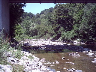
Highland Creek is a neighbourhood in eastern Toronto, Ontario, Canada. It is located along the southern portion of the river of the same name in the former suburb of Scarborough. To the east are the neighbourhoods of Port Union and West Rouge, to the west West Hill and Woburn, and to the south Centennial Scarborough.

References

  1. "New French-language School to Support Scarborough Students". Queen's Printer for Ontario. 5 September 2017. Archived from the original on 7 December 2018. Retrieved 6 December 2018.

43°44′24″N79°14′46″W / 43.740°N 79.246°W / 43.740; -79.246