
Barnes is a district in the London Borough of Richmond upon Thames. It takes up the extreme north-east of the borough, and as such is the closest part of the borough to central London. It is centred 5.8 miles (9.3 km) west south-west of Charing Cross in a bend of the River Thames.

East Sheen, also known as Sheen, is a suburb in south-west london in the London Borough of Richmond upon Thames.

Barnes was a local government district in north west Surrey from 1894 to 1965, when its former area was absorbed into the London Borough of Richmond upon Thames.

St Mary's Church, Barnes is the parish church of Barnes, formerly in Surrey and now in the London Borough of Richmond upon Thames. It is a Grade II* listed building.
Hackford Road is a road in Oval, Lambeth, south London, England. It runs north–south and is located between Clapham Road (A3) to the west and Brixton Road (A23) to the east. To the north is the Oval tube station.

Paultons Square is a Georgian terraced garden square in Chelsea, London, SW3. It was built in 1836–40 on the site of a former market garden, land previously owned by Sir Thomas More and Sir John Danvers. The square features a central lawn enclosed by metal railings; the houses surrounding it are listed Grade II on the National Heritage List for England.

St Mary the Virgin, Mortlake is a parish church in Mortlake, in the London Borough of Richmond upon Thames. It is part of the Church of England and the Anglican Communion. The rector is The Revd Canon Dr Ann Nickson.

St Mary Magdalen Roman Catholic Church, Mortlake is a Roman Catholic church in North Worple Way, Mortlake, in the London Borough of Richmond upon Thames. Its priest is Canon Francis Moran.

The Mawson Arms/Fox and Hounds is a Grade II* listed public house at 110 Mawson Row, and 110 Chiswick Lane South, Chiswick. The entire terrace of five houses is listed, and they were built in about 1715 for the founder of Fuller's Brewery, Thomas Mawson. They are situated adjacent to Fuller's Griffin Brewery.
213 and 215 King's Road SW3 are a pair of terraced houses on King's Road, Chelsea, London, built in 1720. English Heritage has designated them a Grade II* listed building.
123 Mortlake High Street, also known as The Limes or Limes House and previously referred to as Mortlake Terrace, is a Grade II* listed 18th-century property in Mortlake in the London Borough of Richmond upon Thames.

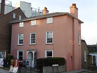
The Homestead is a Grade II listed house at Church Road, Barnes, London SW13, built in about 1720.

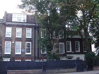
18 Station Road, also known as Milbourne House, is a Grade II* listed house at Station Road, Barnes, London SW13, in the London Borough of Richmond upon Thames. It has an early 18th-century facade, and earlier features internally.
70 Barnes High Street, also known as the Rose House, is a Grade II listed house in Barnes, London SW13, which dates from the 17th century. It is now used by the Barnes Community Association as office accommodation.

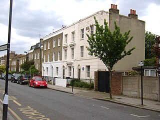
The Terrace is a street in Barnes in the London Borough of Richmond upon Thames. It forms part of the A3003, and runs west from its junction with Barnes High Street and Lonsdale Road to the east, where it becomes Mortlake High Street. The street has houses only on one side, all overlooking the River Thames.

Brompton Square is a garden square in London's Brompton district, in the Royal Borough of Kensington and Chelsea.
Barnes Football Club was an association football that had its origins in Barnes, London. The club had great importance in the development of the game in the nineteenth century.

Alexander Square is a garden square in London's Chelsea district, SW3. The communal garden at the centre of the development is 0.1226 hectares in size.


