The Mariner program was conducted by the American space agency NASA to explore other planets. Between 1962 and late 1973, NASA's Jet Propulsion Laboratory (JPL) designed and built 10 robotic interplanetary probes named Mariner to explore the inner Solar System - visiting the planets Venus, Mars and Mercury for the first time, and returning to Venus and Mars for additional close observations.

Mariner 2, an American space probe to Venus, was the first robotic space probe to conduct a successful planetary encounter. The first successful spacecraft in the NASA Mariner program, it was a simplified version of the Block I spacecraft of the Ranger program and an exact copy of Mariner 1. The missions of the Mariner 1 and 2 spacecraft are sometimes known as the Mariner R missions. Original plans called for the probes to be launched on the Atlas-Centaur, but serious developmental problems with that vehicle forced a switch to the much smaller Agena B second stage. As such, the design of the Mariner R vehicles was greatly simplified. Far less instrumentation was carried than on the Soviet Venera probes of this period—for example, forgoing a TV camera—as the Atlas-Agena B had only half as much lift capacity as the Soviet 8K78 booster. The Mariner 2 spacecraft was launched from Cape Canaveral on August 27, 1962, and passed as close as 34,773 kilometers (21,607 mi) to Venus on December 14, 1962.

STS-66 was a Space Shuttle program mission that was flown by the Space Shuttle Atlantis. STS-66 launched on 3 November 1994 at 11:59:43.060 am EDT from Launch Pad 39-B at NASA's Kennedy Space Center. Atlantis landed at Edwards Air Force Base on 14 November 1994 at 10:33:45 am EST.

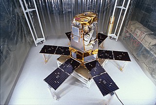
The Upper Atmosphere Research Satellite (UARS) was a NASA-operated orbital observatory whose mission was to study the Earth's atmosphere, particularly the protective ozone layer. The 5,900-kilogram (13,000 lb) satellite was deployed from Space Shuttle Discovery during the STS-48 mission on 15 September 1991. It entered Earth orbit at an operational altitude of 600 kilometers (370 mi), with an orbital inclination of 57 degrees.

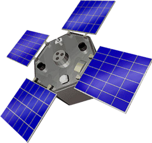
Jason-1 was a satellite altimeter oceanography mission. It sought to monitor global ocean circulation, study the ties between the ocean and the atmosphere, improve global climate forecasts and predictions, and monitor events such as El Niño and ocean eddies. Jason-1 was launched in 2001 and it was followed by OSTM/Jason-2 in 2008, and Jason-3 in 2016 – the Jason satellite series. Jason-1 was launched alongside the TIMED spacecraft.

Deep Space Climate Observatory is a National Oceanic and Atmospheric Administration (NOAA) space weather, space climate, and Earth observation satellite. It was launched by SpaceX on a Falcon 9 v1.1 launch vehicle on 11 February 2015, from Cape Canaveral. This is NOAA's first operational deep space satellite and became its primary system of warning Earth in the event of solar magnetic storms.

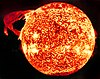
Solar irradiance is the power per unit area received from the Sun in the form of electromagnetic radiation in the wavelength range of the measuring instrument. Solar irradiance is measured in watts per square metre (W/m2) in SI units.
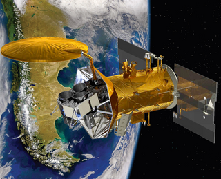
The Solar Radiation and Climate Experiment (SORCE) was a NASA-sponsored satellite mission that measured incoming X-ray, ultraviolet, visible, near-infrared, and total solar radiation. These measurements specifically addressed long-term climate change, natural variability, atmospheric ozone, and UV-B radiation, enhancing climate prediction. These measurements are critical to studies of the Sun, its effect on the Earth's system, and its influence on humankind. SORCE was launched on 25 January 2003 on a Pegasus XL launch vehicle to provide NASA's Earth Science Enterprise (ESE) with precise measurements of solar radiation.
Aquarius was a NASA instrument aboard the Argentine SAC-D spacecraft. Its mission was to measure global sea surface salinity to better predict future climate conditions.

OSTM/Jason-2, or Ocean Surface Topography Mission/Jason-2 satellite, was an international Earth observation satellite altimeter joint mission for sea surface height measurements between NASA and CNES. It was the third satellite in a series started in 1992 by the NASA/CNES TOPEX/Poseidon mission and continued by the NASA/CNES Jason-1 mission launched in 2001.

The Solar Mesosphere Explorer was a NASA spacecraft to investigate the processes that create and destroy ozone in Earth's upper of the atmosphere of Earth. The mesosphere is a layer of the atmosphere extending from the top of the stratosphere to an altitude of about 80 km (50 mi). The spacecraft carried five instruments to measure ozone, water vapor, and incoming solar radiation.
NOAA-13, also known as NOAA-I before launch, was an American weather satellite operated by the National Oceanic and Atmospheric Administration (NOAA). NOAA-I continued the operational, polar orbiting, meteorological satellite series operated by the National Environmental Satellite System (NESS) of the National Oceanic and Atmospheric Administration (NOAA). NOAA-I continued the series (fifth) of Advanced TIROS-N (ATN) spacecraft begun with the launch of NOAA-8 (NOAA-E) in 1983. NOAA-I was in an afternoon equator-crossing orbit and was intended to replace the NOAA-11 (NOAA-H) as the prime afternoon (14:00) spacecraft.

Soil Moisture Active Passive (SMAP) is a NASA environmental monitoring satellite that measures soil moisture across the planet. It is designed to collect a global 'snapshot' of soil moisture every 2 to 3 days. With this frequency, changes from specific storms can be measured while also assessing impacts across seasons of the year. SMAP was launched on 31 January 2015. It was one of the first Earth observation satellites developed by NASA in response to the National Research Council's Decadal Survey.

ADEOS I was an Earth observation satellite launched by NASDA in 1996. The mission's Japanese name, Midori means "green". The mission ended in July 1997 after the satellite sustained structural damage to the solar panel. Its successor, ADEOS II, was launched in 2002. Like the first mission, it ended after less than a year, also following solar panel malfunctions.

The Joint Polar Satellite System (JPSS) is the latest generation of U.S. polar-orbiting, non-geosynchronous, environmental satellites. JPSS will provide the global environmental data used in numerical weather prediction models for forecasts, and scientific data used for climate monitoring. JPSS will aid in fulfilling the mission of the U.S. National Oceanic and Atmospheric Administration (NOAA), an agency of the Department of Commerce. Data and imagery obtained from the JPSS will increase timeliness and accuracy of public warnings and forecasts of climate and weather events, thus reducing the potential loss of human life and property and advancing the national economy. The JPSS is developed by the National Aeronautics and Space Administration (NASA) for the National Oceanic and Atmospheric Administration (NOAA), who is responsible for operation of JPSS. Three to five satellites are planned for the JPSS constellation of satellites. JPSS satellites will be flown, and the scientific data from JPSS will be processed, by the JPSS – Common Ground System (JPSS-CGS).

The Suomi National Polar-orbiting Partnership, previously known as the National Polar-orbiting Operational Environmental Satellite System Preparatory Project (NPP) and NPP-Bridge, is a weather satellite operated by the United States National Oceanic and Atmospheric Administration (NOAA). It was launched in 2011 and continues to operate in June 2022.

Student Nitric Oxide Explorer, was a NASA small scientific satellite which studied the concentration of nitric oxide in the thermosphere. It was launched in 1998 as part of NASA's Explorer program. The satellite was the first of three missions developed within the Student Explorer Demonstration Initiative (STEDI) program funded by the NASA and managed by the Universities Space Research Association (USRA). STEDI was a pilot program to demonstrate that high-quality space science can be carried out with small, low-cost free-flying satellites on a time scale of two years from go-ahead to launch. The satellite was developed by the University of Colorado Boulder's Laboratory for Atmospheric and Space Physics (LASP) and had met its goals by the time its mission ended with reentry in December 2003.

NOAA-9, known as NOAA-F before launch, was an American weather satellite operated by the National Oceanic and Atmospheric Administration (NOAA) for use in the National Environmental Satellite Data and Information Service (NESDIS). It was the second of the Advanced TIROS-N series of satellites. The satellite design provided an economical and stable Sun-synchronous platform for advanced operational instruments to measure the atmosphere of Earth, its surface and cloud cover, and the near-space environment.
NOAA-10, known as NOAA-G before launch, was an American weather satellite operated by the National Oceanic and Atmospheric Administration (NOAA) for use in the National Environmental Satellite Data and Information Service (NESDIS). It was the third of the Advanced TIROS-N series of satellites. The satellite design provided an economical and stable Sun-synchronous platform for advanced operational instruments to measure the atmosphere of Earth, its surface and cloud cover, and the near-space environment.
NOAA-11, known as NOAA-H before launch, was an American weather satellite operated by the National Oceanic and Atmospheric Administration (NOAA) for use in the National Operational Environmental Satellite System (NOESS) and for support of the Global Atmospheric Research Program (GARP) during 1978–1984. It was the fourth of the Advanced TIROS-N series of satellites. The satellite design provided an economical and stable Sun-synchronous platform for advanced operational instruments to measure the atmosphere of Earth, its surface and cloud cover, and the near-space environment.