Aquaveo

Last updated
Aquaveo, LLC
Company type Private
Industry Hydrogeology software
FoundedApril 2007
Headquarters Provo, Utah
Key people
  • Alan Zundel
  • Norm Jones
  • Royd Nelson
  • Jim Nelson
Website Aquaveo.com

Aquaveo is a modeling software company based in Provo, Utah that develops software used to model and simulate groundwater, watershed, and surface water resources. [1] Its main software products include SMS, GMS, WMS, and Arc Hydro Groundwater.

Contents

History

The Engineering Computer Graphics Laboratory (ECGL) was established in 1985 at Brigham Young University (BYU). [2] Simulation data produced in the lab was critical to Anderson v. Cryovac, Inc. , a 1986 federal lawsuit concerning toxic contamination of groundwater in Woburn, Massachusetts. [3] After using another BYU product—Movie BYU—to animate a hydrology problem to make it easier to understand, Norm Jones decided to start work on software that helped engineers visualize problems and solutions. [4] Use of the tools created by Jones allowed the U.S. Army Corps of Engineers to save "hundreds of thousands of dollars". [4]

Alan Zundel and James Nelson, two other professors at BYU, also became involved in the process of developing the software in 1991. [4] By 2002, the company's software was being used in "more than 100 countries and [by] more than 9,000 organizations." [4] Royd Nelson created Environmental Modeling Systems (EMSI), a private company, in October 1995 to distribute the software created in the ECGL. [5] The name of the lab was changed in September 1998 to the Environmental Modeling Research Laboratory (EMRL). [2]

The government of India used early versions of the software developed by the EMRL to help with finding sources of clean groundwater, setting groundwater policy, and setting a course of action to clean up the contaminated groundwater in their country. [3] State and local governments in Utah and California have used the software to help trace contaminant sources at farms and mining facilities, and to determine how to manage water resources in drier climates like the Los Angeles area. [3]

The planners of the 2002 Winter Olympics, held in Salt Lake City, Utah, used the Watershed Modeling System (WMS) software to simulate terrorist attacks on water infrastructure such as the Jordanelle Reservoir. [4] In April 2007, a private company named Aquaveo was created to develop the work of the EMRL as commercial products, and the main people at the lab moved to the new company. [1] [6] [7] EMSI and Aquaveo merged in October 2008, keeping the company name of "Aquaveo". [8]

Local and federal government agencies, including the US Army Corps of Engineers, the US Federal Highway Administration, Los Angeles County, the USGS, the US Department of Energy, and the USEPA, have software and consulting contracts with Aquaveo. In 2011, the government of Australia used Arc Hydro Groundwater to help in developing a national groundwater information system. [9] Arc Hydro was used to convert bore and construction log data and to create geovolumes from georasters. [10]

Aquaveo worked with the Office of Naval Research, the Carderock Division of the Naval Surface Warfare Center, and several universities and companies to create the Environmental and Ship Motion Forecasting system. [11] This system was designed to "provide sea-based forces with new capabilities for difficult operations like ship-to-ship transfer of personnel, vehicles or material-giving operators sea condition information at levels of accuracy never possible before". [11]

Products

Aquaveo is primarily a software development company for water modeling that allow water to be modeled in most situations: watershed, rivers, lakes, ocean tides, flooding, and so on. Its flagship products are SMS and GMS, which are used by municipalities and universities around the world. It also produces WMS and Arc Hydro Groundwater. Their software is used by "over 12,000 firms, government institutions, and universities in over 120 countries". [1] [7]

Arc Hydro Groundwater

Arc Hydro Groundwater allows for managing groundwater and subsurface data within ArcGIS. The software was created in cooperation with ESRI to allow groundwater and subsurface analysis, as well as using MODFLOW to analyze results. [12]

CityWater

CityWater is a cloud-based water distribution management tool. It uses EPANET model files to allow users via any modern browser to access current information on a water distribution system such as a municipal water system. [13]

GMS

The Groundwater Modeling System (GMS) is a computer application designed to build and simulate groundwater models. It uses 2D and 3D geostatistics and stratigraphic modeling to show how water and contaminants can move through various soil structures. The software supports many standard models, including MODFLOW, MODPATH, MT3DMS, RT3D, FEMWATER, SEEP2D, and UTEXAS. [14]

SMS

The Surface-water Modeling System (SMS) is an application used for building and simulating surface water models within the hydrological cycle, including river and stream flow models, flooding, and sediment and particle flow in lakes and oceans. It features 1D and 2D conceptual modeling. The software supports standard models, including ADCIRC, CMS-FLOW2D, FESWMS, TABS, TUFLOW, BOUSS-2D, CGWAVE, STWAVE, CMS-WAVE (WABED), GENESIS, and PTM. [15]

WMS

The Watershed Modeling System (WMS) is an application used for developing watershed simulations of river hydraulics, municipal storm drain systems, floodplains, and watersheds. WMS supports lumped parameter, regression, and 2D hydrologic modeling of watersheds, and can be used to model both water quantity and water quality. It supports standard models such as HEC-1, HEC-RAS, HEC-HMS, TR-20, TR-55 hydrologic model, National Flood Frequency Model, rational hydrologic model, MODRAT, HSPF, CE-QUAL-W2, GSSHA, and SMPDBK. [16]

XMDF

XMDF (eXtensible Model Data Format) is a library providing a standard format for the geometric data storage of river cross-sections, 2D/3D structured and unstructured meshes, geometric paths through space, and associated time data. XMDF uses HDF5 for cross-platform data storage and compression. API includes interfaces for C/C++ and Fortran.

Associations

Aquaveo is a member of the American Water Resources Association. [17]

Related Research Articles

The United States Environmental Protection Agency (EPA) Storm Water Management Model (SWMM) is a dynamic rainfall–runoff–subsurface runoff simulation model used for single-event to long-term (continuous) simulation of the surface/subsurface hydrology quantity and quality from primarily urban/suburban areas.

<span class="mw-page-title-main">MODFLOW</span>

MODFLOW is the U.S. Geological Survey modular finite-difference flow model, which is a computer code that solves the groundwater flow equation. The program is used by hydrogeologists to simulate the flow of groundwater through aquifers. The source code is free public domain software, written primarily in Fortran, and can compile and run on Microsoft Windows or Unix-like operating systems.

<span class="mw-page-title-main">Hydrological transport model</span>

An hydrological transport model is a mathematical model used to simulate the flow of rivers, streams, groundwater movement or drainage front displacement, and calculate water quality parameters. These models generally came into use in the 1960s and 1970s when demand for numerical forecasting of water quality and drainage was driven by environmental legislation, and at a similar time widespread access to significant computer power became available. Much of the original model development took place in the United States and United Kingdom, but today these models are refined and used worldwide.

<span class="mw-page-title-main">HEC-RAS</span> Software for simulating water flow within rivers

HEC-RAS is simulation software used in computational fluid dynamics – specifically, to model the hydraulics of water flow through natural rivers and other channels. Prior to the 2016 update to Version 5.0, the program was one-dimensional, meaning that there is no direct modeling of the hydraulic effect of cross section shape changes, bends, and other two- and three-dimensional aspects of flow. The release of Version 5.0 introduced two-dimensional modeling of flow as well as sediment transfer modeling capabilities. The program was developed by the United States Army Corps of Engineers in order to manage the rivers, harbors, and other public works under their jurisdiction; it has found wide acceptance by many others since its public release in 1995.

<span class="mw-page-title-main">GMS (software)</span>

GMS is water modeling application for building and simulating groundwater models from Aquaveo. It features 2D and 3D geostatistics, stratigraphic modeling and a unique conceptual model approach. Currently supported models include MODFLOW, MODPATH, MT3DMS, RT3D, FEMWATER, SEEP2D, and UTEXAS.

Geographic information systems (GISs) have become a useful and important tool in the field of hydrology to study and manage Earth's water resources. Climate change and greater demands on water resources require a more knowledgeable disposition of arguably one of our most vital resources. Because water in its occurrence varies spatially and temporally throughout the hydrologic cycle, its study using GIS is especially practical. Whereas previous GIS systems were mostly static in their geospatial representation of hydrologic features, GIS platforms are becoming increasingly dynamic, narrowing the gap between historical data and current hydrologic reality.

Groundwater models are computer models of groundwater flow systems, and are used by hydrologists and hydrogeologists. Groundwater models are used to simulate and predict aquifer conditions.

<span class="mw-page-title-main">Runoff model (reservoir)</span> Type of water motion

A runoff models or rainfall-runoff model describes how rainfall is converted into runoff in a drainage basin. More precisely, it produces a surface runoff hydrograph in response to a rainfall event, represented by and input as a hyetograph. Rainfall-runoff models need to be calibrated before they can be used.

<span class="mw-page-title-main">WMS (hydrology software)</span> Watershed simulation and modelling software

WMS is a watershed computer simulation and modeling software application from Aquaveo. It was originally created in the early 1990s at the Engineering Computer Graphics Laboratory at Brigham Young University.

SMS is a complete program for building and simulating surface water models from Aquaveo. It features 1D and 2D modeling and a unique conceptual model approach. Currently supported models include ADCIRC, CMS-FLOW2D, FESWMS, TABS, TUFLOW, BOUSS-2D, CGWAVE, STWAVE, CMS-WAVE (WABED), GENESIS, PTM, and WAM.

XMDF is a library providing a standard format for the geometric data storage of river cross-sections, 2D/3D structured and unstructured meshes, geometric paths through space, and associated time data. XMDF uses HDF5 for cross-platform data storage and compression. It was initiated in Engineer Research and Development Center (ERDC) and is developed by Aquaveo . API includes interfaces for C/C++ and Fortran.

MIKE SHE is an integrated hydrological modelling system for building and simulating surface water flow and groundwater flow. MIKE SHE can simulate the entire land phase of the hydrologic cycle and allows components to be used independently and customized to local needs. MIKE SHE emerged from Système Hydrologique Européen (SHE) as developed and extensively applied since 1977 onwards by a consortium of three European organizations: the Institute of Hydrology, SOGREAH (France) and DHI (Denmark). Since then, DHI has continuously invested resources into research and development of MIKE SHE. MIKE SHE can be used for the analysis, planning and management of a wide range of water resources and environmental problems related to surface water and groundwater, especially surface-water impact from groundwater withdrawal, conjunctive use of groundwater and surface water, wetland management and restoration, river basin management and planning, impact studies for changes in land use and climate.

<span class="mw-page-title-main">Hydrological model</span>

A hydrologic model is a simplification of a real-world system that aids in understanding, predicting, and managing water resources. Both the flow and quality of water are commonly studied using hydrologic models.

The Hydrologic Modeling System (HEC-HMS) is designed to simulate the precipitation-runoff processes of dendritic drainage basins. It is designed to be applicable in a wide range of geographic areas for solving the widest possible range of problems. This includes large river basin water supply and flood hydrology, and small urban or natural watershed runoff. Hydrographs produced by the program are used directly or in conjunction with other software for studies of water availability, urban drainage, flow forecasting, future urbanization impact, reservoir spillway design, flood damage reduction, floodplain regulation, and systems operation.

GSSHA is a two-dimensional, physically based watershed model developed by the Engineer Research and Development Center of the United States Army Corps of Engineers. It simulates surface water and groundwater hydrology, erosion and sediment transport. The GSSHA model is used for hydraulic engineering and research, and is on the Federal Emergency Management Agency (FEMA) list of hydrologic models accepted for use in the national flood insurance program for flood hydrograph estimation. Input is best prepared by the Watershed Modeling System interface, which effectively links the model with geographic information systems (GIS).

SWAT is a river basin scale model developed to quantify the impact of land management practices in large, complex watersheds. SWAT is a public domain software enabled model actively supported by the USDA Agricultural Research Service at the Blackland Research & Extension Center in Temple, Texas, USA. It is a hydrology model with the following components: weather, surface runoff, return flow, percolation, evapotranspiration, transmission losses, pond and reservoir storage, crop growth and irrigation, groundwater flow, reach routing, nutrient and pesticide loading, and water transfer. SWAT can be considered a watershed hydrological transport model. This model is used worldwide and is continuously under development. As of July 2012, more than 1000 peer-reviewed articles have been published that document its various applications.

Hydrological optimization applies mathematical optimization techniques to water-related problems. These problems may be for surface water, groundwater, or the combination. The work is interdisciplinary, and may be done by hydrologists, civil engineers, environmental engineers, and operations researchers.

The following outline is provided as an overview of and topical guide to hydrology:

Integrated Water Flow Model (IWFM) is a computer program for simulating water flow through the integrated land surface, surface water and groundwater flow systems. It is a rewrite of the abandoned software IGSM, which was found to have several programing errors. The IWFM programs and source code are freely available. IWFM is written in Fortran, and can be compiled and run on Microsoft Windows, Linux and Unix operating systems. The IWFM source code is released under the GNU General Public License.

<span class="mw-page-title-main">Watershed delineation</span> Science and engineering method

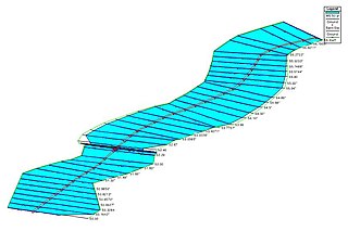
Watershed delineation is the process of identifying the boundary of a watershed, also referred to as a catchment, drainage basin, or river basin. It is an important step in many areas of environmental science, engineering, and management, for example to study flooding, aquatic habitat, or water pollution.

References

  1. 1 2 3 Ewell, Christopher (29 May 2015). "Aquaveo: Using Geospatial Modeling to Map Surface and Groundwater". Ubique: The American Geographical Society Newsletter. Archived from the original on 2 March 2016.
  2. 1 2 "Environmental Modeling Research Laboratory". Engineering Computer Graphics Laboratory at Brigham Young University. Archived from the original on April 21, 1999. Retrieved March 5, 2018.
  3. 1 2 3 Spangler, Jerry (2 April 1999). "Software keeps an eye on 'invisible' water: Provo product monitors ground supply". Deseret News . Archived from the original on 4 March 2016. Retrieved 25 February 2016.
  4. 1 2 3 4 5 Chai, Nathan K. (Fall 2002). "Modeling the World's Waters". BYU Magazine. Archived from the original on 10 March 2016. Retrieved 25 February 2016.
  5. "Entity Search: Environmental Modeling Systems Incorporated". Division of Corporations and Commercial Code on Utah.gov. 29 September 2015. Archived from the original on 4 March 2016. Retrieved 25 February 2016.
  6. "The Environmental Modeling Research Laboratory". Brigham Young University. 3 May 2012. Archived from the original on 10 March 2016. Retrieved 9 September 2013.
  7. 1 2 "About Us". Aquaveo. Archived from the original on 2 March 2016. Retrieved 6 August 2013.
  8. "EMS-I is now Aquaveo!". Aquaveo. Archived from the original on 4 March 2016. Retrieved 25 February 2016.
  9. "Australia Develops a National Groundwater Information System". Esri. 2011. Archived from the original on 2 March 2016. Retrieved 19 February 2016.
  10. "National Groundwater Information System: Data Product Specification, version 1.2" (PDF). April 2015. pp. 22–23. Archived (PDF) from the original on 19 February 2016. Retrieved 19 February 2016.
  11. 1 2 Smalley, David (27 September 2013). "New Technology Could Impact Ships at Sea". Military.com. Archived from the original on 2 March 2016. Retrieved 19 February 2016.
  12. "Arc Hydro Groundwater". Aquaveo. Retrieved 19 February 2016.
  13. "CityWater - EPANET Web Solution". Aquaveo. Retrieved 19 December 2018.
  14. "Groundwater Modeling System Introduction". Aquaveo. Retrieved 19 February 2016.
  15. "SMS Introduction". Aquaveo. Retrieved 19 February 2016.
  16. "WMS Introduction". Aquaveo. Retrieved 19 February 2016.
  17. "Aquaveo". American Water Resources Association. Archived from the original on 2 March 2016. Retrieved 19 February 2016.