Related Research Articles
Worcestershire is a county in the West Midlands of England. The area that is now Worcestershire was absorbed into the unified Kingdom of England in 927, at which time it was constituted as a county. Over the centuries the county borders have been modified, but it was not until 1844 that substantial changes were made. This culminated with the abolition of Worcestershire in 1974 with its northern area becoming part of the West Midlands and the rest part of the county of Hereford and Worcester. However, in 1998 the county of Hereford and Worcester was abolished and Worcestershire was reconstituted without the northern area, which was ceded to the West Midlands.

Hwicce was a tribal kingdom in Anglo-Saxon England. According to the Anglo-Saxon Chronicle, the kingdom was established in 577, after the Battle of Deorham. After 628, the kingdom became a client or sub-kingdom of Mercia as a result of the Battle of Cirencester.

Hereford and Worcester was an English non-metropolitan county created on 1 April 1974 by the Local Government Act 1972 from the areas of the former administrative county of Herefordshire, most of Worcestershire and the county borough of Worcester. An aim of the Act was to increase efficiency of local government: the two counties are among England's smaller and less populous counties, particularly after the same Act transferred some of Worcestershire's most urbanised areas to the West Midlands.

Herefordshire is a county in the West Midlands of England, governed by Herefordshire Council. It is bordered by Shropshire to the north, Worcestershire to the east, Gloucestershire to the south-east, and the Welsh counties of Monmouthshire and Powys to the west.

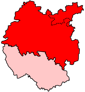
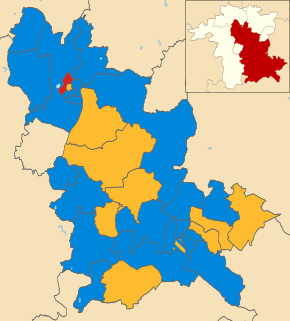
Malvern Hills is a local government district in Worcestershire, England. Its council is based in the town of Malvern, and its area covers most of the western half of the county, including the outlying towns of Tenbury Wells and Upton-upon-Severn. It was originally formed in 1974 and was subject to a significant boundary reform in 1998. In the 2011 census the population of the Malvern Hills district was 74,631.

West Mercia Police is the territorial police force responsible for policing the counties of Herefordshire, Shropshire and Worcestershire in England. The force area covers 2,868 square miles (7,430 km2) making it the fourth largest police area in England and Wales. The resident population of the area is 1.19 million Its name comes from the ancient kingdom of Mercia.
Leominster was a parliamentary constituency represented until 1707 in the House of Commons of England, then until 1801 in that of Great Britain, and finally until 2010, when it disappeared in boundary changes, in the Parliament of the United Kingdom.
The River Arrow may mean:
The River Arrow is a river in the Welsh Marches, rising in Powys in Wales, then flowing into the English county of Herefordshire.

West Midlands English is a group of dialects of the English language native to the English West Midlands.

Melolonthinae is a subfamily of the scarab beetles. It is a very diverse group; distributed over most of the world, it contains over 11,000 species in over 750 genera. Some authors include the scarab subfamilies Euchirinae and Pachypodinae as tribes in the Melolonthinae.
Pershore High School is a co-educational academy school, with a Sixth form, in Pershore, Worcestershire, England. It is the only high school in Pershore and also takes pupils from surrounding villages. It has a capacity of 1,273 pupils aged between 12 and 18.
The Tomsaete or Tomsæte were a tribe or clan in Anglo-Saxon England living in the valley of the River Tame in the West Midlands of England from around 500 and remaining around Tamworth throughout the existence of the Kingdom of Mercia. The tribe was identified as Anglian Mercens who came from the north, following the Trent Valley, and eventually settling along the valleys of the Tame.

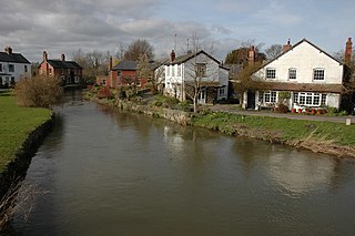
Shrawley is a village and civil parish in the Malvern Hills District in the county of Worcestershire, England. The village is situated on the western bank of the River Severn. The northern and southern boundaries of the parish are two small tributaries of the River Severn, Dick Brook to the north and Shrawley Brook to the south. To the west is Hillhampton, the north west and north is the parish of Astley and to the south Holt.
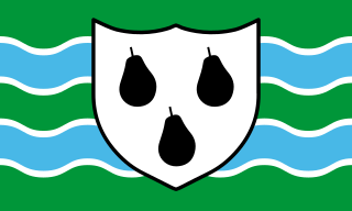
The Husmerae were a tribe or clan in early medieval England, possibly forming an early settlement of the Hwicce subkingdom. Charter evidence also referred to the group as Wiogorna and was also considered a prouvincia or provincia, an administrative division with its own territorial boundaries. An account also refer to the Husmerae territory as a regio.
The Cilternsæte were a tribe that occupied the Chilterns, probably in the 6th century AD.
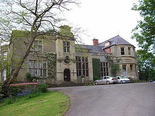
Burton Court is a Grade II* listed English country manor house in the Parish of Eardisland, southwest of Leominster, Herefordshire, England. The manor dates to at least the 11th century and the current house to the early 14th and 18th century. It lies along the A44 road, about 1 mile (1.6 km) south of Eardisland in the northern part of the hamlet of Lower Burton. It is now run as a Herefordshire wedding and private hire venue. Burton Court featured in Simon Jenkins's book England's Thousand Best Houses.

James Pytts was an English landowner and politician who sat in the House of Commons at various times between 1660 and 1686.
Frederick Preedy was an architect and glass painter in England.
The 2003 Wychavon District Council election took place on 1 May 2003 to elect members of Wychavon District Council in Worcestershire, England. The whole council was up for election with boundary changes since the last election in 1999 reducing the number of seats by four. The Conservative party stayed in overall control of the council.
References
- ↑ Kirby, D. P. (2001) The Earliest English Kings; 2nd ed. New York: Routledge (1st ed. London: Unwin Hyman, 1991)