Arran Hydro-Electric Schemes

Last updated

Arran
Hydro-Electric Schemes
Eas Mor Hydro Intake 1445.jpg
The intake for the Eas Mor Hydro-Electric Scheme
Argyll and Bute UK relief location map.jpg
Red pog.svg
Location of Arran
Hydro-Electric Schemes in Argyll and Bute
CountryScotland
Location Isle of Arran
Coordinates 55°35′31″N5°09′18″W / 55.592°N 5.155°W / 55.592; -5.155
PurposePower
StatusOperational

There are several hydro-electric schemes on the Isle of Arran , an island in the Firth of Clyde, Scotland. Most of them were installed during the early 21st century, but one is considerably older.

Contents

Electricity supply

Brodick Castle was the first residence on the Isle of Arran to benefit from an electricity supply, when the owners installed a private turbine in 1909. The next development was the creation of the Arran Power and Light Company which began operating in 1933, initially supplying just the village of Brodick. [1] Following the creation of the North of Scotland Hydro-Electric Board in 1943, they became responsible for electricity supply on the island in the early 1950s, and this resulted in the price paid by consumers dropping significantly, from 7.86 pence per unit to 1.80 pence per unit. The number of people using electricity rose rapidly, from 577 consumers prior to the Board taking over to 1,643 by April 1952. [2]

Although the National Grid was developed from 1926 to supply consumers on the mainland of Britain, connections to the islands did not occur until much later. Arran is connected to it by two submarine cables that run across the Kilbrannan Sound from Carradale on the Kintyre Peninsula to Balliekine on the west coast of Arran. They are known as the north cable and south cable, as they follow different routes between the places where they reach land, and both operate at 33kV. The north cable, which was installed in 1993, was found to be in a poor condition when it was inspected in 2017, and plans were drawn up to replace the 4.3-mile (6.9 km) link during 2021. At that time, it was owned and operated by Scottish Hydro-Electric Power Distribution. [3] [4]

Hydro-electric schemes

There is a limited amount of electricity generation on Arran. As of 2018, there were no wind farms on the island. [5] However, there are four hydro-electric schemes, one long-standing, and the others developed in the 2010s.

Claddoch Hydro-Electric Scheme

Claddoch
Hydro-Electric Scheme
BSicon uexKHSTa.svg
BSicon uexKHSTa.svg
Cnocan Burn sources
BSicon uexSTR.svg
BSicon uexSTR.svg
BSicon uexSTRl.svg
BSicon uexABZ+lr.svg
BSicon uexSTRr.svg
BSicon uexSTR+l.svg
BSicon uexABZlr.svg
BSicon uexSTR+r.svg
BSicon uexABZg+l.svg
BSicon uexSTRq.svg
BSicon uexSTR.svg
BSicon uexENDEeq.svg
BSicon uexSTR.svg
BSicon utSTR+l.svg
BSicon uxWEIRg@G.svg
BSicon utENDEeq.svg
Intake + pipeline
BSicon uexSTR.svg
BSicon utSTR.svg
BSicon uexSTR.svg
BSicon uexSTR.svg
BSicon utSTRl.svg
BSicon utSTRq.svg
BSicon uexBRUCKEu.svg
BSicon utSTR+r.svg
BSicon uexSTR.svg
BSicon uxSTRbr.svg
BSicon utSTRr.svg
Turbine house
BSicon uexSTR.svg
BSicon RA+l.svg
BSicon uexSKRZ-Au.svg
A841 bridge
BSicon uexSTRl.svg
BSicon uexSKRZ-Auq.svg
BSicon uexABZql.svg
BSicon uexSTR+r.svg
Cnocan Bridge
BSicon uDOCKSa.svg
Brodick Bay
The turbine house for the Claddoch power station Claddoch Hydro 1421.jpg
The turbine house for the Claddoch power station

The Claddoch scheme was a private scheme installed by the owners of Brodick Castle in 1909. [1] The present scheme, which is also known as Claddach or Cladach dam, uses water from the Cnochan Burn, on which there is a small dam close to the 720-foot (220 m) contour. An underground pipeline runs to the turbine house, which is located on the A841 road behind the sawmill on the north side of Brodick Bay. [6] The dam was created in the 1940s, but ceased to be used in the 1950s. [7] Following the death of the Dowager Duchess of Montrose and the need to pay huge death duties, the castle ceased to be a private residence and was acquired by the National Trust for Scotland from the Duchess's daughter Lady Jean Fforde in 1958. [8] Subsequently, the hydro scheme was renovated by the North of Scotland Hydro-Electric Board, and is now operated by Scottish and Southern Energy (SSE), their successors. [9] Data from the Office of Gas and Electricity Markets (Ofgem), the energy regulator, gives a commissioning date of 1949 for the scheme. [10]

In 2006, a new pipeline was run from the intake to the turbine house. Topsoil was removed from a strip of land some 23 feet (7 m) wide, and the new pipe was buried close to the old pipe. A small quantity of chipped stone was found in Greenhyde Field during the work, but archaeological investigation found that it had been used as fill for a 19th century field drain, and so was not in its original context. [11] For managemnent purposes, SSE treat the station as part of their Sloy/Awe scheme. [9]

Glenkiln Hydro-Electric Scheme

Glenkiln
Hydro-Electric Scheme
BSicon uexKHSTa.svg
BSicon uexKHSTaq.svg
BSicon uexABZg+r.svg
BSicon uexKHSTa.svg
BSicon uexKHSTa.svg
Benlister Burn sources
BSicon uexKHSTaq.svg
BSicon uexABZg+r.svg
BSicon uexSTR.svg
BSicon uexABZg+l.svg
BSicon uexKHSTeq.svg
BSicon uexSTR.svg
BSicon uexSTR.svg
BSicon uexABZg+l.svg
BSicon uexKHSTeq.svg
BSicon uxWEIRg@G.svg
BSicon utENDEaq.svg
BSicon uxWEIRg@G.svg
BSicon utSTRq.svg
BSicon uxWEIRg@G.svg
BSicon utSTRq.svg
BSicon utSTR+r.svg
Intakes + pipeline
BSicon uexABZg+l.svg
BSicon uexABZqr.svg
BSicon uexSTRr.svg
BSicon utSTR.svg
BSicon uexSTR.svg
BSicon utSTR+l.svg
BSicon utSTRq.svg
BSicon utSTRr.svg
BSicon uexABZg+l.svg
BSicon utSTR.svg
BSicon uexKRZuwq.svg
BSicon uexSTRq.svg
BSicon uexKHSTeq.svg
Tounie Burn pipe bridge
BSicon uxWEIRg.svg
BSicon utSTR.svg
Eas Geal (waterfall)
BSicon uexSTR.svg
BSicon utSTR.svg
BSicon uxSTRbr.svg
BSicon utSTRr.svg
Turbine house
BSicon uexSKRZ-Eu.svg
track
BSicon uexSKRZ-Au.svg
A841 Arranton Bridge
BSicon uDOCKSa.svg
Lamlash Bay

The Glenkiln scheme is located near Lamlash in the south-east of Arran. Ideas for the scheme were first discussed in 2012, but planning was complicated by the fact that the works were to take place in an area designated as a Special Protection Area (SPA), where the habitat of migratory birds must be safeguarded, and as a Site of Special Scientific Interest (SSSI). The project was a collaboration between J K and C Bone, a long-established farming business that runs Glenkiln Farm, supplying beef and lamb to local restaurants, and MEG Renewables, who are a renewable energy developer. [12] Planning consent to allow the project to proceed was obtained in September 2014, with construction work beginning in January 2015. [13] Bones employed 12 men to install the pipework over a period of nearly two years, which was hampered by appalling weather conditions and record levels of rainfall, particularly during the winter of 2015/16. Work within the SPA and SSSI had to be completed by March 2016 for the project to qualify for higher levels of feed in tariff. The project was completed by a local contractor, Murchie Sand and Gravel. [12]

It utilises the waters of the Benlister Burn. Water is collected at intakes, and flows along low-pressure pipelines, made from high performance polyethylene (HPPE). These pipelines together are 629 yards (575 m) long, and feed the water into a high-pressure pipeline made from ductile iron, which runs for 1.942 miles (3.125 km) to the turbine house. For most of its route, this pipeline in buried underground, but there is a small section above ground where a pipe bridge carries it across the Tounie Burn. This arrangement provides a gross head of 876 feet (267 m) to a twin jet Pelton wheel, which can produce 500 kW. [14]

In order to access the intake sites, 2.6 miles (4.2 km) of road was built across the moorland. Material for its construction was obtained from whinstone quarries, opened up along the route, which saved the costs of obtaining the stone from further afield. Because of the nature of the terrain, one 1,300-yard (1,200 m) section floats on top of the peat and heather, and three bridges were built to cross streams. Construction work was restricted to the winter months, to prevent disturbing nesting hen harriers in the Special Protection Area. The road will continue to be used for maintenance purposes. [15]

The scheme is expected to produce 1,570 MWh of energy per year, and was commissioned in July 2016. [14] An official opening was held on 28 October [16] and guided tours were offered to pupils from seven primary schools. The scheme generates around 15 percent of the electricity used by Arran's domestic consumers. [17] Shortly after the official opening, the Scottish Parliament passed a motion to congratulate Kenneth Bone for steering the scheme through to completion. [16]

Eas Mor Hydro-Electric Scheme

Eas Mor
Hydro-Electric Scheme
BSicon uexKHSTa.svg
BSicon uexKBHFa.svg
Loch Garbal
BSicon uexSTRl.svg
BSicon uexABZg+r.svg
BSicon uexKHSTa.svg
BSicon POINTERg@fq.svg
BSicon uexSTR.svg
BSicon uexSTR.svg
Loch Burn
BSicon uexABZg+l.svg
BSicon uexSTRr.svg
BSicon uexSTR.svg
Allt Mor
BSicon uxWEIRg@G.svg
BSicon utENDEaq.svg
BSicon utSTR+r.svg
Intake + pipeline
BSicon uxWEIRg.svg
BSicon utSTR.svg
Eas Mor (waterfall)
BSicon uexSTR.svg
BSicon utSTR.svg
BSicon uexSKRZ-Yu.svg
BSicon utSKRZ-Yu.svg
Auchenhew Bridge (ex A841)
BSicon utSTR+l.svg
BSicon utSTRq.svg
BSicon uexBRUCKEu.svg
BSicon utSTRr.svg
Pipe bridge
BSicon utSTR.svg
BSicon uexSTR.svg
BSicon utSTRl.svg
BSicon uxSTRbl.svg
Turbine house
BSicon uexSKRZ-Eu.svg
BSicon uDOCKSa.svg
Sound of Pladda

The Eas Mor Hydro-Electric Scheme is located on the Allt Mor, a small river near Kildonan in the south of Arran. It is operated by the Eas Mor Ecology Centre, who originally applied for planning permission for a smaller scheme and to build a visitor centre just to the north of the A841 road, which they received. However, before construction started, the centre obtained additional land below the road, and the plans were revised to move the turbine house further downstream on the Allt Mor, which increased the head significantly. The intake for the scheme is located just above the Eas Mor waterfall, and consists of a low weir, with an intake chamber which is screened to prevent debris entering the pipeline. The pipeline is made of a plastic material and is 16 inches (400 mm) in diameter. For most of its 1,040-yard (950 m) length it is buried beneath existing pathways to the east of the river. The exception is where it crosses the Allt Mor, a short distance above the turbine house in Auchenhew Wood, where it is carried by a pipe bridge after which it is buried on the west bank of the river. The turbine house is around 360 feet (110 m) below the level of the intake. [18]

The water feeds a Pelton wheel turbine, with an installed capacity of 95 kW. The tailrace feeds back into the Allt Mor. A buried cable carries the generated power away to a transformer, connecting the scheme to the 33 kV network on Arran. The cost of the project was around £315,000, and it had to be completed by 19 December 2015 in order to qualify for the feed-in tariffs negotiated at the beginning of the project. The station should produce around 274 MWh of energy per year, and the feed-in tariffs should be about £78,000 per year. Once the captital costs have been covered, all profits from the operation of the station will be used to improve the facilities at the ecology centre. [18] The section of the A841 road that passes the ecology centre and crosses over the pipeline has since been downgraded to an unclassified minor road. [6]

Dougarie Hydro-Electric Scheme

Dougarie
Hydro-Electric Scheme
BSicon uexKHSTa.svg
BSicon uexKHSTa.svg
BSicon uexKHSTaq.svg
BSicon uexABZg+r.svg
BSicon uexSTR.svg
Allt Gobhlach sources
BSicon uexSTR.svg
BSicon uexSTR.svg
BSicon uexABZg+l.svg
BSicon uexSTRq.svg
BSicon uexKSTRe.svg
BSicon uexKSTReq.svg
new cut
BSicon uxWEIRg@G.svg
BSicon utENDEaq.svg
BSicon utSTR+r.svg
Intake + pipeline
BSicon uexABZg+1.svg
BSicon utSTR.svg
BSicon uexSTR.svg
BSicon utSTR.svg
Allt Gobhlach
BSicon uxWEIRg.svg
BSicon utSTR.svg
Falls
BSicon uexABZg+l.svg
BSicon uexSTRq.svg
BSicon utKRZuw.svg
BSicon uexKHSTeq.svg
BSicon uexSTR.svg
BSicon utSTR.svg
BSicon uexSTR+l.svg
BSicon uexKHSTeq.svg
BSicon uexABZg+l.svg
BSicon uexSTRq.svg
BSicon utKRZuw.svg
BSicon uexABZqr.svg
BSicon uexKHSTeq.svg
Allt na h-Airighe
BSicon uexSTR.svg
BSicon utSTR.svg
BSicon uxSTRbr.svg
BSicon utSTRr.svg
Turbine house
BSicon uxWEIRg.svg
weir
BSicon uexSKRZ-Yu.svg
Bridge (former A841)
BSicon uDOCKSa.svg
Arran Sound
The Dougarie turbine house. The Allt Gobhlach is just behind the building. Dougarie Hydro 1452.jpg
The Dougarie turbine house. The Allt Gobhlach is just behind the building.

Dougarie Hydro-Electric Scheme is located near Pirnmill, on the west coast of Arran. It is a run-of-the-river scheme, utilising the waters of the Allt Gobhlach. A concrete intake structure, including a header tank, was constructed at the upper end of the scheme. The upper end of the pipeline consists of 1,100 yards (1,000 m) of 25-inch (630 mm) diameter High-density polyethylene (HDPE) pipe. At the lower end, 770 yards (700 m) of 20-inch (500 mm) diameter ductile iron pipe completes the connection to the turbine house. This provides a head of 620 feet (190 m) to the Canyon turbine, which is rated at 500 kW. The scheme was designed by Campbell of Doune. [19]

The scheme is built on land owned by the Dougarie Estate, who initially looked at the possibility of wind turbines as a way to generate income, but this was ruled out by the local development plan. However, a hydro-electric scheme was acceptable to the planning authority, as it has a much lower visual impact. In 2008 the estate approached SSE plc, the local energy supplier, for permission to connect one of four possible schemes to the National Grid, and began a project to collect flow data from the rivers. By the end of 2009, they had an offer for a grid connection, which was restricted to a maximum of 500 kW. The Allt Gobhlach had an average flow rate of around 26 Megalitres per day (Mld) over the course of a year, and this was chosen as the most suitable. Planning permission was secured in early 2012, and the scheme was commissioned in June 2013. It will benefit from feed-in tariffs for the electricity sold to the grid. During the early stages, the local community were kept well informed of the proposals, with a document outlining the scheme placed in the post office, while local residents all received their own copy, and the plans were well-received by those living nearby. [20]

Bibliography

Related Research Articles

<span class="mw-page-title-main">Micro hydro</span> Hydroelectric power generation of 5 to 100 kW of electricity

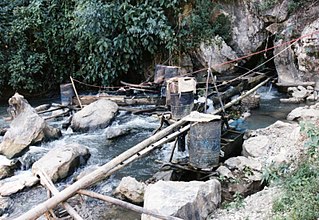
Micro hydro is a type of hydroelectric power that typically produces from 5 kW to 100 kW of electricity using the natural flow of water. Installations below 5 kW are called pico hydro. These installations can provide power to an isolated home or small community, or are sometimes connected to electric power networks, particularly where net metering is offered. There are many of these installations around the world, particularly in developing nations as they can provide an economical source of energy without the purchase of fuel. Micro hydro systems complement solar PV power systems because in many areas water flow, and thus available hydro power, is highest in the winter when solar energy is at a minimum. Micro hydro is frequently accomplished with a pelton wheel for high head, low flow water supply. The installation is often just a small dammed pool, at the top of a waterfall, with several hundred feet of pipe leading to a small generator housing. In low head sites, generally water wheels and Archimedes' screws are used.

<span class="mw-page-title-main">Falls of Foyers</span> Waterfall in Highland, Scotland

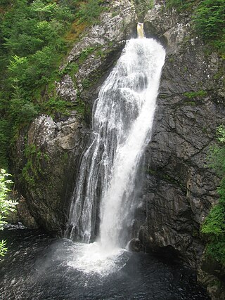
The Falls of Foyers are two waterfalls on the River Foyers, which feeds Loch Ness, in Highland, Scotland. They are located on the lower portion of the River Foyers, and consist of the upper falls, with a drop of 46 feet (14 m) and the lower falls, which drop 98 feet (30 m).

<span class="mw-page-title-main">Microgeneration</span> Small-scale heating and electric power creation

Microgeneration is the small-scale production of heat or electric power from a "low carbon source," as an alternative or supplement to traditional centralized grid-connected power.

<span class="mw-page-title-main">Tummel hydro-electric power scheme</span> Power stations in Perth and Inverness

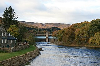
The Tummel hydro-electric power scheme is an interconnected network of dams, power stations, aqueducts and electric power transmission in the Grampian Mountains of Scotland. Roughly bounded by Dalwhinnie in the north, Rannoch Moor in the west and Pitlochry in the east it comprises a water catchment area of around 1,800 square kilometres and primary water storage at Loch Ericht, Loch Errochty, Loch Rannoch and Loch Tummel, in Perth and Kinross. Water, depending on where it originates and the path it takes, may pass through as many as five of the schemes nine power stations as it progresses from north-west to south-east. The scheme was constructed in the 1940s and 50s incorporating some earlier sites. It is managed by SSE plc.

<span class="mw-page-title-main">Affric-Beauly hydro-electric power scheme</span> Power stations on River Affric and River Beauly in Scottish Highlands

The Affric-Beauly hydro-electric power scheme for the generation of hydro-electric power is located in the western Highlands of Scotland. It is based around Glen Strathfarrar, Glen Cannich and Glen Affric, and Strathglass further downstream.

<span class="mw-page-title-main">Glendoe Hydro Scheme</span> Hydro-electric power scheme in Scotland

The Glendoe Hydro Scheme for the generation of hydro-electric power is located in the Monadhliath Mountains near Fort Augustus, above Loch Ness in the Highlands of Scotland. The change in financial incentives following the publication of the Renewables Obligation in 2001 caused Scottish and Southern Energy (SSE) to reconsider a number of schemes that had been mothballed in the 1960s by the North of Scotland Hydro-Electric Board, and plans for the Glendoe scheme were resurrected.

<span class="mw-page-title-main">Nostie</span> Human settlement and power station in Scotland

Nostie is a small remote hamlet, lying on Nostie Bay, an inlet at the northeastern end of the sea loch, Loch Alsh in the Scottish Highlands and is in the council area of Highland. Nostie lies a short distance from one of Scotland's popular tourist attractions, Eilean Donan Castle.

<span class="mw-page-title-main">Loch Sloy Hydro-Electric Scheme</span> Dam in Argyll and Bute

The Loch Sloy Hydro-Electric Scheme is a hydro-electric facility situated between Loch Sloy and Inveruglas on the west bank of Loch Lomond in Scotland.

<span class="mw-page-title-main">Hydroelectricity in the United Kingdom</span>

As of 2018, hydroelectric power stations in the United Kingdom accounted for 1.87 GW of installed electrical generating capacity, being 2.2% of the UK's total generating capacity and 4.2% of UK's renewable energy generating capacity. This includes four conventional hydroelectric power stations and run-of-river schemes for which annual electricity production is approximately 5,000 GWh, being about 1.3% of the UK's total electricity production. There are also four pumped-storage hydroelectric power stations providing a further 2.8 GW of installed electrical generating capacity, and contributing up to 4,075 GWh of peak demand electricity annually.

<span class="mw-page-title-main">Lanark Hydro Electric Scheme</span> Two power stations in South Lanarkshire, Scotland

The Lanark Hydro Electric Scheme consists of two hydroelectric plants in the Clydesdale area of South Lanarkshire, Scotland. They are run-of-the-river power stations, using water from the River Clyde near to the Falls of Clyde. Bonnington Power Station gets its water supply from just above Corra Linn in New Lanark, while Stonebyres Power Station takes water from above Stonebyres Linn near Kirkfieldbank. Bonnington is the larger of the two stations, which between them can produce 17 MW.

<span class="mw-page-title-main">Breadalbane Hydro-Electric Scheme</span> Multiple power stations in Scotland

The Breadalbane Hydro-Electric Scheme is a hydroelectric scheme in the Breadalbane area of Perthshire, Scotland. It comprises seven power stations which generate 120MW of power from the dams around Loch Lyon, Loch Earn and Loch Tay.

Scottish and Southern Electricity Networks is one of two energy companies in the UK to be involved both in electricity transmission and distribution.

<span class="mw-page-title-main">Gisla Hydro-Electric Scheme</span> Power station on Lewis, Outer Hebrides, Scotland

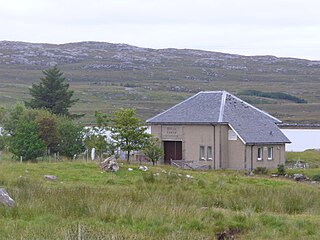
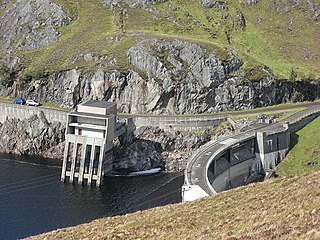
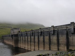
Gisla Hydro-Electric Scheme was a small scheme promoted by the North of Scotland Hydro-Electric Board on the Isle of Lewis, Outer Hebrides, Scotland. It consisted of a single power station powered with water from Loch Coirceabhat, and was commissioned in 1960.

<span class="mw-page-title-main">Awe Hydro-Electric Scheme</span> Power stations near Loch Awe, Scotland

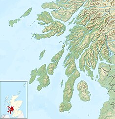
The Awe Hydro-Electric Scheme was the penultimate scheme developed by the North of Scotland Hydro-Electric Board. It centres around Loch Awe, in Argyll and Bute, on the southern edge of the Scottish Highlands. It consists of three power stations, two conventional hydro-electric stations, and the Cruachan power station, the first large pumped storage scheme built by the Board. It was completed in 1965.

<span class="mw-page-title-main">Inver Hydro-Electric Scheme</span> Power station on Jura, Inner Hebrides, Scotland

Inver Hydro-Electric Scheme is a remote hydro-electric plant on the Scottish island of Jura, part of the Inner Hebrides. Construction began in 2011, and it was operational by June 2012. It is the third scheme built on the Inver Estate, but the first to be connected to the National Grid. It can produce 2 MW of electric power.

<span class="mw-page-title-main">Lussa Hydro-Electric Scheme</span> Power station near Peninver, Scotland

Lussa Hydro-Electric Scheme is a small-scale hydro-electric power station, built by the North of Scotland Hydro-Electric Board and commissioned in 1956. It is located near Peninver on the Kintyre peninsula, part of Argyll and Bute in Scotland. It was originally designed to supply power to Campbeltown, but is now connected to the National Grid.

<span class="mw-page-title-main">Striven Hydro-Electric Scheme</span> Power station near Ardtaraig, Scotland

Striven Hydro-Electric Scheme is a small-scale hydro-electric power station, built by the North of Scotland Hydro-Electric Board and commissioned in 1951. It is located near Ardtaraig on the Cowal peninsula, part of Argyll and Bute in Scotland. It is sometimes known as the Cowal Hydro-Electric Scheme. It was originally designed to supply power to the remote communities on the peninsula, but is now connected to the National Grid.

<span class="mw-page-title-main">Kilmelfort Hydro-Electric Scheme</span> Power station near Kilmelford, Scotland

Kilmelfort Hydro-Electric Scheme is a small-scale hydro-electric power station, built by the North of Scotland Hydro-Electric Board and commissioned in 1956. It is located near Kilmelford in Argyll and Bute, Scotland. It was originally designed to supply power to the local communities around Kilmelford, but is now connected to the National Grid.

<span class="mw-page-title-main">Loch Gair Hydro-Electric Scheme</span> Power station near Lochgilphead, Scotland

Loch Gair Hydro-Electric Scheme is a small-scale hydro-electric power station, built by the North of Scotland Hydro-Electric Board and commissioned in 1956. It is located near Lochgair, a hamlet to the north-east of Lochgilphead, Argyll and Bute in Scotland. It was originally designed to supply power to Lochgilphead and the surrounding communities, but is now connected to the National Grid.

References

  1. 1 2 "A brief history of Arran". Cottages on Arran. Archived from the original on 18 May 2022.
  2. "Electricity Charges, Isle of Arran (House of Commons debate)". Hansard. 13 May 1952. Archived from the original on 2 February 2024.
  3. "Carradale - Arran Cable Replacement" (PDF). Xodus Group. 13 July 2021. pp. 9–11, 14. Archived (PDF) from the original on 19 April 2023.
  4. "Carradale - Arran Cable Replacement". Scottish and Southern Electricity Networks. Archived from the original on 28 October 2022.
  5. "North Ayrshire Landscape Wind Energy Capacity Study" (PDF). North Ayrshire Council. October 2018. p. 16. Archived (PDF) from the original on 21 January 2022.
  6. 1 2 Ordnance Survey, 1:25000 and 1:2500 map
  7. "Claddoch Hydro Dam". Geocashing.com. Archived from the original on 27 October 2023.
  8. Coventry 2006, p. 139.
  9. 1 2 "Our sites". SSE Renewables.
  10. "Renewable Energy Installation data". Energy Map. Row 22. Archived from the original on 27 October 2023.
  11. "Arran, Brodick Castle". Canmore.
  12. 1 2 "Hydro power for Arran". The Scottish Farmer. 12 December 2016. Archived from the original on 24 October 2023.
  13. "500-kW Benlister small hydro plant operating on Isle of Arran, Scotland". Hydro Review. 21 November 2016.
  14. 1 2 "Benlister Hydro". Greencat Renewables. 2016. Archived from the original on 7 July 2022.
  15. Boag 2016.
  16. 1 2 "The Opening of Glenkiln Hydro, Arran". Scottish Parliament. 7 November 2016. Archived from the original on 26 October 2023.
  17. "New hydro power plant opens on Isle of Arran". BBC. 18 November 2016. Archived from the original on 19 November 2016.
  18. 1 2 "Planning a truly green source of sustainable power". Eas Mor Ecology. Archived from the original on 25 October 2023.
  19. "Dougarie Hydro". MAM Contracting. Archived from the original on 30 June 2022.
  20. Davidson 2014.

Commons-logo.svg Media related to Arran hydro-electric schemes at Wikimedia Commons