Ashby | |
---|---|
Motto: You'll Like Ashby | |
Coordinates: 46°05′35″N95°48′56″W / 46.09306°N 95.81556°W | |
Country | United States |
State | Minnesota |
County | Grant |
Area | |
• Total | 0.59 sq mi (1.53 km2) |
• Land | 0.55 sq mi (1.43 km2) |
• Water | 0.04 sq mi (0.10 km2) |
Elevation | 1,286 ft (392 m) |
Population (2020) | |
• Total | 469 |
• Density | 851.18/sq mi (328.48/km2) |
Time zone | UTC-6 (Central (CST)) |
• Summer (DST) | UTC-5 (CDT) |
ZIP code | 56309 |
Area code | 218 |
FIPS code | 27-02422 [3] |
GNIS feature ID | 2393997 [2] |
Website | ashbyminnesota.org |
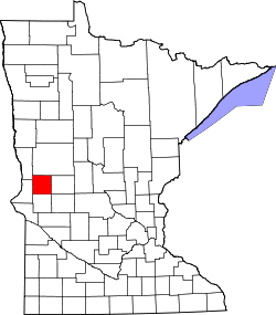
Ashby is a city in northeastern Grant County, Minnesota, United States. The population was 469 at the 2020 census. [4]
Ashby was platted in 1879, and named for Gunder Ash, an early Norwegian settler. [5] A post office has been in operation at Ashby since 1880. [6]
On July 8, 2020, areas north of Ashby were struck by a violent EF4 tornado. The twister killed one person and destroyed three farmsteads. [7]
In 2021, there was an 80 car pileup that occurred during a snowstorm. [8]
According to the United States Census Bureau, the city has a total area of 0.59 square miles (1.53 km2), of which 0.55 square miles (1.42 km2) is land and 0.04 square miles (0.10 km2) is water. [9]
Minnesota State Highway 78 serves as a main route in the community. Interstate 94 is nearby.
Census | Pop. | Note | %± |
---|---|---|---|
1890 | 231 | — | |
1900 | 279 | 20.8% | |
1910 | 334 | 19.7% | |
1920 | 388 | 16.2% | |
1930 | 358 | −7.7% | |
1940 | 384 | 7.3% | |
1950 | 443 | 15.4% | |
1960 | 426 | −3.8% | |
1970 | 415 | −2.6% | |
1980 | 486 | 17.1% | |
1990 | 469 | −3.5% | |
2000 | 472 | 0.6% | |
2010 | 446 | −5.5% | |
2020 | 469 | 5.2% | |
U.S. Decennial Census [10] 2020 Census [4] |
As of the census [11] of 2010, there were 446 people, 197 households, and 132 families residing in the city. The population density was 810.9 inhabitants per square mile (313.1/km2). There were 232 housing units at an average density of 421.8 per square mile (162.9/km2). The racial makeup of the city was 95.3% White, 1.8% African American, 0.4% Asian, 0.2% from other races, and 2.2% from two or more races. Hispanic or Latino of any race were 1.1% of the population.
There were 197 households, of which 26.9% had children under the age of 18 living with them, 53.3% were married couples living together, 10.2% had a female householder with no husband present, 3.6% had a male householder with no wife present, and 33.0% were non-families. 31.5% of all households were made up of individuals, and 17.7% had someone living alone who was 65 years of age or older. The average household size was 2.26 and the average family size was 2.80.
The median age in the city was 43.2 years. 24.2% of residents were under the age of 18; 5.6% were between the ages of 18 and 24; 22.9% were from 25 to 44; 21.7% were from 45 to 64; and 25.6% were 65 years of age or older. The gender makeup of the city was 46.6% male and 53.4% female.
As of the census [3] of 2000, there were 472 people, 185 households, and 113 families residing in the city. The population density was 883.9 inhabitants per square mile (341.3/km2). There were 202 housing units at an average density of 378.3 per square mile (146.1/km2). The racial makeup of the city was 97.67% White, 0.21% African American, 0.21% Native American, and 1.91% from two or more races.
There were 185 households, out of which 23.8% had children under the age of 18 living with them, 51.9% were married couples living together, 7.0% had a female householder with no husband present, and 38.9% were non-families. 36.2% of all households were made up of individuals, and 27.0% had someone living alone who was 65 years of age or older. The average household size was 2.25 and the average family size was 2.89.
In the city, the population was spread out, with 18.6% under the age of 18, 8.9% from 18 to 24, 19.3% from 25 to 44, 20.6% from 45 to 64, and 32.6% who were 65 years of age or older. The median age was 47 years. For every 100 females, there were 75.5 males. For every 100 females age 18 and over, there were 73.8 males.
The median income for a household in the city was $28,333, and the median income for a family was $39,375. Males had a median income of $31,250 versus $20,104 for females. The per capita income for the city was $15,296. About 8.7% of families and 11.1% of the population were below the poverty line, including 13.1% of those under age 18 and 17.8% of those age 65 or over.
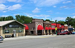
Ashby's public school is K-12. Known as the "Ashby Arrows", its sports teams' colors are maroon and gold.
Each year, a local sporting group which calls itself "Coots Unlimited "—a parody of Ducks Unlimited—holds a fundraising event with proceeds to rebuild local wildlife habitat. A metal statue of a coot (a duck-like creature) was erected on the south border of the city. [12]
Ashby is on the eastern fringe of the Red River Valley, which was carved out by ancient glaciers. As a result, it is nested in gently rolling hills and amongst many good fishing lakes, most prominent among them is Pelican Lake to the direct south of the city.
Correll is a city in Big Stone County, Minnesota, United States. The population was 34 at the 2010 census. Correll was named for David N Correll, a railroad official who founded the city in 1881.
Hanska is a city in Brown County, Minnesota, United States. The population was 402 at the 2010 census.
Chickamaw Beach is a city in Cass County, Minnesota, United States. The population was 114 at the 2010 census. It is part of the Brainerd Micropolitan Statistical Area.
Shafer is a city in Chisago County, Minnesota, United States. The population was 1,045 at the 2010 census. The city was named for Jacob Shafer, a pioneer settler.
Miltona is a city in Douglas County, Minnesota, United States. The population was 431 at the 2020 census.
Easton is a city in Faribault County, Minnesota, United States. The population was 199 at the 2010 census.
Twin Lakes is a city in Freeborn County, Minnesota, United States, near Albert Lea. The population was 134 at the 2020 census.
Calumet is a city in Itasca County, Minnesota, United States. The population was 367 at the 2010 census.
Hillman is a city in Morrison County, Minnesota, United States. The population was 23 at the 2020 census.
Sanborn is a city in Redwood County, Minnesota, United States. The population was 339 at the 2010 census.
St. Martin or Saint Martin, Smartin to locals, is a city in Stearns County, Minnesota, United States. The population was 308 at the 2010 census. It is part of the St. Cloud Metropolitan Statistical Area.
West Union is a city in Todd County, Minnesota, United States. The population was 111 at the 2010 census. By the 2020 Decennial Census the population had declined to 92.
Hammond is a city in Wabasha County, Minnesota, United States. The population was 132 at the 2010 census.
Dakota is a city in Winona County, Minnesota, United States. The population was 295 at the 2020 census.
Minnesota City is a city in Winona County, Minnesota, United States. The population was 202 at the 2020 census.
Rollingstone is a city in Winona County, Minnesota, United States. The population was 678 at the 2020 census.
Cooter is a city in Pemiscot County, Missouri, United States. The population was 343 at the 2020 census.
Brownsville is a city in Houston County, Minnesota, United States. The population was 566 at the 2020 census.
Silver Lake is a city in McLeod County, Minnesota, United States. The population was 866 at the 2020 census.
North Mankato is a city in Nicollet and Blue Earth counties in the State of Minnesota. The population was 14,275 at the 2020 census.
Media related to Ashby, Minnesota at Wikimedia Commons