Ashley, Ohio | |
---|---|
Coordinates: 40°24′35″N82°57′06″W / 40.40972°N 82.95167°W | |
Country | United States |
State | Ohio |
County | Delaware |
Township | Oxford |
Area | |
• Total | 0.66 sq mi (1.71 km2) |
• Land | 0.66 sq mi (1.71 km2) |
• Water | 0.00 sq mi (0.00 km2) |
Elevation | 978 ft (298 m) |
Population (2020) | |
• Total | 1,198 |
1,318 | |
• Density | 1,817.91/sq mi (702.12/km2) |
Time zone | UTC-5 (Eastern (EST)) |
• Summer (DST) | UTC-4 (EDT) |
ZIP code | 43003 |
Area code | 740 |
FIPS code | 39-02582 [4] |
GNIS feature ID | 1086041 [2] |
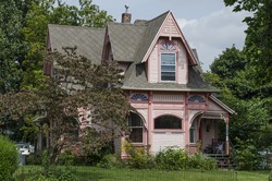
Ashley is a village in Delaware County, Ohio, United States. The population was 1,198 at the 2020 census.
Ashley students attend the Buckeye Valley Local School District.
Ashley was laid out in 1849. [5] The village takes its name from L. W. Ashley, one of the original owners of the village site. [6]
According to the United States Census Bureau, the village has a total area of 0.66 square miles (1.71 km2), all land. [7]
Census | Pop. | Note | %± |
---|---|---|---|
1870 | 454 | — | |
1880 | 483 | 6.4% | |
1890 | 628 | 30.0% | |
1900 | 700 | 11.5% | |
1910 | 706 | 0.9% | |
1920 | 786 | 11.3% | |
1930 | 734 | −6.6% | |
1940 | 762 | 3.8% | |
1950 | 798 | 4.7% | |
1960 | 907 | 13.7% | |
1970 | 1,034 | 14.0% | |
1980 | 1,057 | 2.2% | |
1990 | 1,059 | 0.2% | |
2000 | 1,216 | 14.8% | |
2010 | 1,330 | 9.4% | |
2020 | 1,198 | −9.9% | |
2023 (est.) | 1,318 | [3] | 10.0% |
U.S. Decennial Census [8] |
As of the census [9] of 2010, there were 1,330 people, 503 households, and 342 families living in the village. The population density was 2,015.2 inhabitants per square mile (778.1/km2). There were 542 housing units at an average density of 821.2 per square mile (317.1/km2). The racial makeup of the village was 97.2% White, 0.5% African American, 0.1% Native American, 0.2% Asian, 0.1% from other races, and 2.0% from two or more races. Hispanic or Latino of any race were 1.5% of the population.
There were 503 households, of which 36.8% had children under the age of 18 living with them, 47.7% were married couples living together, 14.9% had a female householder with no husband present, 5.4% had a male householder with no wife present, and 32.0% were non-families. 26.8% of all households were made up of individuals, and 11.1% had someone living alone who was 65 years of age or older. The average household size was 2.62 and the average family size was 3.12.
The median age in the village was 36.3 years. 27.1% of residents were under the age of 18; 7.5% were between the ages of 18 and 24; 26.3% were from 25 to 44; 25.4% were from 45 to 64; and 13.6% were 65 years of age or older. The gender makeup of the village was 47.1% male and 52.9% female.
As of the census [4] of 2000, there were 1,216 people, 469 households, and 324 families living in the village. The population density was 2,241.4 inhabitants per square mile (865.4/km2). There were 500 housing units at an average density of 921.6 per square mile (355.8/km2). The racial makeup of the village was 96.96% White, 0.99% African American, 0.33% Native American, 0.08% Pacific Islander, 0.25% from other races, and 1.40% from two or more races. Hispanic or Latino of any race were 0.82% of the population.
There were 469 households, out of which 35.4% had children under the age of 18 living with them, 51.4% were married couples living together, 12.8% had a female householder with no husband present, and 30.9% were non-families. 27.3% of all households were made up of individuals, and 12.8% had someone living alone who was 65 years of age or older. The average household size was 2.57 and the average family size was 3.06.
In the village, the population was spread out, with 29.5% under the age of 18, 7.8% from 18 to 24, 31.3% from 25 to 44, 18.3% from 45 to 64, and 13.1% who were 65 years of age or older. The median age was 34 years. For every 100 females there were 90.9 males. For every 100 females age 18 and over, there were 85.1 males.
The median income for a household in the village was $38,239, and the median income for a family was $42,313. Males had a median income of $31,667 versus $25,000 for females. The per capita income for the village was $15,513. About 10.2% of families and 12.7% of the population were below the poverty line, including 13.8% of those under age 18 and 24.4% of those age 65 or over.
Emergency medical services for the Village of Ashley and its surrounding area are provided by the Delaware County EMS. Fire protection services are provided by the Elm Valley Joint Fire District. [10]
Ashley is a village in Gratiot County in the U.S. state of Michigan. The population was 508 at the 2020 census. The village is located in the northwest corner of Elba Township. No major state trunkline runs through the village, although M-57 passes within one mile to the south. Ashley was platted in 1884.
Brookside is a village in eastern Belmont County, Ohio, United States. The population was 538 at the 2020 census. It is part of the Wheeling metropolitan area.
Flushing is a village in Belmont County, Ohio, United States. The population was 830 at the 2020 census.
Galena is a village in Delaware County, Ohio, United States. The population was 924 at the 2020 United States Census.
Ostrander is a village in Delaware County, Ohio, United States. The population was 1,094 at the 2020 census.
Shawnee Hills is a village in Delaware County, Ohio, United States. The population was 835 at the 2020 census. It is a part of the Columbus, Ohio Metropolitan Statistical Area.
Sunbury is a city in Delaware County, Ohio, United States. The population was 6,614 at the 2020 census. Sunbury went from being a village to a city on October 22, 2021.
Millersport is a village in Fairfield County, Ohio, United States. The population was 978 at the 2020 census. Millersport is most notable as the home of the Sweet Corn Festival, which is held in Millersport annually during the first week of September.
Cumberland is a village in Guernsey County, Ohio, United States. It is seventy miles east of Columbus. The population was 317 at the 2020 census.
Addyston is a village in Miami Township, Hamilton County, Ohio, United States. Located along the Ohio River, it is a western suburb of the neighboring city of Cincinnati. The population was 927 at the 2020 census.
Cleves is a village in Miami Township, Hamilton County, Ohio, United States. Located along the Ohio River, it is a western suburb of Cincinnati. The population was 3,414 at the 2020 census.
Evendale is a village in Hamilton County, Ohio, United States, within the Cincinnati metropolitan area. The population was 2,669 at the 2020 census.
Hartford is a village in the township of the same name in Licking County, Ohio, United States. The population was 404 at the 2020 census.
Whitehouse is a village within the Toledo Metropolitan Area in Lucas County, Ohio, United States. The population was 4,990 at the 2020 census.
Clarksburg is a village in Ross County, Ohio, United States. The population was 409 at the 2020 census.
Bolivar is a village in Tuscarawas County, Ohio, United States. The population was 1,000 at the 2020 census. Bolivar is also home to Fort Laurens, the only American Revolutionary War-era fort in what is now Ohio.
Newcomerstown is a village in Tuscarawas County, Ohio, United States, 85 miles (137 km) east-northeast of Columbus. The population was 3,702 at the 2020 census.
Wilson is a village in Belmont and Monroe counties in the U.S. state of Ohio. The population was 129 at the 2020 census. It is part of the Wheeling metropolitan area.
Gratiot is a village in Licking and Muskingum counties in the U.S. state of Ohio. The population was 215 at the 2020 census.
Verona is a village in Montgomery and Preble counties in the U.S. state of Ohio. The population was 403 at the 2020 census. It is part of the Dayton Metropolitan Statistical Area.