
A ring road is a road or a series of connected roads encircling a town, city, or country. The most common purpose of a ring road is to assist in reducing traffic volumes in the urban centre, such as by offering an alternate route around the city for drivers who do not need to stop in the city core.

Milan has an extensive internal transport network and is also an important transportation node in Italy, being one of the country's biggest hubs for air, rail and road networks. Internal public transport network includes the Metro, the Suburban Railway, the tram and bus network, as well as taxi, car and bike sharing services.

The Milan Metro is the rapid transit system serving Milan, Italy, operated by Azienda Trasporti Milanesi. The network consists of 4 lines, identified by different numbers and colours, with a total network length of 96.8 kilometres (60.1 mi), and a total of 106 stations, mostly underground. It has a daily ridership of about 1.4 million on weekdays.

Line 1 is the first underground rapid transit line built in Milan, Italy. It is part of the Milan Metro and it is operated by ATM. Works on the line began in 1957, and the first part was opened on 1 November 1964, running from Sesto Marelli to Lotto station. The line is also called Red Line, as it is visually identified by red signs. Due to its premiership, the line gave its red color to the Milan Metro logo.

Line 3 is a subway line serving Milan, Italy. The line is part of the Milan Metro and is operated by ATM. Construction began in 1981 in order to be ready for the 1990 Football World Cup. It is also called the Yellow Line as it is identified by yellow signage.

The Autostrada A56, more commonly known as the Tangenziale di Napoli, is a controlled access toll road bypassing the urban center and suburban developments of Naples, Italy — connecting the SS7 near Arco Felice/Pozzuoli at the west to the A1 Autostrade at the east, with a total length of 20.2 km. The most eastward section, from Junction 3 at Doganella to the A1, is toll-free.
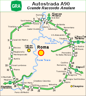
The GRA or Grande Raccordo Anulare is a toll-free, ring-shaped 68.2 kilometres (42.4 mi) long orbital motorway that encircles Rome. GRA is one of the most important roads in Rome, and traffic reaches 160,000 vehicles per day as of 2011.
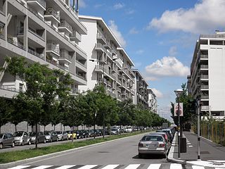
Milano Santa Giulia is a green and residential district ("quartiere") under construction in the south-east periphery of Milan, Italy, between the districts of Rogoredo and Taliedo, in the Zone 4 administrative division. As the construction is still in progress, the district is not formally recognized as such, and its area is still referred to as being part of Rogoredo and Taliedo.
The Autostrada A4, or Serenissima, is a motorway which connects Turin and Trieste via Milan and Venice. The city of Venice originally formed a bottleneck on the A4, but is now bypassed by the Passante di Mestre. The A4 passes just north of the city of Milan, where it is toll-free.

The Milan–Bologna high-speed railway is a railway line that links the cities of Milan and Bologna, part of the Italian high-speed rail network. It runs parallel to the historical north-south railway between Milan and Bologna, which itself follows the ancient Roman Road, the Via Aemilia. The new railway follows the Autostrada A1 closely for much of its length. The new line allows faster traffic to run separated and increase the overall railway capacity between the two cities.
Quartiere Feltre is a residential district ("quartiere") of Milan, Italy. It is located in the Zone 3 administrative division, extending east of the city centre, adjacent to the districts of Lambrate and Cimiano, the Lambro river and the Tangenziale Est ring road. It is named after Via Feltre, a large suburban street that connects Milan to the Parco Lambro city park.

Ponte Lambro is a district ("quartiere") of Milan, Italy. It is the outermost part of the Zone 4 administrative division, extending south-east of the city centre.
Ghisolfa is a district ("quartiere") of Milan, Italy, part of the Zone 8 administrative division of the city, located north-west of the city centre. It is named after the "Ghisolfa Bridge" overpass, part of the external Circonvallazione ring road enclosing the centre of Milan. In turn, the bridge was named after two cascine, "Cascina Ghisolfa" and "Cascina Ghisolfetta", that existed in the area before the urbanization of the mid 20th century. The bridge was completed in 1941, prolonged in the 1960s, and enlarged in the 1990s.
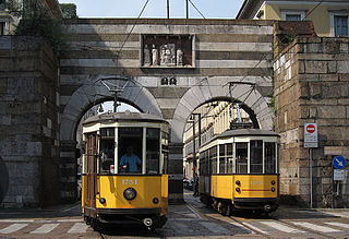
The Milan tramway network is part of the public transport network of Milan, Italy, operated by Azienda Trasporti Milanesi (ATM).
Milano Serravalle – Milano Tangenziali S.p.A. is an Italian transport company. The company owned the concession until 2028 on Milan to Serravalle Scrivia section of Autostrada A7, as well as the concession of the ring roads or bypass road surrounding Milan. The company was the holding company of Autostrada Pedemontana Lombarda, the operator of A36.

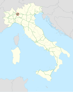
Autostrada A50, also called tangenziale Ovest di Milano, is a motorway that connects the suburban area of Milan from south-east to north-west, managed by Milano Serravalle – Milano Tangenziali.

Autostrada A52, also called tangenziale Nord di Milano, is a motorway that connects the northern suburban area of Milan, managed by Milano Serravalle – Milano Tangenziali. On 29 March 2005, the second section to the west was opened, not connected to the original A52, connecting the SS 33 and the A8.
Autostrada A51, also called tangenziale Est di Milano, is a motorway tangent to the city and suburban area of Milan in its eastern part, managed by Milano Serravalle – Milano Tangenziali.

Autostrada A59, also called tangenziale di Como, is a motorway tangent to the city of Como in its southern area. The first part of about 3 km was opened to traffic on 23 May 2015.


