
Dundonald is a large settlement and civil parish in County Down, Northern Ireland. It lies east of Belfast and is often considered a suburb of the city. It is home to the Ulster Hospital, Dundonald International Ice Bowl, Dundonald Omniplex, has a Park and Ride facility for the Glider, access to the Comber Greenway and several housing developments. John de Courcey established a keep including a motte-and-bailey in the 12th century. This is known as Moat Park and can be accessed from Church Green, Comber Road and the Upper Newtownards Road.
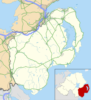
Ballywalter is a village, townland and civil parish in County Down, Northern Ireland. It is on the east coast of the Ards Peninsula between Donaghadee and Ballyhalbert. Ballywalter was formerly known as Whitkirk as far back as the 12th century. It had a population of 2,027 people in the 2011 census.
Carrowdore is a small village on the Ards Peninsula in County Down, Northern Ireland. It is situated in the townland of Ballyrawer, the civil parish of Donaghadee and the historic barony of Ards Lower. It lies within the Ards and North Down Borough. It had a population of 960 people in the 2011 Census.

Cloghy, also spelt Cloughey or Cloughy, is a small village and townland in County Down, Northern Ireland. It lies on the east coast of the Ards Peninsula, in the Ards and North Down Borough. It had a population of 1,075 people in the 2011 Census.
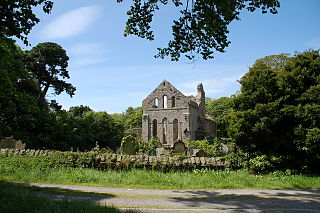
Greyabbey or Grey Abbey is a small village, townland and civil parish located on the eastern shores of Strangford Lough, on the Ards Peninsula in County Down, Northern Ireland. It lies 7 miles (11 km) south of Newtownards. Both townland and civil parish are situated in the historic barony of Ards Lower. It is within the Ards and North Down Borough. It had a population of 939 people in the 2011 Census.

Killinchy is a townland and small village in County Down, Northern Ireland. It is two miles inland from the western shores of Strangford Lough in the Borough of Ards and North Down. It is situated in the townland of the same name, the civil parish of Killinchy and the historic barony of Dufferin. It had a population of 539 people in the 2011 Census.
Balloo is a small village and townland near Killinchy in County Down, Northern Ireland. It is 5 miles south of Comber on the A22 road to Downpatrick. It is situated in the townland of the same name, the civil parish of Killinchy and the historic barony of Dufferin. It lies within the Ards and North Down Borough. It had a population of 189 people in the 2011 Census.

Whiterock is a small village in County Down, Northern Ireland. It is within the townland of Killinakin, in the civil parish of Killinchy and historic barony of Dufferin, on the western shore of Strangford Lough, near to the village of Killinchy. It is in the Ards and North Down Borough. It had a population of 355 people in the 2011 Census.
Ballyboley is a townland of 294 acres in County Antrim, Northern Ireland. It is situated in the civil parish of Larne and the historic barony of Glenarm Upper.
Ballycor is a townland and civil parish in County Antrim, Northern Ireland. Both are in the historic barony of Antrim Upper.
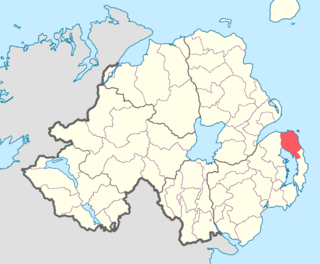
Ards Lower, alternatively known as North Ards, is a barony in County Down, Northern Ireland. It lies on the northern half of the Ards Peninsula in the north-east of the county, with the Irish Sea to its east and Strangford Lough to its south-west. It is bordered by two other baronies: Ards Upper to the south; and Castlereagh Lower to the west.
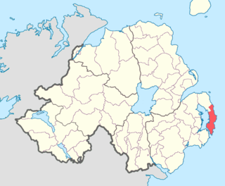
Ards Upper is a barony in County Down, Northern Ireland. It lies on the southern half of the Ards Peninsula in the east of the county, with the Irish Sea to its east and Strangford Lough to its west. It is bordered by two other baronies: Ards Lower to the north; and Lecale Lower just across the mouth of Strangford Lough to the south.

Lecale Lower is a barony in County Down, Northern Ireland. It lies to the east of the county with Strangford Lough to its north and the Irish Sea to its right. It is bordered by five other baronies: Lecale Upper to the south; Ards Upper to the north-east just across the mouth of Strangford Lough; Dufferin to the north; Castlereagh Upper to the north-west; and Kinelarty to the west.

Ardtole is a townland of 431 acres in County Down, Northern Ireland, near Ardglass. It is situated in the civil parish of Ardglass and the historic barony of Lecale Lower. The southern part of Ardtole townland is known as English Ardtole and the northern part is known as Irish Ardtole.
Tullycarnan (Ardglass) is a townland of 154 acres in County Down, Northern Ireland. It is situated in the civil parish of Ardglass and the historic barony of Lecale Lower.
Ardbrin is a townland of 1,007 acres in County Down, Northern Ireland. It is situated in the civil parish of Annaclone and the historic barony of Iveagh Upper, Upper Half.
Balleyboley may refer to:
Ballyboley is a townland of 2,988 acres in County Antrim, Northern Ireland. It is situated in the civil parish of Ballycor and the historic barony of Antrim Upper.

Castlereagh Lower is a historic barony in County Down, Northern Ireland. It was created by 1841 with the division of Castlereagh into two. It is bordered by three other baronies: Ards Lower to the east; Dufferin to the south; and Castlereagh Upper to the west and south-west. Castlereagh Lower is also bounded by Belfast Lough to the north and Strangford Lough to the south-east.
Slanes is a civil parish and townland in County Down, Northern Ireland. It is situated in the historic barony of Ards Upper.


