County Antrim is one of the six counties of Northern Ireland, located within the historic province of Ulster. Adjoined to the north-east shore of Lough Neagh, the county covers an area of 3,086 square kilometres (1,192 sq mi) and has a population of 651,321, as of the 2021 census. County Antrim has a population density of 211 people per square kilometre or 546 people per square mile. It is also one of the thirty-two traditional counties of Ireland.

Newtownards is a town in County Down, Northern Ireland. It lies at the most northern tip of Strangford Lough, 10 miles (16 km) east of Belfast, on the Ards Peninsula. It is in the civil parish of Newtownards and the historic baronies of Ards Lower and Castlereagh Lower. Newtownards is in the Ards and North Down Borough. The population was 29,677 in the 2021 Census.

William James Pirrie, 1st Viscount Pirrie, KP, PC, PC (Ire) was a leading British shipbuilder and businessman. He was chairman of Harland & Wolff, shipbuilders, between 1895 and 1924, and also served as Lord Mayor of Belfast between 1896 and 1898. He was ennobled as Baron Pirrie in 1906, appointed a Knight of the Order of St Patrick in 1908 and made Viscount Pirrie in 1921. In the months leading up to the 1912 Sinking of the Titanic, Lord Pirrie was questioned about the number of life boats aboard the Olympic-class ocean liners. He responded that the great ships were unsinkable and the rafts were to save others. This would haunt him forever. In Belfast he was, on other grounds, already a controversial figure: a Protestant employer associated as a leading Liberal with a policy of Home Rule for Ireland.

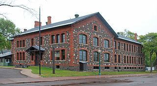
Keweenaw National Historical Park is a unit of the U.S. National Park Service. Established in 1992, the park celebrates the life and history of the Keweenaw Peninsula in the Upper Peninsula of the U.S. state of Michigan. It is a federal-local cooperative park made up of two primary units, the Calumet Unit and the Quincy Unit, and almost two dozen cooperating "Heritage Sites" located on federal, state, and privately owned land in and around the Keweenaw Peninsula. The National Park Service owns approximately 1,700 acres (690 ha) in the Calumet and Quincy Units. Units are located in Baraga, Houghton, Keweenaw, and Ontonagon counties.
Ian Adamson OBE was an Ulster Unionist Party (UUP) politician and paediatrician, who was the Lord Mayor of Belfast from 1996 to 1997, having been Deputy Lord Mayor from 1994 to 1995.

The Clandeboye Estate is a country estate in Bangor, County Down, Northern Ireland, 12 miles (19 km) outside Belfast. Covering 2,000 acres (8.1 km2), it contains woodlands, formal and walled gardens, lawns, a lake, and 250 hectares of farmland. Named after the former Gaelic territory of Clandeboye, the estate was the home of Lindy, Marchioness of Dufferin and Ava, widow of the last Marquess, until her death in October 2020.

Clandeboye or Clannaboy was a kingdom of Gaelic Ireland, comprising what is now south County Antrim, north County Down, and the barony of Loughinsholin. The entity was relatively late in appearance and is associated partly with the Gaelic resurgence of the High Middle Ages. The O'Neill Clandeboy who reigned in the territory descended from Hugh Boy O'Neill, a king of Tyrone. His descendants took advantage of the demise of the Earldom of Ulster during the latter 14th century and seized vast portions of territory. Clandeboye's main seats of power were Shane's Castle and Castle Reagh.

Morwellham Quay is an historic river port in Devon, England that developed to support the local mines. The port had its peak in the Victorian era and is now run as a tourist attraction and museum. It is the terminus of the Tavistock Canal, and has its own copper mine.

Slieve Gallion is a mountain in County Londonderry, Northern Ireland. It is the easternmost of the Sperrin Mountains. It reaches a height of 528 metres (1,732 ft) and dominates the western shore of Lough Neagh. Its prominent northeastern summit has a transmitter station with a small road leading to it, and stands at a height of 496 metres (1,627 ft).

Helen's Tower is a 19th-century folly and lookout tower in Conlig, County Down, Northern Ireland. It was built by 5th Lord Dufferin and Clandeboye and named for his mother, Helen. He intended it as a shrine for poems, first of all a poem by his mother and then others that he solicited from famous poets over the years. Tennyson's Helen's Tower is the best known of them. The tower is an example of Scottish Baronial architecture. Helen's Tower inspired the design of the Ulster Tower, a war memorial at Thiepval, France.

Assisi Animal Sanctuary in Conlig, County Down is Northern Ireland's largest independent animal welfare charity. It shelters up to 200 companion animals at any given time. These have included dogs, puppies, cats, kittens, rabbits and guinea pigs. Several hamsters are permanent residents, and have been included in the center's animal welfare education program.

Scawt Hill is a volcanic plug in County Antrim, Northern Ireland, in the borough of Larne, 5 km from the village of Ballygally.


