Ballynagarrick (fromIrish Baile na gCarraig, meaning 'townland of the rocks') is a townland situated outside Craigavon, County Armagh, Northern Ireland. The literal translation of the name means town (land) of the rocks, and indeed in bygone days two quarries were situated on the small townland.[1]
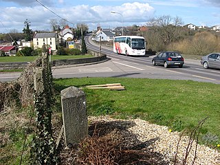
2. Ballynagarrick (Baile na gCarraig) is a small townland in the area of Kilclief (Irish: Cill Cleithe - "Church of the Wattles"), a parish in the area of Lecale, County Armagh. Ballynagarrick is bordered by the townlands of Ballynarry, Ballywooden and Ballyorgan.[2] It largely consists of two major laneways, once part of a larger circuit of laneways across the area which linked into the former British Army barracks at Bishopscourt. Many of these laneways are now abandoned.[3]
Julianstown is a village in County Meath, Ireland. It is located near Drogheda on the R132 regional road. In 1641, the Battle of Julianstown was fought here during the Irish Rebellion of 1641.
Baile Chláir or Baile Chláir na Gaillimhe is a Gaeltacht village about 10 km north of Galway in County Galway, Ireland. Claregalway was founded on the banks of the River Clare, hence the derivation of its name: Baile Chláir na Gaillimhe meaning "town on the Clare, in Galway". Claregalway lies within the Gaeltacht and traditionally most of the locals would have only spoken English as a second language. Until September 2017, the village sat at the junction of the busy N17 and N18 national primary routes with over 27,000 vehicles having formerly passed through the village every day.
Newtownabbey is a large settlement north of Belfast in County Antrim, Northern Ireland. Sometimes considered to be a suburb of Belfast, it is separated from the rest of the city by Cavehill and Fortwilliam golf course. At the 2011 Census, Metropolitan Newtownabbey Settlement had a population of 65,646, making it the third largest settlement in Northern Ireland. It is part of Antrim and Newtownabbey Borough Council.
Carrickmore is a village in County Tyrone, Northern Ireland. It lies in the centre of the county on a raised site colloquially called "Carmen"; between Cookstown, Dungannon and Omagh. It is situated in the historic barony of Omagh East and the civil parish of Termonmaguirk. It had a population of 612 in the 2001 Census. In the 2011 Census 2,330 people lived in the Termon Ward, which covers the Carrickmore and Creggan areas.
Camlough is a small village five kilometres west of Newry in County Armagh, Northern Ireland. The village is named after a lake, known as Cam Lough, in the parish, which is about 90 acres in extent. South of the village is Camlough Mountain which is part of the Ring of Gullion. The Ring of Gullion is a geological formation and area and is officially designated as an Area of Outstanding Natural Beauty, (AONB).
Balscaddan is a village in Fingal, Ireland. It is the most northerly village of Dublin, approx 5 km north of Balbriggan and close to the Meath border.
Annahugh is a small village and townland near Loughgall in County Armagh, Northern Ireland. While most of the settlement is within the townland of Annahugh, part of it extends into the neighbouring townland of Ballyhagan. Hence, the two names are sometimes used to refer to the same settlement. It is situated within the Armagh City and District Council area. It had a population of 275 people in the 2011 Census.
Carrickaness is a small village and townland in County Armagh, Northern Ireland. In the 2001 Census it had a population of 99 people. It is within the Armagh City and District Council area.
Naul, is a village at the northern edge of Fingal and the traditional County Dublin, Ireland. At the northern side of the village, the Delvin River marks the boundary with County Meath.
Ailladie, is an 800 metres (2,600 ft) long west-facing limestone sea-cliff, that varies in height from 8 metres (26 ft) metres to 35 metres (115 ft) metres, situated on the coast of The Burren in County Clare, Ireland. Ailladie is one of Ireland's most highly regarded rock-climbing locations, and particularly for high technical grade climbs and deep-water soloing. It is also a location for shore-angling competitions, and, with its cliffs and view of the Aran Islands, a popular photography stop for tourists.
Newtowncashel is a village located near Lough Ree in County Longford, Ireland. It is within the townland of Cornadowagh. Newtowncashel won the Irish Tidy Towns Competition in 1980.
Ballynacally is a village and townland situated 16.7 km (10.4 mi) southwest of Ennis, on the R473 coast road to Kilrush in the civil parish of Kilchreest, County Clare, Ireland. It lies near the bank of the River Shannon.
Ballyedmond is a small village and townland in County Wexford in Ireland. It is situated on the R741 regional road.
Kilsheelan is a village in County Tipperary, Ireland. It is also a civil parish in the barony of Iffa and Offa East. It is one half of the Roman Catholic parish of Kilsheelan & Kilcash in the Roman Catholic Diocese of Waterford and Lismore. It is situated on the north bank of the River Suir, 8.5 km east of Clonmel and 11.8 km west of Carrick-on-Suir. As of 2016, it had a population of 812 people. Kilsheelan has won Tidy Towns twice in 1975 and 1979. Its GAA club is Kilsheelan-Kilcash.
Ballinora or Ballynora is a small rural parish and townland near Cork city and Ballincollig in County Cork, Ireland. The townland is home to several education facilities and sporting clubs, and includes the village of Waterfall.
Stonetown is a small rural community spanning the townlands of Stonetown Upper and Stonetown Lower in County Louth. It lies in the parish of Louth, 10 kilometres from Dundalk, County Louth, and 11 kilometres from Carrickmacross, County Monaghan. The community consists of a small chapel, a primary school, a football field and a community centre.
Bangor is a civil and ecclesiastical parish in County Down, Northern Ireland. It is located in the north of the Ards Peninsula, consisting of 30 townlands, twenty-two and a half of which lie in the barony of Ards Lower, with seven and a half lying within that of Castlereagh Lower. Its ancient monastery was of ecclesiastical importance.
Ballynagaul is a townland within the Irish-speaking Gaeltacht na nDéise part of County Waterford. It is located approximately 9.6 kilometres from Dungarvan.
Carrickbrack is a townland of 213 acres in County Armagh, Northern Ireland. It is situated in the civil parish of Ballymore and the historic barony of Orior Lower.
Ballynaleck is a townland of 332 acres (134 ha) in County Armagh, Northern Ireland. It is situated in the civil parish of Ballymore and the historic barony of Orior Lower.
This page is based on this Wikipedia article Text is available under the CC BY-SA 4.0 license; additional terms may apply. Images, videos and audio are available under their respective licenses.