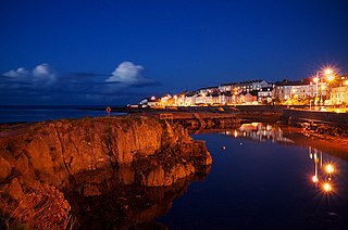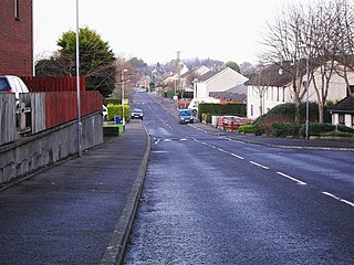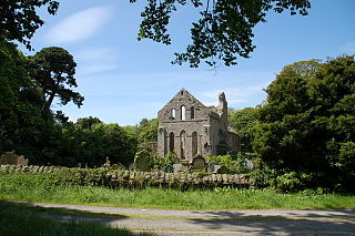
Omagh is the county town of County Tyrone, Northern Ireland. It is situated where the rivers Drumragh and Camowen meet to form the Strule. Northern Ireland's capital city, Belfast, is 68 miles (109.5 km) to the east of Omagh, and Derry is 34 miles (55 km) to the north.

Dungiven is a small town, townland and civil parish in County Londonderry, Northern Ireland. It is near the main A6 Belfast to Derry road, which bypasses the town. It lies where the rivers Roe, Owenreagh and Owenbeg meet at the foot of the 1,525 ft (465 m) Benbradagh. Nearby is the Glenshane Pass, where the road rises to over 1,000 ft (300 m). It had a population of 3,346 people in the 2021 Census. It is within Causeway Coast and Glens district council area.

Bangor is a city and seaside resort in County Down, Northern Ireland, on the southern side of Belfast Lough. It is within the Belfast metropolitan area and is 13 miles (22 km) east of Belfast city centre, to which it is linked by the A2 road and the Belfast–Bangor railway line. The population was 64,596 at the 2021 census. Bangor was granted city status in 2022, becoming Northern Ireland's sixth city.

Warrenpoint is a small port town and civil parish in County Down, Northern Ireland. It sits at the head of Carlingford Lough, south of Newry, and is separated from the Republic of Ireland by a narrow strait. The town is beside the village of Rostrevor and is overlooked by the Mournes and Cooley Mountains. Warrenpoint sprang up within the townland of Ringmackilroy, and is locally nicknamed "The Point", which also represents the town's full name in Irish, An Pointe".

Kilkeel is a small town, civil parish and townland in County Down, Northern Ireland. It is the southernmost town in Northern Ireland. It lies within the historic barony of Mourne. Kilkeel town is the main fishing port on the Down coast, and its harbour is home to the largest fishing fleet in Northern Ireland. It had a population of 6,633 people at the 2021 census. The town contains the ruins of a 14th-century church and fort, winding streets and terraced shops. It lies just south of the Mourne Mountains.

Carrick-on-Shannon is the county town of County Leitrim in Ireland. It is the largest town in the county. A smaller part of the town located on the west bank of the River Shannon lies in County Roscommon and is home to the town's main train station. As of the 2022 census, the population of the town was 4,743. It is situated on a strategic crossing point of the River Shannon. The main part of the town, the County Leitrim part, is in the civil parish of Kiltoghert, which is in the barony of Leitrim, while Cortober, which is the County Roscommon side of the town, is in the civil parish of Killukin, in the barony of Boyle.

Carryduff is a small town and townland in County Down, Northern Ireland, about 10 kilometres (6.2 mi) south of Belfast city centre. It had a population of 7,173 people in the 2021 census. Most of the settlement lies within the townland of Carryduff, although part of it extends into the neighbouring townlands of Killynure and Mealough.
Cabra is an inner suburb on the northside of Dublin city in Ireland. It is approximately 2 kilometres (1.2 mi) northwest of the city centre, in the administrative area of Dublin City Council. It was commonly known as Cabragh until the early 20th century. Largely located between the Royal Canal and the Phoenix Park, it is primarily a residential suburb, with a range of institutions and some light industry. Cabra is served by bus, tram and mainline rail; it lies across Navan Road, one of the main roads from central Dublin to the orbital motorway.

Newtownabbey is a large settlement north of Belfast city centre in County Antrim, Northern Ireland. It is separated from the rest of the city by Cavehill and Fortwilliam golf course, but it still forms part of the Belfast metropolitan area. It surrounds Carnmoney Hill, and was formed from the merging of several small villages including Whiteabbey, Glengormley and Carnmoney. At the 2021 census, Metropolitan Newtownabbey Settlement had a population of 67,599, making it the third largest settlement in Northern Ireland and seventh on the Island of Ireland. It is part of Antrim and Newtownabbey Borough Council.

Fintona, is a village and townland in County Tyrone, Northern Ireland. Its population at the 2011 Census was 1,164.

Hilltown is a small village within the townland of Carcullion in County Down, Northern Ireland. Hilltown is the main village of the parish of Clonduff which contains the village and the rural areas around it at one end, and the rural enclave of Cabra at the other end of the parish. It had a population of 899 people in the 2001 census. On 27 March 2011, the usually resident population of Hilltown was 1,709.

Dundonald is a large settlement and civil parish in County Down, Northern Ireland, United Kingdom. It lies east of Belfast and is often considered a suburb of the city. It is home to the Ulster Hospital, Dundonald International Ice Bowl, Dundonald Omnipark, has a Park and Ride facility for the Glider, access to the Comber Greenway and several housing developments. John de Courcey established a keep including a motte-and-bailey in the 12th century. This is known as Moat Park and can be accessed from Church Green, Comber Road and the Upper Newtownards Road.

Carrickmore is a small town in County Tyrone, Northern Ireland. It is situated in the historic barony of Omagh East, the civil parish of Termonmaguirk and the Roman Catholic Parish of Termonmaguirc between Cookstown, Dungannon and Omagh. It had a population of 612 in the 2001 Census. In the 2011 Census 2,330 people lived in the Termon Ward, which covers the Carrickmore and Creggan areas.

Artigarvan is a village and townland in County Tyrone, Northern Ireland.

Greyabbey or Grey Abbey is a small village, townland and civil parish located on the eastern shores of Strangford Lough, on the Ards Peninsula in County Down, Northern Ireland.
Killough is a village and townland in County Down, Northern Ireland. It lies on the Irish Sea shore near Ardglass, five miles southeast of Downpatrick. It is a conservation area notable for its sycamore-lined main street. In the 2001 Census it had a population of 845 people.

Clonduff GAC is a Gaelic Athletic Association club, based in Hilltown County Down, Northern Ireland. It represents the 2 areas that make up the Clonduff parish, namely Hilltown and Cabra.
Mac Maoláin Gaelic-Irish surname.

Kilcommon is a civil parish in Erris, north County Mayo, consisting of two large peninsulas; Dún Chaocháin and Dún Chiortáin. It consists of 37 townlands, some of which are so remote that they have no inhabitants. Habitation is concentrated mainly along both sides of Sruwaddacon Bay which flows into Broadhaven Bay, in villages including Glengad, Pollathomas, Rossport, Inver and Carrowteige, and in the Glenamoy area further inland.
Braniel or The Braniel is a large housing estate and townland in southeast Belfast, Northern Ireland. It is in the barony of Castlereagh Upper and parish of Knockbreda in County Down. Two small developments, Roddens and Glenview, are located in the area, and are often referred to the Braniel. It is a predominantly unionist area.


