The Sea of Okhotsk is a marginal sea of the western Pacific Ocean. It is located between Russia's Kamchatka Peninsula on the east, the Kuril Islands on the southeast, Japan's island of Hokkaido on the south, the island of Sakhalin along the west, and a stretch of eastern Siberian coast along the west and north. Its northeast corner is the Shelikhov Gulf. The sea is named for the port of Okhotsk, itself named for the Okhota River.

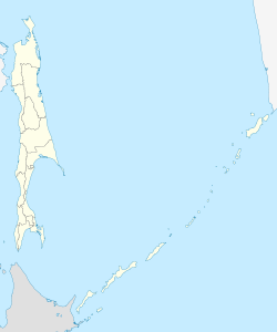
Sakhalin is an island in Northeast Asia. Its north coast lies 6.5 km (4.0 mi) off the southeastern coast of Khabarovsk Krai in Russia, while its southern tip lies 40 kilometres (25 mi) north of the Japanese island of Hokkaido. An island of the West Pacific, Sakhalin divides the Sea of Okhotsk to its east from the Sea of Japan to its southwest. It is administered as part of Sakhalin Oblast and is the largest island of Russia, with an area of 72,492 square kilometres (27,989 sq mi). The island has a population of roughly 500,000, the majority of whom are Russians. The indigenous peoples of the island are the Ainu, Oroks, and Nivkhs, who are now present in very small numbers.
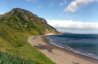
The Kuril Islands or Kurile Islands are a volcanic archipelago administered as part of Sakhalin Oblast in the Russian Far East. The islands stretch approximately 1,300 km (810 mi) northeast from Hokkaido in Japan to Kamchatka Peninsula in Russia, separating the Sea of Okhotsk from the north Pacific Ocean. There are 56 islands and many minor islets. The Kuril Islands consist of the Greater Kuril Chain and, at the southwest end, the parallel Lesser Kuril Chain. They cover an area of around 10,503.2 square kilometres (4,055.3 sq mi), with a population of roughly 20,000.

Okha is a town and the administrative center of Okhinsky District of Sakhalin Oblast, Russia. Population: 23,008 (2010 Census); 27,963 (2002 Census); 36,104 (1989 Soviet census).

Yuzhno-Sakhalinsk is a city and the administrative center of Sakhalin Oblast, Russia. It is located on Sakhalin Island in the Russian Far East, north of Japan. Gas and oil extraction as well as processing are amongst the main industries on the island. It was called Vladimirovka (Влади́мировка) from 1882 to 1905, then Toyohara during its period of Imperial Japanese control from 1905 to 1946. As of the 2010 Census, its population was 181,728.

Severo-Kurilsk is a town and the administrative center of Severo-Kurilsky District of Sakhalin Oblast, Russia, located in the northern part of the Kuril Islands, on the island of Paramushir. Population: 2,536 (2010 Census); 2,592 (2002 Census); 5,180 (1989 Soviet census).

The Nivkh, or Gilyak, are an Indigenous ethnic group inhabiting the northern half of Sakhalin Island and the lower Amur River and coast on the adjacent Russian mainland. Historically, they may have inhabited parts of Manchuria.

Kholmsk, known until 1946 as Maoka, is a port town and the administrative center of Kholmsky District of Sakhalin Oblast, Russia. It is located on the southwest coast of the Sakhalin Island, on coast of the gulf of Nevelsky in the Strait of Tartary of the Sea of Japan, 83 kilometers (52 mi) west of Yuzhno-Sakhalinsk. Population: 30,937 (2010 Census); 35,141 (2002 Census); 51,381 (1989 Soviet census).

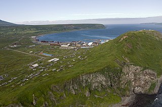
Yuzhno-Kurilsky District is an administrative district (raion) of Sakhalin Oblast, Russia; one of the seventeen in the oblast. Municipally, it is incorporated as Yuzhno-Kurilsky Urban Okrug. It is located on the southern Kuril Islands southeast of the Island of Sakhalin, comprising the islands of Kunashir, Shikotan, and the Habomai. The area of the district is 1,856.1 square kilometers (716.6 sq mi). Its administrative center is the urban locality of Yuzhno-Kurilsk, located on Kunashir Island. Population: 9,501 (2010 Census); 9,727 (2002 Census); 13,597 (1989 Soviet census). The population of Yuzhno-Kurilsk accounts for 61.4% of the district's total population.
Shakhtyorsk is a town in Uglegorsky District of Sakhalin Oblast, Russia, located on the western coast of the Sakhalin Island, 376 kilometers (234 mi) northwest of Yuzhno-Sakhalinsk, the administrative center of the oblast. Population: 8,382 (2010 Census); 10,643 (2002 Census); 12,945 (1989 Soviet census).

Nevelsk is a port town and the administrative center of Nevelsky District of Sakhalin Oblast, Russia, located on the southwest coast of the Sakhalin Island, 123 kilometers (76 mi) from Yuzhno-Sakhalinsk, the administrative center of the oblast. Population: 11,682 (2010 Census); 18,639 (2002 Census); 24,236 (1989 Soviet census).

Uglegorsk is a coastal port town and the administrative center of Uglegorsky District in Sakhalin Oblast, Russia, located on the west coast of Sakhalin Island, 277 kilometers (172 mi) northwest of Yuzhno-Sakhalinsk, the administrative center of the oblast. Population: 10,381 (2010 Census); 13,396 (2002 Census); 18,402 (1989 Soviet census).

Aniva is a coastal town and the administrative center of Anivsky District of Sakhalin Oblast, Russia, located on the coast of Aniva Bay in southern Sakhalin Island on the Lyutoga River, 37 kilometers (23 mi) south of Yuzhno-Sakhalinsk. Population: 9,115 (2010 Census); 8,084 (2002 Census); 8,905 (1989 Soviet census).
Makarov is a coastal town and the administrative center of Makarovsky District of Sakhalin Oblast, Russia, located on the eastern coast of the Sakhalin Island, 235 kilometers (146 mi) north of Yuzhno-Sakhalinsk. Population: 6,705 (2010 Census); 7,271 (2002 Census); 11,351 (1989 Soviet census).
Sakhalin Koreans are Russian citizens and residents of Korean descent living on Sakhalin Island, who can trace their roots to the immigrants from the Gyeongsang and Jeolla provinces of Korea during the late 1930s and early 1940s, the latter half of the Japanese ruling era.
The 1952 Severo-Kurilsk earthquake struck off the coast of the Kamchatka Peninsula. The 9.0 Mw earthquake occurred on 5 November 1952 at 04:58 local time, triggering a major tsunami that hit Severo-Kurilsk, Kuril Islands, Sakhalin Oblast, Russian SFSR, USSR. This led to the destruction of many settlements in Sakhalin Oblast and Kamchatka Oblast, while the main impact struck the town of Severo-Kurilsk. It was the most powerful earthquake ever recorded in Russia, and the fifth most powerful earthquake ever recorded in the world since modern seismography began in 1900.

Nogliki is an urban locality and the administrative center of Nogliksky District of Sakhalin Oblast, Russia, located near the eastern coast of Sakhalin Island, about 6 kilometers (3.7 mi) inland from the Sea of Okhotsk shoreline and about 600 kilometers (370 mi) north of Yuzhno-Sakhalinsk. Population: 10,231 (2010 Census); 10,729 (2002 Census); 11,546 (1989 Soviet census).

The 1995 Neftegorsk earthquake occurred on 28 May at in northern Sakhalin Island in the Russian Far East. It was the most destructive earthquake known within the modern borders of Russia, with a magnitude of 7.1 and maximum Mercalli intensity of IX (Violent) that devastated the town of Neftegorsk. Many buildings collapsed, and 1,989 of its 3,977 citizens were killed, with another 750 injured. Infrastructure was catastrophically damaged, leading to Neftegorsk becoming a ghost town. Surface effects from the earthquake were widespread, with many geological features changing or developing. Due to its location along a poorly understood plate boundary, the earthquake received considerable attention from scientists, and dozens of research papers have been written about it.

Tymovskoye is an urban locality and the administrative center of Tymovsky District of Sakhalin Oblast, Russia, located in the central part of the Sakhalin Island on the right bank of the Tym River, about 450 kilometers (280 mi) north of Yuzhno-Sakhalinsk. Population: 7,855 (2010 Census); 8,532 (2002 Census); 10,869 (1989 Soviet census).
Sakhalin Ainu is an extinct Ainu language, or perhaps several Ainu languages, that was or were spoken on the island of Sakhalin, now part of Russia.