Spafaryev Islands

Last updated
Spafaryev Islands
Остров Спарафьева
Island group

Spafariev1w.png

Spafaryev and Talan Islands
Okhotsk-Japan5SPF.png
Location of the Spafaryev Islands in the Sea of Okhotsk.
Country Russian Federation
Federal subject Far Eastern Federal District
Oblast Magadan Oblast

The Spafaryev Islands, or Spafaryev Island (Остров Спарафьева; Ostrov Spafar’yeva), a relatively large double island, are located in the Sea of Okhotsk. It was formerly known as Korovi Island. [1] It lies 7 km east of the Antamlan Peninsula (also known as Khmitevsky), the southernmost peninsula enclosing the Taui Bay (Тауйская губа; Tauyskaya Guba) from its western side.

Island Any piece of sub-continental land that is surrounded by water

An island or isle is any piece of sub-continental land that is surrounded by water. Very small islands such as emergent land features on atolls can be called islets, skerries, cays or keys. An island in a river or a lake island may be called an eyot or ait, and a small island off the coast may be called a holm. A grouping of geographically or geologically related islands is called an archipelago, such as the Philippines.

Sea of Okhotsk A marginal sea of the western Pacific Ocean, between the Kamchatka Peninsula, the Kuril Islands, the island of Hokkaido, the island of Sakhalin, and eastern Siberian coast

The Sea of Okhotsk is a marginal sea of the western Pacific Ocean, between the Kamchatka Peninsula on the east, the Kuril Islands on the southeast, the island of Hokkaido to the south, the island of Sakhalin along the west, and a long stretch of eastern Siberian coast along the west and north. The northeast corner is the Shelikhov Gulf. The sea is named after Okhotsk, the first Russian settlement in the Far East.

Taui Bay Bay in Far Eastern Federal District, Russian Federation

Taui Bay is a body of water in the Sea of Okhotsk off the coast of the Magadan Oblast in Russia. The bay opens to the south.

Contents

Administratively these islands belong to the Magadan Oblast of the Russian Federation.

Magadan Oblast First-level administrative division of Russia

Magadan Oblast is a federal subject of Russia. It is geographically located in the Far East region of the country, and is administratively part of the Far Eastern Federal District. Magadan Oblast has a population of 156,996, making it the least populated oblast and the third-least populated federal subject in Russia.

Etymology

The Spafaryev Islands were named after Major General knight Leontiy Spafaryev (1765–1847) of the Imperial Russian Navy. Spafaryev was Director of the Russian Lighthouse Administration and cartographer of the Russian Admiralty. [2]

Leontiy Spafaryev Russian admiral

Knight Leontiy Vassilievich Spafaryev was a Lieutenant General of the Imperial Russian Navy. Spafaryev was Director of Lighthouses in the Gulf of Finland and cartographer of the Russian Admiralty.

Imperial Russian Navy navy of the Russian Empire

The Imperial Russian Navy was the navy of the Russian Empire. It was formally established in 1696 and lasted until being dissolved during the February Revolution of 1917. It developed from a smaller force that had existed prior to Czar Peter the Great's founding the regular Russian Navy during the Second Azov campaign. It was expanded in the second half of the 18th century and by the early part of the 19th century, it reached its peak strength, behind only the British and French fleets in terms of size.

History

The islands were frequented by American and French whaleships hunting bowhead and gray whales between 1849 and 1885. [3] [4] [5] [6] Talan was called Green Island, while Spafaryev was called Fog Island. [7] Boats were sent ashore to shoot seabirds [8] and collect eggs [9] and berries [10] as well as to search for whales. [11]

United States federal republic in North America

The United States of America (USA), commonly known as the United States or America, is a country composed of 50 states, a federal district, five major self-governing territories, and various possessions. At 3.8 million square miles, the United States is the world's third or fourth largest country by total area and is slightly smaller than the entire continent of Europe's 3.9 million square miles. With a population of over 327 million people, the U.S. is the third most populous country. The capital is Washington, D.C., and the largest city by population is New York City. Forty-eight states and the capital's federal district are contiguous in North America between Canada and Mexico. The State of Alaska is in the northwest corner of North America, bordered by Canada to the east and across the Bering Strait from Russia to the west. The State of Hawaii is an archipelago in the mid-Pacific Ocean. The U.S. territories are scattered about the Pacific Ocean and the Caribbean Sea, stretching across nine official time zones. The extremely diverse geography, climate, and wildlife of the United States make it one of the world's 17 megadiverse countries.

France Republic with mainland in Europe and numerous oversea territories

France, officially the French Republic, is a country whose territory consists of metropolitan France in Western Europe and several overseas regions and territories. The metropolitan area of France extends from the Mediterranean Sea to the English Channel and the North Sea, and from the Rhine to the Atlantic Ocean. It is bordered by Belgium, Luxembourg and Germany to the northeast, Switzerland and Italy to the east, and Andorra and Spain to the south. The overseas territories include French Guiana in South America and several islands in the Atlantic, Pacific and Indian oceans. The country's 18 integral regions span a combined area of 643,801 square kilometres (248,573 sq mi) and a total population of 67.3 million. France, a sovereign state, is a unitary semi-presidential republic with its capital in Paris, the country's largest city and main cultural and commercial centre. Other major urban areas include Lyon, Marseille, Toulouse, Bordeaux, Lille and Nice.

Whaler specialized ship designed for whaling

A whaler or whaling ship is a specialized ship, designed, or adapted, for whaling: the catching or processing of whales. The former includes the whale catcher – a steam or diesel-driven vessel with a harpoon gun mounted at its bow. The latter includes such vessels as the sail or steam-driven whaleship of the 16th to early 20th centuries and the floating factory or factory ship of the modern era. There have also been vessels which combined the two activities, such as the bottlenose whalers of the late 19th and early 20th century, and catcher/factory ships of the modern era.

Geography

The Spafaryev Islands are composed of two islands joined by a narrow landspit, less than 750 m wide.

Seabird birds that have adapted to life within the marine environment

Seabirds are birds that are adapted to life within the marine environment. While seabirds vary greatly in lifestyle, behaviour and physiology, they often exhibit striking convergent evolution, as the same environmental problems and feeding niches have resulted in similar adaptations. The first seabirds evolved in the Cretaceous period, and modern seabird families emerged in the Paleogene.

Crested auklet species of bird

The crested auklet is a small seabird of the family Alcidae, distributed throughout the northern Pacific and the Bering Sea. The species feeds by diving in deep waters, eating krill and a variety of small marine animals. It nests in dense colonies of up to 1 million individuals in the Bering Sea and the Sea of Okhotsk. It often breeds in mixed-species colonies with the least auklet, a smaller congener.

Tufted puffin species of bird

The tufted puffin, also known as crested puffin, is a relatively abundant medium-sized pelagic seabird in the auk family (Alcidae) found throughout the North Pacific Ocean. It is one of three species of puffin that make up the genus Fratercula and is easily recognizable by its thick red bill and yellow tufts.

Related Research Articles

Sea of Japan Marginal sea between Japan, Russia and Korea

The Sea of Japan is the marginal sea between the Japanese archipelago, Sakhalin, the Korean Peninsula and Russia. The Japanese archipelago separates the sea from the Pacific Ocean. It is bordered by Japan, Korea and Russia. Like the Mediterranean Sea, it has almost no tides due to its nearly complete enclosure from the Pacific Ocean. This isolation also reflects in the fauna species and in the water salinity, which is lower than in the ocean. The sea has no large islands, bays or capes. Its water balance is mostly determined by the inflow and outflow through the straits connecting it to the neighboring seas and Pacific Ocean. Few rivers discharge into the sea and their total contribution to the water exchange is within 1%.

Shelikhov Gulf bay

Shelikhov Gulf is a large gulf off the northwestern coast of Kamchatka, Russia. It is located in the northeastern corner of the Sea of Okhotsk and it branches into two main arms, Gizhigin Bay to the west and Penzhina Bay to the east. Its southwest corner is formed by the P'yagin Peninsula, Yam Gulf and the Yamsky Islands.

Penzhina Bay bay

Penzhina Bay is a long and narrow bay off the northwestern coast of Kamchatka, Russia.

Shantar Islands Island group in Far Eastern Federal District, Russian Federation

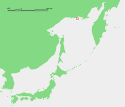
The Shantar Islands are a group of fifteen islands located off the northwestern shore of the Sea of Okhotsk east of Uda Gulf and north of Academy Bay. Most of the islands have rugged cliffs, but they are of moderate height; the highest point in the island group is 720 metres.

Bolshoy Shantar Island island

Bolshoy Shantar is an island in the Sea of Okhotsk, Russia. It is the main island of the Shantar Islands. Its area is 1766 km². It is about 72 km (44.7 mi) in length and 49 km (30.4 mi) in width. It has a large brackish lake on its north side which is connected to the sea through a narrow passage. Yakshin Bay indents the southwest side of the island.

Feklistova Island Island in Far Eastern Federal District, Russian Federation

Feklistova or Feklistov Island is one of the Shantar Islands in Sea of Okhotsk. With an area of 372 km², it is the second largest in the archipelago.

Zavyalov Island island in Russia

Zavyalov Island, formerly Ola Island, is a relatively large island in the Sea of Okhotsk, northwestern Pacific. It is located on the eastern side of Taui Bay, 20 km west of Cape Taran, Koni Peninsula, about 50 km south of the city of Magadan.

Iony Island Island in Khabarovsk Krai, Russian Federation

Iony Island, or Jonas' Island, formerly Ostrov Svyatogo Iony, is a small island in the Sea of Okhotsk.

Trety Island Island in Kamchatka Krai, Russian Federation

Trety Island or Treti Island is a relatively large island in the western shores of the Shelikhov Bay, at the northern end of the Sea of Okhotsk. It is located 4 km to the south of a peninsula that encloses a small bay in an area that is largely uninhabited.

Nedorazumeniya Island island in Russia

Nedorazumeniya Island is an island on the north coast of the Sea of Okhotsk. It lies on the north side of Taui Bay, between Amakhton Bay to the west and Nagaev Bay to the east. It is about 20 kilometres (12 mi) west of the city of Magadan.

Yam Islands Island group in Far Eastern Federal District, Russian Federation

The Yam Islands, Yamsky Islands or Yamskiye Islands, is a small island group located close to the coast in the northern Sea of Okhotsk. Administratively the Yam Islands belong to the Magadan Oblast of the Russian Federation.

Maly Shantar Island Island in Far Eastern Federal District, Russian Federation

Maly Shantar Island is a small, narrow island in the northwestern Sea of Okhotsk, one of the Shantar Islands.

Medvezhy Island Island in Far Eastern Federal District, Russian Federation

Medvezhy Island is a long, narrow island in the northwestern Sea of Okhotsk, the westernmost of the Shantar Islands. It lies on the eastern side of Uda Gulf. It is 12.9 km long. It is separated from the mainland by Shevchenko Straight.

Kusova Island in Far Eastern Federal District, Russian Federation

Kusova or Kusov Island is a small island in the Shantar Islands in the Sea of Okhotsk. It lies southeast of Bolshoy Shantar Island.

Menshikov Island Island in Far Eastern Federal District, Russian Federation

Menshikov Island is an island in the Sea of Okhotsk located east of the Shantar Islands.

Prokofyeva Island

Prokofyeva is a small island in the Sea of Okhotsk. It is one of the Shantar Islands. It lies to the northeast of Bolshoy Shantar Island.

Ptichy Island (Shantar Islands)

Ptichy Island is a small island in the Sea of Okhotsk.

Sakharnaya Golova Island

Sakharnaya Golova is a small island in the northwestern Sea of Okhotsk. It is part of the Shantar Islands National Park.

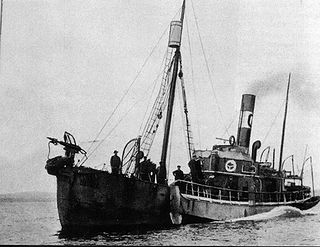
Commercial open-boat whaling by American and European ships occurred in the Sea of Okhotsk from the 1830s to the early 1900s. They primarily caught right and bowhead whales. Both populations of these species declined drastically, with the latter once thought to be extinct by western historians. Peak catches were made in the 1840s and 1850s. It's estimated that as many as 15,200 bowheads and 2,400 rights were taken in the sea.

References

  1. United States. (1918). Asiatic Pilot, Volume 1: East coast of Siberia, Sakhalin Island and Chosen. Washington: Hydrographic Office.
  2. L. Spafarieff or Spafaryev Archived 2007-11-26 at the Wayback Machine .
  3. India, of New Bedford, July 13, July 29-September 17, 1849, June 27-August 27, 1850, Old Dartmouth Historical Society (ODHS).
  4. Betsey Williams, of Stonington, August 13, August 20-21, 1853, Nicholson Whaling Collection (NWC).
  5. Florida, of Fairhaven, September 8, 1861, in Williams, H. (1964). One whaling family. Boston, Houghton Mifflin.
  6. Mary and Helen II, of San Francisco, September 18-20, 1885, Kendall Whaling Museum.
  7. India, of New Bedford, August 18, August 29, 1849, ODHS.
  8. India, of New Bedford, June 28, 1850, Spafaryev, July 2, 1850, Talan, ODHS.
  9. India, of New Bedford, July 2, 1850, Talan, ODHS.
  10. India, of New Bedford, September 18, 1849, Spafaryev, ODHS.
  11. Daniel Wood, of New Bedford, August 26-27, 1853, Spafaryev, NWC.
  12. Location
  13. Talan Island
  14. Ostrov Talan
  15. Talan location
  16. Kondratyev, A. Y., Litvinenko, N. M., Shibaev, Y. V., Vyatkin, P. S., & Kondratyeva, L. F. (2000). "The breeding seabirds of the Russian Far East". Seabirds of the Russian Far East, 37-81.
  17. Utekhina, I., Potapov, E., & McGrady, M. J. (2000). "Diet of the Steller's sea eagle in the northern Sea of Okhotsk". In First Symposium on Steller’s and White-tailed Sea Eagles in East Asia. Tokyo, Japan: Wild Bird Society of Japan (pp. 71-92).

Coordinates: 59°10′N149°03′E / 59.167°N 149.050°E / 59.167; 149.050

Geographic coordinate system Coordinate system

A geographic coordinate system is a coordinate system that enables every location on Earth to be specified by a set of numbers, letters or symbols. The coordinates are often chosen such that one of the numbers represents a vertical position and two or three of the numbers represent a horizontal position; alternatively, a geographic position may be expressed in a combined three-dimensional Cartesian vector. A common choice of coordinates is latitude, longitude and elevation. To specify a location on a plane requires a map projection.