Telan Island

Last updated
Telan
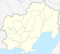
Outline Map of Magadan Oblast.svg
Red pog.svg
Telan
Coordinates: 60°54′4″N159°52′35″E / 60.90111°N 159.87639°E / 60.90111; 159.87639
Country Russian Federation
Federal subject Far Eastern Federal District
Oblast Magadan Oblast
Elevation
505 m (1,657 ft)

Telan Island, also Ostrov Telan, is an island in the Sea of Okhotsk, roughly 1 mile south-southwest of Mys Vnutrenniy. It is described as "a very conspicuous island resembling a castle." [1]
Geography

The island is located at the southern end of the Taygonos Peninsula, which separates the Gizhigin Bay from the Penzhina Bay. It is roughly triangular in shape and has a maximum length of 1.7 km; it is separated from the continental shore by a 0.5 km wide sound.

Administratively Telan Island is part of the Magadan Oblast. [2]

Related Research Articles

<span class="mw-page-title-main">Moskva (river)</span> River in Russia

The Moskva is a river running through western Russia. It rises about 140 km (90 mi) west of Moscow and flows roughly east through the Smolensk and Moscow Oblasts, passing through central Moscow. About 110 km (70 mi) southeast of Moscow, at the city of Kolomna, it flows into the Oka, itself a tributary of the Volga, which ultimately flows into the Caspian Sea.

<span class="mw-page-title-main">Iturup</span> Largest of the Kuril Islands

Iturup, also historically known by other names, is an island in the Kuril Archipelago separating the Sea of Okhotsk from the North Pacific Ocean. The town of Kurilsk, administrative center of Kurilsky District, is located roughly midway along its western shore. Iturup is the largest and northernmost of the southern Kurils, ownership of which is disputed by Japan and Russia. It is located between Kunashiri 19 km (12 mi) to its southwest and Urup 37 km (23 mi) to its northeast. The Vries Strait between Iturup and Urup forms the Miyabe Line dividing the predominant plants of the Kurils.

Ostrov is a town and the administrative center of Ostrovsky District in Pskov Oblast, Russia, located on the Velikaya River, 55 kilometers (34 mi) south of Pskov, the administrative center of the oblast. Population: 21,668 (2010 Census); 25,078 (2002 Census); 29,060 (1989 Census); 27,000 (1974).

<span class="mw-page-title-main">Losiny Ostrov National Park</span> Urban national park in Moscow City and Oblast, Russia

Losiny Ostrov National Park is the second oldest national park of Russia. It is located in Moscow and Moscow Oblast. It is the largest urban park in Europe.

<span class="mw-page-title-main">Bely Island</span> Island in the Kara Sea, Siberia, Russia

Bely Island is a relatively large island in the Kara Sea off the tip of the Yamal Peninsula, Siberia, Russia. Close to the island's northwest tip, there is the Russian Experiment Station Popov Station.

<span class="mw-page-title-main">Hooker Island</span> Central islands of Franz Josef Land

Hooker Island is one of the central islands of Franz Josef Land. It is located in the central area of the archipelago at 80.23°N 53.02°E. It is administered by the Arkhangelsk Oblast, Russia.

<span class="mw-page-title-main">Salm Island</span> Island in Franz Josef Land, Arkhangelsk Oblast, Russia

Salm Island is a roughly round-shaped island in Franz Josef Land, Arkhangelsk Oblast, Russia.

<span class="mw-page-title-main">Greely Island</span> Island in Franz Josef Land, Arkhangelsk Oblast, Russia

Greely Island is an island in Franz Josef Land, Arkhangelsk Oblast, Russia.

<span class="mw-page-title-main">Eva-Liv Island</span> Island in Franz Josef Land, Arkhangelsk Oblast, Russian Arctic

Eva-Liv Island, alternatively transcribed as Yeva-Liv Island, and also known as Eva Island, is the northeasternmost island in Franz Josef Land, Arkhangelsk Oblast, Russian Arctic.

<span class="mw-page-title-main">Kolosovykh Island</span> Island in the Kara Sea

Kolosovykh Island is an island, in the Kara Sea off the coast of Siberia.

Batkachny Island is an island in the Caspian Sea. It is located right off the mouths of the Volga in an area where there are many delta islands.

Trety Island or Treti Island is a relatively large island in the western shores of the Shelikhov Bay, at the northern end of the Sea of Okhotsk. It is located 4 km to the south of a peninsula that encloses a small bay in an area that is largely uninhabited.

<span class="mw-page-title-main">Spafaryev Islands</span> Island group in Far Eastern Federal District, Russian Federation

The Spafaryev Islands, or Spafaryev Island, a relatively large double island, are located in the Sea of Okhotsk. It was formerly known as Korovi Island. It lies 7 km east of the Antamlan Peninsula, the southernmost peninsula enclosing the Taui Bay from its western side.

Ush Island is an island in the northern coast of Sakhalin. Ush Island is located between a shallow bay and the Sea of Okhotsk, at the mouth of the Sakhalin Gulf.

Banka Zotova is an island in the Sea of Okhotsk near the coast of Sakhalin.

<span class="mw-page-title-main">Umara Island</span> Island in Far Eastern Federal District, Russian Federation

Umara Island is an island in the Sea of Okhotsk on the south side of Odyan Bay.

Shelikan, also Ostrovok Shelikan, is a coastal islet in the Sea of Okhotsk near Magadan. It lies on the south side of Amakhton Bay.

Rovnyy Island or Arka Island is an island in Shelikhov Bay, Sea of Okhotsk.

<span class="mw-page-title-main">Ukatny Island</span> Disputed island in Caspian Sea

Ukatnyy or Ukatny is an island in the northern Caspian Sea. It is located off the eastern end of the mouths of the Volga.

<span class="mw-page-title-main">Kuhn Island (Franz Josef Land)</span> Island in Franz Josef Land, Arkhangelsk Oblast, Russia

Kuhn Island is an island in Franz Josef Land, Arkhangelsk Oblast, Russia.

References

  1. Prostar Sailing Directions 2004 East Coast of Russia Enroute. ProStar Publications. 1 January 2004. p. 80. ISBN   978-1-57785-560-6 . Retrieved 17 October 2012.
  2. Ostrov Telan / Magadanskaya Oblast'