Kusova

Last updated
Kusova
Кусова
Island

Shantar1z.png

Map of the Shantar Islands.
Russia Khabarovsk Krai location map.svg
Red pog.svg
Kusova
Coordinates: 54°42′45″N138°12′55″E / 54.71250°N 138.21528°E / 54.71250; 138.21528
Country Russian Federation
Federal subject Far Eastern Federal District
Krai Khabarovsk Krai
Elevation 633 m (2,077 ft)

Kusova or Kusov Island (Russian : остров Кусова; Ostrov Kusova) is a small island in the Shantar Islands in the Sea of Okhotsk. It lies southeast of Bolshoy Shantar Island.

Russian language East Slavic language

Russian is an East Slavic language, which is official in the Russian Federation, Belarus, Kazakhstan and Kyrgyzstan, as well as being widely used throughout Eastern Europe, the Baltic states, the Caucasus and Central Asia. It was the de facto language of the Soviet Union until its dissolution on 25 December 1991. Although nearly three decades have passed since the breakup of the Soviet Union, Russian is used in official capacity or in public life in all the post-Soviet nation-states, as well as in Israel and Mongolia.

Shantar Islands Island group in Far Eastern Federal District, Russian Federation

The Shantar Islands are a group of fifteen islands located off the northwestern shore of the Sea of Okhotsk east of Uda Gulf and north of Academy Bay. Most of the islands have rugged cliffs, but they are of moderate height; the highest point in the island group is 720 metres. The name of the island group has its origins in the Nivkh language from the word ч’андь/č’and’’ meaning "to be white". The islands are currently uninhabited.

Sea of Okhotsk A marginal sea of the western Pacific Ocean, between the Kamchatka Peninsula, the Kuril Islands, the island of Hokkaido, the island of Sakhalin, and eastern Siberian coast

The Sea of Okhotsk is a marginal sea of the western Pacific Ocean, between the Kamchatka Peninsula on the east, the Kuril Islands on the southeast, the island of Hokkaido to the south, the island of Sakhalin along the west, and a long stretch of eastern Siberian coast along the west and north. The northeast corner is the Shelikhov Gulf. The sea is named after Okhotsk, the first Russian settlement in the Far East.

Contents

Geography

The island lies towards the eastern end of the group. It is 4.2 km (2.6 mi) in length, with a maximum width of 2.6 km (1.6 mi). It is quite high, rising abruptly to a height of 633 m (2,076 ft).

Kusova Island is separated from Bolshoy Shantar Island to the northwest by a 14 km (8.7 mi) wide sound.

Bolshoy Shantar Island island

Bolshoy Shantar is an island in the Sea of Okhotsk, Russia. It is the main island of the Shantar Islands. Its area is 1766 km². It is about 72 km (44.7 mi) in length and 49 km (30.4 mi) in width. It has a large brackish lake on its north side which is connected to the sea through a narrow passage. Yakshin Bay indents the southwest side of the island.

History

Kusova was frequented by American whaleships targeting bowhead whales between 1853 and 1867. [1] They simply called it Round Island. They would anchor off the island and send men ashore to obtain wood. [2]

United States Federal republic in North America

The United States of America (USA), commonly known as the United States or America, is a country composed of 50 states, a federal district, five major self-governing territories, and various possessions. At 3.8 million square miles, the United States is the world's third or fourth largest country by total area and is slightly smaller than the entire continent of Europe's 3.9 million square miles. With a population of over 327 million people, the U.S. is the third most populous country. The capital is Washington, D.C., and the largest city by population is New York City. Forty-eight states and the capital's federal district are contiguous in North America between Canada and Mexico. The State of Alaska is in the northwest corner of North America, bordered by Canada to the east and across the Bering Strait from Russia to the west. The State of Hawaii is an archipelago in the mid-Pacific Ocean. The U.S. territories are scattered about the Pacific Ocean and the Caribbean Sea, stretching across nine official time zones. The extremely diverse geography, climate, and wildlife of the United States make it one of the world's 17 megadiverse countries.

Bowhead whale Species of mammal

The bowhead whale is a species of the family Balaenidae, in parvorder Mysticeti, and genus Balaena, which once included the right whale.

Related Research Articles

Sakhalin Gulf is a gulf in the Sea of Okhotsk between continental Russia and the northern tip of Sakhalin Island. The width of the gulf reaches up to 160 km. It is covered with ice from mid-November until late April, but north winds can leave the bay blocked with ice until July.

Feklistova Island Island in Far Eastern Federal District, Russian Federation

Feklistova or Feklistov Island is one of the Shantar Islands in Sea of Okhotsk. With an area of 372 km², it is the second largest in the archipelago.

Zavyalov Island island in Russia

Zavyalov Island, formerly Ola Island, is a relatively large island in the Sea of Okhotsk, northwestern Pacific. It is located on the eastern side of Taui Bay, 20 km west of Cape Taran, Koni Peninsula, about 50 km south of the city of Magadan.

Iony Island Island in Khabarovsk Krai, Russian Federation

Iony Island, or Jonas' Island, formerly Ostrov Svyatogo Iony, is a small island in the Sea of Okhotsk.

Taui Bay Bay in Far Eastern Federal District, Russian Federation

Taui Bay is a body of water in the Sea of Okhotsk off the coast of the Magadan Oblast in Russia. The bay opens to the south.

Tugur Bay

Tugur Bay or Tugursky Bay is a large bay in the Tuguro-Chumikansky District of Khabarovsk Krai, Russian Federation.

Maly Shantar Island Island in Far Eastern Federal District, Russian Federation

Maly Shantar Island is a small, narrow island in the northwestern Sea of Okhotsk, one of the Shantar Islands.

Belichy Island Island in Far Eastern Federal District, Russian Federation

Belichy Island is a narrow island in the northwestern Sea of Okhotsk, one of the Shantar Islands.

Medvezhy Island Island in Far Eastern Federal District, Russian Federation

Medvezhy Island is a long, narrow island in the northwestern Sea of Okhotsk, the westernmost of the Shantar Islands. It lies on the eastern side of Uda Gulf. It is 12.9 km long. It is separated from the mainland by Shevchenko Straight.

Prokofyeva Island

Prokofyeva is a small island in the Sea of Okhotsk. It is one of the Shantar Islands. It lies to the northeast of Bolshoy Shantar Island.

Lindholm Strait is a strait in the northwestern Sea of Okhotsk. It separates Malyy Shantar and Belichiy Islands to the north from the Tugur Peninsula to the south. At its narrowest it is only 3.2 km wide. Tides are semidiurnal. Springs rise 4.9 m, while neaps rise 3.6 m. The flood current sets west, while the stronger ebb current flows in the opposite direction. The former creates large eddies and whirlpools. Tidal currents vary from 3.5 to 6 knots.

Ptichy Island (Shantar Islands)

Ptichy Island is a small island in the Sea of Okhotsk.

Sakharnaya Golova Island

Sakharnaya Golova is a small island in the northwestern Sea of Okhotsk. It is part of the Shantar Islands National Park.

Academy Bay (Sea of Okhotsk)

Academy Bay is a large bay in the Tuguro-Chumikansky District of Khabarovsk Krai, Russian Federation.

Lebyazhya Bay is a small bay that indents the south side of Feklistova Island, one of the Shantar Islands, in the western Sea of Okhotsk. Its entrance is 11.3 kilometers (7.0 mi) wide and it is 5.6 kilometers (3.5 mi) deep. There are three small bays at its head: Enegelma Road to the west, Soboleva to the north, and Rosseta to the east. A small island, Sukhotina, lies to its southeast. In the spring and summer it is host to a small nesting colony of thick-billed murre. A number of streams of fresh water flow down the hills into the bay. Spring tides rise 6.5 meters (21 ft) while neaps rise 2.4 meters.

Abrek Bay is a small bay on the southeast coast of Maly Shantar Island, one of the Shantar Islands, in the western Sea of Okhotsk. It is 2.4 km (1.5 mi) wide at its entrance and about 1.6 km (1 mi) deep. Spring tides rise about 4.5 m (15 ft) and neaps about 2.7 m (9 ft).

Yakshin Bay is a small bight in the western Sea of Okhotsk. It is 29 km wide and indents the southwest side of Bolshoy Shantar Island. The bay is entered between Capes Raduzhnyy to the west and Filippa to the east. The Yakshin River flows into the head of the bay. There is ice in the bay from December to July. Tides rise 4.9 m at springs, with the flood current flowing in a counterclockwise direction round the bay and the ebb in the reverse direction. These tidal currents may reach 3.5 to 4 knots near the entrance of the bay but are less than 2 knots at its head.

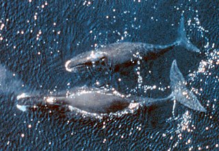
Commercial open-boat whaling by American and European ships occurred in the Sea of Okhotsk from the 1830s to the early 1900s. They primarily caught right and bowhead whales. Both populations of these species declined drastically, with the latter once thought to be extinct by western historians. Peak catches were made in the 1840s and 1850s. It's estimated that as many as 15,200 bowheads and 2,400 rights were taken in the sea.

References

  1. Harrison, of New Bedford, September 12, 1853, Nicholson Whaling Collection (NWC); Lexington, of Nantucket, July 5, 1854, Nantucket Historical Association; Mary Frazier, of New Bedford, June 26, 1859, NWC; Josephine, of New Bedford, July 20, 1864, Kendall Whaling Museum; Java, of New Bedford, July 4–5, 1867, NWC.
  2. Mary Frazier, of New Bedford, July 10–11, 1857, June 26, 1859, NWC.