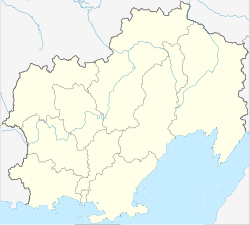
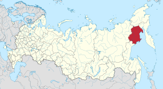
Okhotsk is an urban locality and the administrative center of Okhotsky District of Khabarovsk Krai, Russia, located at the mouth of the Okhota River on the Sea of Okhotsk. Population: 4,215 (2010 Census); 5,738 (2002 Census); 9,298 (1989 Census).

La Pérouse Strait, or Sōya Strait, is a strait dividing the southern part of the Russian island of Sakhalin (Karafuto) from the northern part of the Japanese island of Hokkaidō, and connecting the Sea of Japan on the west with the Sea of Okhotsk on the east.
Gerasim Grigoryevich Izmaylov was a Russian navigator involved in the Russian colonization of the Americas and in the establishment of the colonies of Russian America in Alaska. He was responsible for the first detailed maps of the Aleutian Islands.

Chirinkotan is an uninhabited volcanic island located in the centre of the Kuril Islands chain in the Sea of Okhotsk in the northwest Pacific Ocean. Its name is derived from the Ainu language for "mudslide". It is located 3 kilometres west of Ekarma, its nearest neighbor.
Sea Lion Rock, is a rock islet in the Commander Islands archipelago, in the Bering Sea, the Russian Far East.

Iony Island, or Jonas' Island, formerly Ostrov Svyatogo Iony, is a small island in the Sea of Okhotsk.

The Yam Islands, Yamsky Islands or Yamskiye Islands, is a small island group located close to the coast in the northern Sea of Okhotsk. Administratively the Yam Islands belong to the Magadan Oblast of the Russian Federation.

Kamen Opasnosti is an islet group of rocks, in La Pérouse Strait and the Sea of Okhotsk.

Kekurny Island is a very small island in the Gertner Inlet of Taui Bay, in the Sea of Okhotsk, within Magadan Oblast, Russian Far East.
Khalpili Islands is an archipelago in the Sea of Okhotsk of the North Pacific region, in Northeast Asia.
Shelikan, also Ostrovok Shelikan, is a coastal islet in the Sea of Okhotsk near Magadan. It lies on the south side of Amakhton Bay.

Zubchatyy Island is an uninhabited island in the Shelikhov Gulf of the northeastern Sea of Okhotsk.
Reyneke Island is an island in the Sea of Okhotsk, administratively part of Khabarovsk Krai, Russia. The uninhabited island lies 45 kilometres to the south-east of Menshikov Island, and has an area of approximately 7 kilometres in length and a maximum width of 1.6 kilometres. It is a mountainous island located close to a headland of the continental shore, separated from mainland Khabarovsk Krai by a 45 kilometres wide sound.

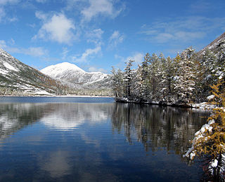
Shantar Islands National Park covers both the terrestrial and maritime surroundings of the Shantar Islands, a group of 15 currently uninhabited islands that lie close to the coast of Khabarovsk Krai, in the Sea of Okhotsk in the Russian Far East. Most of the islands are moderately mountainous, with rugged cliffs; the highest point is 720 m. Situated just to the east of the westernmost, shallowest and calmest bay in the Sea of Okhotsk, the area around the islands is an important area for marine mammals - including Steller Sea Lions, seals, and many species of cetacean - plus spawning salmon and very large colonies of birds. The park was formerly a state nature reserve, but re-established as a federal national park in 2013 with the stated purpose of protecting the habitat of vulnerable species, and supporting the scientific study and ecological tourism of the area. The Shantar Islands are located in the Tuguro-Chumikansky District of Khabarovsk Krai. The park is overseen by the Russian Ministry of Natural Resources.
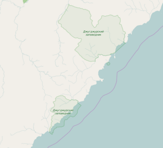
Dzhugdzursky Nature Reserve is a Russian 'zapovednik' on the coast of the Sea of Okhotsk, on the territory of Ayano-Maisky region of the Khabarovsk Territory in the Russian Far East. With over 8,000 km2 of land area and over 500 km2 of marine area, it is the largest of the six nature reserves in Khabarovsk Krai. It supports spawning streams into the Okhotsk Sea for chum, pink salmon and coho salmon.

Prokofyeva is a small island in the Sea of Okhotsk. It is one of the Shantar Islands. It lies to the northeast of Bolshoy Shantar Island.
Ptichy Island is the name of several islands in the Russian Far East.
The Okhotsk-Manchurian taiga ecoregion is an area of coniferous forests in the Russian Far East, covering the Amur River delta, the west coast of the Okhotsk Sea, and the rugged extension of the northern Sikhote-Alin Mountains that run southwest-to-northeast through the Primorsky and Khabarovsk regions. It is the southernmost taiga forest in Eurasia. The ecoregion is distinguished from surrounding ecoregions by the slightly warmer climate due to the maritime influence and the shield of the mountains to the west, and by the mixing of flora and fauna species from Okhotsk-Kamchatka communities to the north and Manchurian species from the south. The forest at lower altitudes is "light taiga", and "dark taiga" at higher altitudes.