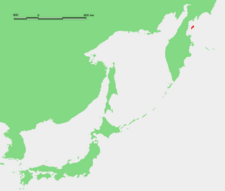
The Sea of Okhotsk is a marginal sea of the western Pacific Ocean. It is located between Russia's Kamchatka Peninsula on the east, the Kuril Islands on the southeast, Japan's island of Hokkaido on the south, the island of Sakhalin along the west, and a stretch of eastern Siberian coast along the west and north. Its northeast corner is the Shelikhov Gulf. The sea is named for the port of Okhotsk, itself named for the Okhota River.

Atlasov Island, known in Russian as Ostrov Atlasova (Остров Атласова), or in Japanese as Araido (阿頼度島), is the northernmost island and volcano and also the highest volcano of the Kuril islands, part of the Sakhalin Oblast in Russia. The Russian name is sometimes rendered in English as Atlasova Island. Other names for the island include Uyakhuzhach, Oyakoba (Ainu) and Alaid, the name of the volcano on the island.

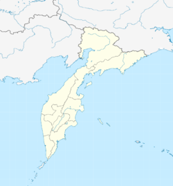
The Kamchatka Peninsula is a 1,250-kilometre-long (777 mi) peninsula in the Russian Far East, with an area of about 270,000 km2 (100,000 sq mi). The Pacific Ocean and the Sea of Okhotsk make up the peninsula's eastern and western coastlines, respectively. Immediately offshore along the Pacific coast of the peninsula runs the 10,500-metre-deep (34,449 ft) Kuril–Kamchatka Trench.

The Kuril–Kamchatka Trench or Kuril Trench is an oceanic trench in the northwest Pacific Ocean. It lies off the southeast coast of Kamchatka and parallels the Kuril Island chain to meet the Japan Trench east of Hokkaido. It extends from a triple junction with the Ulakhan Fault and the Aleutian Trench near the Commander Islands, Russia, in the northeast, to the intersection with the Japan Trench in the southwest.

Many major earthquakes have occurred in the region of the Kamchatka Peninsula in far eastern Russia. Events in 1737, 1923 and 1952, were megathrust earthquakes and caused tsunamis. There are many more earthquakes and tsunamis originating from the region.
Karaginsky Island or Karaginskiy Island is an island in the Karaginsky Gulf of the Bering Sea. The 40-kilometre (25 mi)-wide strait between the Kamchatka Peninsula and this island is called Litke Strait. Karaginsky Island is a Ramsar site.

The Shantar Islands are a group of fifteen islands located off the northwestern shore of the Sea of Okhotsk east of Uda Gulf and north of Academy Bay. Most of the islands have rugged cliffs, but they are of moderate height; the highest point in the island group is 720 metres. The name of the island group has its origins in the Nivkh language from the word ч’андь č’and’ meaning "to be white".

Baydukov Island, formerly Langr Island or Bol'shoy Langr Island, is a coastal island in the southern end of the Sea of Okhotsk. It is located southeast of Chkalov Island, off Schastya Bay, facing the northwestern tip of Sakhalin.
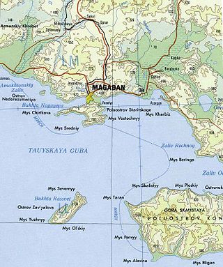
Zavyalov Island, formerly Ola Island, is a relatively large island in the Sea of Okhotsk, northwestern Pacific. It is located on the eastern side of Taui Bay, 20 km (12 mi) west of Cape Taran, Koni Peninsula, about 50 km (31 mi) south of the city of Magadan.
Trety Island or Treti Island is a relatively large island in the western shores of the Shelikhov Bay, at the northern end of the Sea of Okhotsk. It is located 4 km to the south of a peninsula that encloses a small bay in an area that is largely uninhabited.

The Spafaryev Islands, or Spafaryev Island, a relatively large double island, are located in the Sea of Okhotsk. It was formerly known as Korovi Island. It lies 7 km east of the Antamlan Peninsula, the southernmost peninsula enclosing the Taui Bay from its western side.
The 1952 Severo-Kurilsk earthquake struck off the coast of the Kamchatka Peninsula. The 9.0 Mw earthquake triggered a major tsunami that hit Severo-Kurilsk, Kuril Islands, Sakhalin Oblast, Russian SFSR, USSR, on 5 November 1952 at 04:58 local time. This led to the destruction of many settlements in Sakhalin Oblast and Kamchatka Oblast, while the main impact struck the town of Severo-Kurilsk. It was the most powerful earthquake ever recorded in Russia, and the fifth most powerful earthquake ever recorded in the world since modern seismography began in 1900.

Umara Island is an island in the Sea of Okhotsk on the south side of Odyan Bay.
Telan Island, also Ostrov Telan, is an island in the Sea of Okhotsk, roughly 1 mile south-southwest of Mys Vnutrenniy. It is described as "a very conspicuous island resembling a castle."
Kusova or Kusov Island is a small island in the Shantar Islands in the Sea of Okhotsk. It lies southeast of Bolshoy Shantar Island.
Reyneke Island is an island in the Sea of Okhotsk, administratively part of Khabarovsk Krai, Russia. The uninhabited island lies 45 kilometres to the south-east of Menshikov Island, and has an area of approximately 7 kilometres in length and a maximum width of 1.6 kilometres. It is a mountainous island located close to a headland of the continental shore, separated from mainland Khabarovsk Krai by a 4.5 kilometres wide sound.
Rovnyy Island or Arka Island is an island in Shelikhov Bay, Sea of Okhotsk.
Konus Island is an island in Shelikhov Bay, Sea of Okhotsk.
Ivyinichaman is an island in Shelikhov Bay, Sea of Okhotsk.
Ptichy Island is a small island in the Sea of Okhotsk.