
The Illawarra is a coastal region in the southeast of the Australian state of New South Wales. It is situated immediately south of Sydney and north of the South Coast region. It encompasses the two cities of Wollongong, Shellharbour and the coastal town of Kiama. Wollongong is the largest city of the Illawarra with a population of 240,000, then Shellharbour with a population of 70,000 and Kiama with a population of 10,000. These three cities have their own suburbs. Wollongong stretches from Otford in the north to Windang in the south, with Maddens Plains and Cordeaux in the west.
Shellharbour is a suburb located in the Illawarra region of New South Wales, Australia. It also gives its name to the local government area, City of Shellharbour, and its central business district, Shellharbour City Centre.

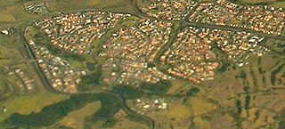
Warilla is a seaside suburb of the City of Shellharbour, Australia within the Wollongong urban area. It is one of the more established areas and is between the suburbs of Mount Warrigal in the west, Barrack Heights and Barrack Point in the south and Lake Illawarra in the north.
Warilla High School is a government-funded co-educational comprehensive secondary day school, located in Barrack Heights, a suburb of the City of Shellharbour, in the Illawarra region of New South Wales, Australia.

The City of Shellharbour is a local government area in the Illawarra region of New South Wales, Australia. The city is located about 100 kilometres (62 mi) south of Sydney and covers the southern suburbs of the Wollongong urban area centred on Shellharbour and it had an estimated population of 68,460 at the 2016 census.

Oak Flats is a suburb of Shellharbour, New South Wales, Australia situated on the south western shores of Lake Illawarra and within the Illawarra region of New South Wales. It is a residential area, which had a population of 6,415 at the 2016 census.

Shellharbour Junction railway station is a railway station located in Dunmore in the City of Shellharbour, New South Wales, Australia, on the Illawarra railway line. The station is served by NSW TrainLink South Coast Line trains traveling south to Kiama and north to Wollongong and Sydney. Premier Illawarra operates a connecting bus service from the station to Shellharbour.
Stockland Shellharbour is a large indoor/outdoor shopping centre in the Shellharbour City Centre of the Illawarra region.
Shellharbour is an electoral district of the Legislative Assembly in the Australian state of New South Wales. It is represented by Anna Watson who won Labor preselection after the former member Lylea McMahon decided not to contest the 2011 election.

Shellharbour Airport, formerly Illawarra Regional Airport, also referred as Albion Park Aerodrome or Wollongong Airport, is an airport located in Albion Park Rail, New South Wales, Australia.

Barrack Heights is a suburb of the City of Shellharbour in New South Wales, Australia in the local government area of the same name. Many institutions are located in Barrack Heights, including Shellharbour Public Hospital, Shellharbour Private Hospital, Warilla Bowling Club, Warilla Sports Club and Warilla High School.

Mount Warrigal is a large suburb of Shellharbour, New South Wales, Australia. The population, according to the 2016 Australian Census, was 4,909. The suburb is in the Shellharbour City LGA.

Shellharbour City Centre is the central business district of the City of Shellharbour, located in the Illawarra region of New South Wales, Australia. Its name reflects its status as the commercial and administrative centre for the City of Shellharbour local government area, and is home to the Council Administration Centre, Stockland Shellharbour shopping centre, cinemas and other retail shops. In recent years, apartment buildings have become more common within the district.
Shell Cove is a seaside suburb in the Shellharbour area located just south of Wollongong, New South Wales, Australia. Shell Cove adjoins Bass Point and Killalea State Park and includes a variety of facilities and amenities such as: parks and bush reserves, The Links Golf Course, Shell Cove Public School & pre-schools, Shellharbour Anglican College, Family Health Medical Centre and of course The newly developed Shell Cove Marina.
The Shellharbour City Dragons are an Australian rugby league football club based in the Shellharbour, New South Wales. They currently are not competing in any competitions and formerly competed in the New South Wales Cup in 2009 and 2010 and acted as a feeder club to the NRL club St. George Illawarra Dragons.

The Shellharbour City Sharks are a Country Rugby League club founded in 1920 located on the South Coast of NSW that compete in the South Coast Group 7 competition.

Flinders is a southern suburb of Shellharbour, located in the Illawarra region of New South Wales, Australia. Flinders is located approximately 111 kilometres south-southwest of New South Wales' capital city of Sydney. Flinders is close to a number of beaches and to and over 60 hectares of green open spaces including bush reserves, waterways and landscaped parks. Flinders adjoins neighbouring suburbs of Shellharbour, Shell Cove, Blackbutt and Shell Heights.
Tullimbar is a suburb situated in the Macquarie Valley in the City of Shellharbour, New South Wales, Australia.
Dunmore is a largely rural suburb of Shellharbour City in New South Wales, Australia. Dunmore is bisected north to south by the South Coast railway line and the Princes Highway.

