Redfern is an inner southern suburb of Sydney located 3 kilometres (1.9 mi) south of the Sydney central business district and is part of the local government area of the City of Sydney. Strawberry Hills is a locality on the border with Surry Hills. The area experienced the process of gentrification and is subject to extensive redevelopment plans by the state government, to increase the population and reduce the concentration of poverty in the suburb and neighbouring Waterloo.

Beverly Hills is a southern suburb of Sydney, in the state of New South Wales, Australia. Beverly Hills is located 15 kilometres southwest of the Sydney central business district and is part of the St George area and is split between the local government areas of the Georges River Council and the City of Canterbury-Bankstown. The postcode is 2209, which it shares with neighbouring Narwee.

Kiama is a coastal country town 120 kilometres south of Sydney in the Illawarra. One of the main tourist attractions is the Kiama Blowhole. Kiama features several popular surfing beaches and caravan parks, and numerous alfresco cafes and restaurants. Its proximity to the south of Sydney makes it an attractive destination for many day-trippers and weekenders. Kiama also has historically been a farming and agricultural centre. Even to today it maintains a country and agricultural community with a weekly farmers markets held on Wednesday afternoons.

Surry Hills is an inner-east suburb of Sydney, in the state of New South Wales, Australia. Surry Hills is immediately south-east of the Sydney central business district in the local government area of the City of Sydney. Surry Hills is surrounded by the suburbs of Darlinghurst to the north, Chippendale and Haymarket to the west, Moore Park and Paddington to the east and Redfern to the south. It is often colloquially referred to as "Surry".
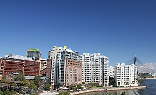
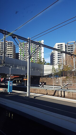
Pyrmont is an inner-city suburb of Sydney, in the state of New South Wales, Australia 2 kilometres south-west of the Sydney central business district in the local government area of the City of Sydney. It is also part of the Darling Harbour region. As of 2011, it is Australia's most densely populated suburb.

Burwood is a suburb in the Inner West of Sydney, in the state of New South Wales, Australia. It is 10 kilometres (6.2 mi) west of the Sydney central business district and is the administrative centre for the local government area of Municipality of Burwood.
Albion Park is a suburb situated in the Macquarie Valley in the City of Shellharbour, which is in turn one of the three local government areas that comprise the Wollongong Metropolitan Area, New South Wales, Australia. Although it is surrounded by a 'green belt' of farms, Albion Park had a population of 13,316 at the 2016 census.

Prospect is a suburb of Sydney, in the state of New South Wales, Australia. Prospect is located 32 kilometres west of the Sydney central business district in the local government area of the City of Blacktown and a small part of Cumberland City Council, is part of the Greater Western Sydney region. One of the oldest suburbs in Sydney, Prospect takes its name from the prominent nearby landmark of Prospect Hill - from the top of which people could get a prospect of the surrounding countryside.
Albion Park Rail is a suburb of Shellharbour, Australia situated in the Macquarie Valley (Shellharbour). The South Coast railway line was opened to the railway station and Bombo in 1887. At the time the nearest town was Albion Park, several kilometres away. Over time, houses were built around the railway station, and Albion Park Rail developed into a town in its own right, and with its own name.
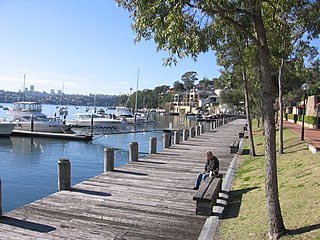
Birchgrove is a suburb in the Inner West of Sydney, in the state of New South Wales, Australia. Birchgrove is located five kilometres west of the Sydney central business district, in the local government area of the Inner West Council.

Pemulwuy is a suburb in Greater Western Sydney, in the state of New South Wales, Australia. Pemulwuy is located 30 kilometres west of the Sydney central business district in the local government area of the Cumberland Council. Pemulwuy is home to the highest point between the Blue Mountains and Sydney, the summit of Prospect Hill.

Dunmore railway station is a heritage-listed former railway station that was located on the South Coast railway line in Dunmore, City of Shellharbour, New South Wales, Australia. The station served the southern Wollongong suburb of Dunmore and indirectly Shellharbour and opened on 9 November 1887. The weatherboard station on Platform 2 dates from 1887. It is also known as the Shellharbour Railway Station Group, Shellharbour railway station and Dunmore Railway Station. The property was added to the New South Wales State Heritage Register on 2 April 1999.

Oak Flats railway station is a single-platform intercity train station located in Oak Flats, New South Wales, Australia, on the South Coast railway line. The station serves NSW TrainLink trains travelling south to Kiama and north to Wollongong and Sydney. Together with the Dunmore and later Shellharbour Junction stations, Oak Flats has long served as the rail connection for the coastal suburbs of the City of Shellharbour.

Bombo railway station is a heritage-listed single-platform intercity train station located at Bombo, in the Illawarra region of New South Wales, Australia. The stationn is served by the NSW TrainLink South Coast line, with trains traveling south to Kiama and north to Wollongong and Sydney. It was added to the New South Wales State Heritage Register on 2 April 1999.

Unanderra railway station is located on the South Coast railway line in the Wollongong suburb of Unanderra, New South Wales, Australia.

The City of Shellharbour is a local government area in the Illawarra region of New South Wales, Australia. The city is located about 100 kilometres (62 mi) south of Sydney and covers the southern suburbs of the Wollongong urban area centred on Shellharbour and it had an estimated population of 68,460 at the 2016 census.

Shellharbour Junction railway station is a railway station located in Dunmore in the City of Shellharbour, New South Wales, Australia, on the Illawarra railway line. The station is served by NSW TrainLink South Coast Line trains traveling south to Kiama and north to Wollongong and Sydney. Premier Illawarra operates a connecting bus service from the station to Shellharbour.

Bombo is a suburb of the Municipality of Kiama, in the Illawarra region of New South Wales, Australia. It is located 2 kilometres (1.2 mi) north of Kiama.
Croom is a rural locality of Wollongong in New South Wales, Australia, part of the state suburb of Dunmore. The name has been variously spelled Croomb, Croom and Croome. The locality shares its name with the village of Croom in County Limerick, Ireland – derived from the Irish cromadh, meaning bend.

Bass Point Reserve is a heritage-listed former cedar timber industry, Aboriginal camping, meeting place, pastoral property and basalt mine and now nature conservation and passive recreation area located at Boollwarroo Parade, Shell Cove in the Illawarra region of New South Wales, Australia. It is also known as Long Point. The property is owned by Department of the Environment and Shellharbour City Council. It was added to the New South Wales State Heritage Register on 18 January 2013.


