Barrack Heights, New South Wales

Last updated

Barrack Heights
Shellharbour,  New South Wales
Barrack Point Barrack Heights Aerial.jpg
Australia New South Wales location map blank.svg
Red pog.svg
Barrack Heights
Coordinates 34°33′54″S150°51′25″E / 34.56500°S 150.85694°E / -34.56500; 150.85694 Coordinates: 34°33′54″S150°51′25″E / 34.56500°S 150.85694°E / -34.56500; 150.85694
Population5,900 (2016 census) [1]
Postcode(s) 2528
Location16 km (10 mi) south of Wollongong
LGA(s) City of Shellharbour
State electorate(s) Shellharbour
Federal Division(s) Gilmore
Suburbs around Barrack Heights:
Mount Warrigal Warilla Warilla
Oak Flats, Shellharbour City Centre Barrack Heights Barrack Point
Blackbutt Blackbutt Shellharbour

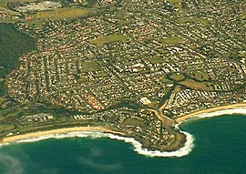
Barrack Heights is a suburb of the City of Shellharbour in New South Wales, Australia in the local government area of the same name. Many institutions are located in Barrack Heights, including Shellharbour Public Hospital, Shellharbour Private Hospital, Warilla Bowling Club, Warilla Sports Club and Warilla High School.

City of Shellharbour Local government area in New South Wales, Australia

The City of Shellharbour is a local government area in the Illawarra region of New South Wales, Australia. The City is located about 100 kilometres (62 mi) south of Sydney and covers the southern suburbs of the Wollongong urban area centred on Shellharbour and it had an estimated population of 68,460 at the 2016 census.

New South Wales State of Australia

New South Wales is a state on the east coast of Australia. It borders Queensland to the north, Victoria to the south, and South Australia to the west. Its coast borders the Tasman Sea to the east. The Australian Capital Territory is an enclave within the state. New South Wales' state capital is Sydney, which is also Australia's most populous city. In December 2018, the population of New South Wales was over 8 million, making it Australia's most populous state. Just under two-thirds of the state's population, 5.1 million, live in the Greater Sydney area. Inhabitants of New South Wales are referred to as New South Welshmen.

Australia Country in Oceania

Australia, officially the Commonwealth of Australia, is a sovereign country comprising the mainland of the Australian continent, the island of Tasmania, and numerous smaller islands. It is the largest country in Oceania and the world's sixth-largest country by total area. The neighbouring countries are Papua New Guinea, Indonesia, and East Timor to the north; the Solomon Islands and Vanuatu to the north-east; and New Zealand to the south-east. The population of 25 million is highly urbanised and heavily concentrated on the eastern seaboard. Australia's capital is Canberra, and its largest city is Sydney. The country's other major metropolitan areas are Melbourne, Brisbane, Perth, and Adelaide.

Contents

Barrack Heights is surrounded by the suburbs of Barrack Point, Blackbutt, Mount Warrigal, Oak Flats, Shellharbour, Shellharbour City Centre and Warilla.

Barrack Point, New South Wales Suburb of Illawarra, New South Wales, Australia

Barrack Point is a seaside suburb of the City of Shellharbour, New South Wales, Australia which sits within the southern Wollongong urban area. Surrounding suburbs are Warilla to the north, Barrack Heights to the west, and Shellharbour to the south.

Blackbutt, New South Wales Suburb of Shellharbour, New South Wales, Australia

Blackbutt is a southern suburb of Shellharbour, New South Wales, Australia. The eastern half of the suburb is occupied by the Blackbutt Forest Reserve.

Mount Warrigal, New South Wales Suburb of Shellharbour, New South Wales, Australia

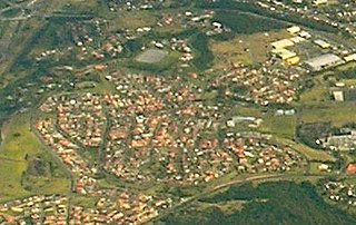
Mount Warrigal is a large suburb of Shellharbour, New South Wales, Australia. The population, according to the 2016 Australian Census, was 4,909. The suburb is in the Shellharbour City LGA.

Demography

The 2016 census revealed that 5,900 lived in the suburb of Barrack Heights. Indigenous peoples accounted for 5.0% of the population. [1]

Country of birth

England Country in north-west Europe, part of the United Kingdom

England is a country that is part of the United Kingdom. It shares land borders with Wales to the west and Scotland to the north. The Irish Sea lies west of England and the Celtic Sea to the southwest. England is separated from continental Europe by the North Sea to the east and the English Channel to the south. The country covers five-eighths of the island of Great Britain, which lies in the North Atlantic, and includes over 100 smaller islands, such as the Isles of Scilly and the Isle of Wight.

Italy republic in Southern Europe

Italy, officially the Italian Republic, is a Southern European country consisting of a peninsula delimited by the Alps and surrounded by several islands. Located in the middle of the Mediterranean sea and traversed along its length by the Apennines, Italy has a largely temperate seasonal and Mediterranean climate. The country covers a total area of 301,340 km2 (116,350 sq mi), and land area of 294,140 km2 (113,570 sq mi), and shares open land borders with France, Slovenia, Austria, Switzerland and the enclaved microstates of Vatican City and San Marino. Italy has a territorial exclave in Switzerland (Campione) and a maritime exclave in the Tunisian Sea (Lampedusa). With around 60 million inhabitants, Italy is the fourth-most populous member state of the European Union.

Scotland Country in Northwest Europe, part of the United Kingdom

Scotland is a country that is part of the United Kingdom. It covers the northern third of the island of Great Britain, with a border with England to the southeast, and is surrounded by the Atlantic Ocean to the north and west, the North Sea to the northeast, the Irish Sea to the south, and more than 790 islands, including the Northern Isles and the Hebrides.

Language spoken at home

English language West Germanic language

English is a West Germanic language that was first spoken in early medieval England and eventually became a global lingua franca. It is named after the Angles, one of the Germanic tribes that migrated to the area of Great Britain that later took their name, as England. Both names derive from Anglia, a peninsula in the Baltic Sea. The language is closely related to Frisian and Low Saxon, and its vocabulary has been significantly influenced by other Germanic languages, particularly Norse, and to a greater extent by Latin and French.

Macedonian language Language spoken in North Macedonia

Macedonian is a South Slavic language spoken as a first language by around two million people, principally in North Macedonia and the Macedonian diaspora, with a smaller number of speakers throughout the transnational region of Macedonia. It is the official language of North Macedonia and a recognized minority language in parts of Albania, Bosnia and Herzegovina, Romania, and Serbia.

Italian language Romance language

Italian is a Romance language of the Indo-European language family. Italian descended from the Vulgar Latin of the Roman Empire and, together with Sardinian, is by most measures the closest language to it of the Romance languages. Italian is an official language in Italy, Switzerland, San Marino and Vatican City. It has an official minority status in western Istria. It formerly had official status in Albania, Malta, Monaco, Montenegro (Kotor) and Greece, and is generally understood in Corsica and Savoie. It also used to be an official language in the former Italian East Africa and Italian North Africa, where it still plays a significant role in various sectors. Italian is also spoken by large expatriate communities in the Americas and Australia. Italian is included under the languages covered by the European Charter for Regional or Minority languages in Bosnia and Herzegovina and in Romania, although Italian is neither a co-official nor a protected language in these countries. Many speakers of Italian are native bilinguals of both Italian and other regional languages.

Related Research Articles

St Albans, Victoria Suburb of Melbourne, Victoria, Australia

St Albans is a suburb 15 km (9 mi) north-west of Melbourne, Victoria, Australia, located within the City of Brimbank local government area. St Albans recorded a population of 37,309 at the 2016 Census.

Shellharbour, New South Wales Suburb in New South Wales, Australia

Shellharbour is a suburb located in the Illawarra region of New South Wales, Australia. It also gives its name to the local government area, City of Shellharbour.

Riverwood, New South Wales Suburb of Sydney, New South Wales, Australia

Riverwood is a suburb in southern Sydney, in the state of New South Wales, Australia. Riverwood is located 18 kilometres south of the Sydney central business district and is part of the St George area. Riverwood is split between the local government areas of the Georges River Council and the Canterbury-Bankstown Council.

Algester, Queensland Suburb of Brisbane, Queensland, Australia

Algester is an outer suburb of City of Brisbane, Queensland, Australia. It is 18 kilometres (11 mi) south-west of the central business district. The suburb's population was 8,433 at the 2016 census. The suburbs of Algester, Calamvale and now Parkinson, sit on the southern border or boundary of the City of Brisbane local government area with suburbs of Logan City such as Browns Plains and Regents Park.

Prairiewood, New South Wales Suburb of Sydney, New South Wales, Australia

Prairiewood is a suburb of Sydney, in the state of New South Wales, Australia 34 kilometres west of the Sydney central business district, in the local government area of the City of Fairfield. It is part of the Greater Western Sydney region.

Wavell Heights, Queensland Suburb of Brisbane, Queensland, Australia

Wavell Heights is a suburb in the City of Brisbane, Queensland, Australia. In the 2016 census, Wavell Heights had a population of 9,684 people.

Warilla, New South Wales Suburb of City of Shellharbour, New South Wales, Australia

Warilla is a seaside suburb of the City of Shellharbour, Australia within the Wollongong urban area. It is one of the more established areas and is between the suburbs of Mount Warrigal in the west, Barrack Heights and Barrack Point in the south and Lake Illawarra in the north.

Warilla High School

Warilla High School is a government-funded co-educational comprehensive secondary day school, located in Barrack Heights, a suburb of the City of Shellharbour, in the Illawarra region of New South Wales, Australia.

Coniston, New South Wales Suburb of Wollongong, New South Wales, Australia

Coniston is a suburb of Wollongong in New South Wales. At the 2016 census, it had a population of 2,268.

Warrawong, New South Wales Suburb of Wollongong, New South Wales, Australia

Warrawong is a suburb of Wollongong, in the Illawarra region of New South Wales, Australia. It is situated on the northeast corner of Lake Illawarra.

Cringila, New South Wales Suburb of Wollongong, New South Wales, Australia

Cringila is a densely populated southern suburb in the city of Wollongong, New South Wales, Australia. The suburb is bounded by Berkeley, Unanderra, Lake Heights and Warrawong.

Stafford Heights, Queensland Suburb of Brisbane, Queensland, Australia

Stafford Heights is a suburb in the City of Brisbane, Queensland, Australia.

Electoral district of Shellharbour state electoral district of New South Wales, Australia

Shellharbour is an electoral district of the Legislative Assembly in the Australian state of New South Wales. It is represented by Anna Watson who won Labor preselection after the former member Lylea McMahon decided not to contest the 2011 election.

Figtree, New South Wales Suburb of Wollongong, New South Wales, Australia

Figtree is an inner western suburb of Wollongong, New South Wales, Australia. It is southwest of West Wollongong and connected to Wollongong by the Princes Highway and The Avenue.

Kane Linnett Australian rugby league player

Kane Linnett is a Scotland international rugby league footballer who plays as a centre or in the second-row for Hull Kingston Rovers in the Super League.

Bilambil Heights Town in New South Wales, Australia

Bilambil Heights is a town located in north-eastern New South Wales, Australia, in the Tweed Shire.

References

  1. 1 2 Australian Bureau of Statistics (27 June 2017). "Barrack Heights (State Suburb)". 2016 Census QuickStats. Retrieved 14 July 2017. OOjs UI icon edit-ltr-progressive.svg