
New South Wales is a state on the east coast of Australia. It borders Queensland to the north, Victoria to the south, and South Australia to the west. Its coast borders the Coral and Tasman Seas to the east. The Australian Capital Territory and Jervis Bay Territory are enclaves within the state. New South Wales' state capital is Sydney, which is also Australia's most populous city. In December 2023, the population of New South Wales was over 8.3 million, making it Australia's most populous state. Almost two-thirds of the state's population, 5.3 million, live in the Greater Sydney area.

Wales is a country that is part of the United Kingdom. It is bordered by the Irish Sea to the north and west, England to the east, the Bristol Channel to the south, and the Celtic Sea to the south-west. As of 2021, it had a population of 3.2 million. It has a total area of 21,218 square kilometres (8,192 sq mi) and over 2,700 kilometres (1,680 mi) of coastline. It is largely mountainous with its higher peaks in the north and central areas, including Snowdon, its highest summit. The country lies within the north temperate zone and has a changeable, maritime climate. Its capital and largest city is Cardiff.

Ku-ring-gai Council is a local government area in Northern Sydney, in the state of New South Wales, Australia. The area is named after a fictional Aboriginal language group.

The Hills Shire is a local government area in the Greater Sydney region of Sydney, New South Wales, Australia. The area is north-west of the Sydney central business district, and encompasses 401 square kilometres (155 sq mi) stretching from the M2 Hills Motorway in the south to Wisemans Ferry on the Hawkesbury River in the north. The Hills Shire had a population of 191,876 as of the 2021 census.
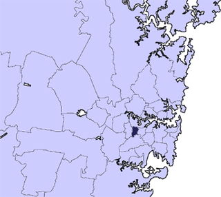
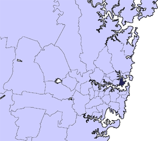
The Municipality of Burwood is a local government area in the inner-west of Sydney, in the state of New South Wales, Australia. The mayor of the Municipality is Cr. John Faker, a member of the Labor Party. The municipality is 7 km2, making it the second smallest Local Government Area in New South Wales, being larger than only Hunter's Hill.

Camden Council is a local government area in the Macarthur region of Sydney, in the state of New South Wales, Australia. The area is located south west of the Sydney central business district and comprises 201 square kilometres (78 sq mi) with an estimated population at the 2021 census of 119,325. The mayor of Camden is Cr. Ashleigh Cagney, a member of the Labor Party.

The City of Campbelltown is a local government area in the Macarthur region of south-western Sydney, in New South Wales, Australia. The area is located about 55 kilometres (34 mi) south west of the Sydney central business district and comprises 312 square kilometres (120 sq mi).

The Fairfield City Council is a local government area in the west of Sydney, in the state of New South Wales, Australia. The council was first incorporated as the "Municipal District of Smithfield and Fairfield" on 8 December 1888, and the council's name was changed to the "Municipality of Fairfield" in 1920, before being proclaimed a city in 1979. The City of Fairfield comprises an area of 102 square kilometres (39 sq mi) and as of the 2021 census had a population of 208,475. The mayor of the City of Fairfield is Cr. Frank Carbone, the first popularly-elected independent mayor of Fairfield.

The Municipality of Hunter's Hill or Hunter's Hill Council is a local government area on the Lower North Shore of Sydney, in the state of New South Wales, Australia. The municipality was first proclaimed in 1861, which includes the suburbs of Hunters Hill, Woolwich, Huntleys Point, Tarban, Henley and part of Gladesville. As at the 2021 census, the Municipality had an estimated population of 13,559. At 5.7 square kilometres (2.2 sq mi), the Municipality is, by area, the smallest local government area in New South Wales and its boundaries remain mostly unaltered since its establishment in 1861. The mayor of Hunters Hill since 4 December 2021 is Clr. Zac Miles.

The Lane Cove Council is a local government area located on the Lower North Shore of Sydney, New South Wales, Australia. The administrative seat of Lane Cove is located 10 kilometres (6.2 mi) north-west of the Sydney central business district.
Mosman Council is a local government area on the Lower North Shore of Sydney, New South Wales, Australia.

The City of Penrith is a local government area in the state of New South Wales, Australia. The seat of the city is located in Penrith, located within Sydney about 50 kilometres (31 mi) west of Sydney central business district. It occupies part of the traditional lands of the Darug people. First incorporated as a municipality on 12 May 1871, on 1 January 1949, the municipalities of Penrith, St Marys and Castlereagh and part of the Nepean Shire amalgamated to form a new Municipality of Penrith. Penrith was declared a City on 21 October 1959, and expanded westwards to include Emu Plains and Emu Heights, formerly part of the City of Blue Mountains, on 25 October 1963. As of the 2021 census the City of Penrith had an estimated population of 217,664.

The City of Randwick is a local government area in the Eastern Suburbs of Sydney, New South Wales, Australia. Established in 1859, Randwick is the second-oldest local government area in New South Wales, after the City of Sydney. It comprises an area of 36 square kilometres (14 sq mi) and as per the 2021 census had a population of 134,252.

The City of Ryde is a local government area in the Northern Sydney region, in New South Wales, Australia. It was first established as the Municipal District of Ryde in 1870, became a municipality in 1906 and was proclaimed as the City of Ryde in 1992.
Mount Murray is a mountain in New South Wales, Australia with an elevation of 780 metres (2,560 ft) above sea level. It is located six kilometres (3.7 mi) outside Robertson. The mountain is named after Sir George Murray. Mount Murray is also the name of a location at the top of the Macquarie Pass on the Illawarra Highway.

The states and territories are the second level of government of Australia. The states are partially sovereign, administrative divisions that are self-governing polities, having ceded some sovereign rights to the federal government. They have their own constitutions, legislatures, executive governments, judiciaries and law enforcement agencies that administer and deliver public policies and programs. Territories can be autonomous and administer local policies and programs much like the states in practice, but are still legally subordinate to the federal government.

The Municipality of Kiama is a local government area in the Illawarra region of New South Wales, Australia. The area is situated south of Shellharbour and the City of Wollongong and is located adjacent to the Pacific Ocean, the Princes Highway and the South Coast railway line.

Tamworth Regional Council is a local government area in the New England region of New South Wales, Australia. The area under administration is located adjacent to the New England Highway and the Main North railway line. It was established in March 2004 through the amalgamation of the former City of Tamworth with surrounding shires of Barraba, Manilla, Nundle and Parry.

Brewarrina Shire is a local government area in the Orana region of New South Wales, Australia. The Shire is located adjacent to the Darling River, which is known as the Barwon River upstream from Bourke; and located adjacent to the Kamilaroi Highway. The northern boundary of the Shire is located adjacent to the border between New South Wales and Queensland. The Shire is a wool and cotton growing area.
Curramore is a rural locality in the Sunshine Coast Region, Queensland, Australia. In the 2021 census, Curramore had a population of 198 people.
