
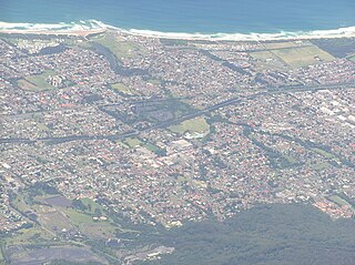
Wollongong is a city located in the Illawarra region of New South Wales, Australia. The name is believed to originate from the Dharawal language, meaning either 'five islands/clouds', 'ground near water' or 'sound of the sea'. Wollongong lies on the narrow coastal strip between the Illawarra Escarpment and the Pacific Ocean, 85 kilometres south of central Sydney. Wollongong had an estimated urban population of 302,739 at June 2018, making it the third-largest city in New South Wales after Sydney and Newcastle and the tenth-largest city in Australia by population. The city's current Lord Mayor is Tania Brown who was elected in 2024.
Shellharbour is a suburb located in the Illawarra region of New South Wales, Australia. It also gives its name to the local government area, City of Shellharbour, and its central business district, Shellharbour City Centre.

Bombo is a suburb of the Municipality of Kiama, in the Illawarra region of New South Wales, Australia. It is located 2 kilometres (1.2 mi) north of Kiama.
Cringila is a southern suburb of the city of Wollongong, New South Wales, Australia. The suburb is bounded by Berkeley, Unanderra, Lake Heights and Warrawong.
Kilaben Bay is a suburb of the city of Lake Macquarie in the Hunter Region of New South Wales, Australia.

Bar Beach is an inner city suburb of Newcastle, New South Wales, Australia, located 1.6 km (1.0 mi) southwest of Newcastle's central business district. The suburb is named for the beach that extends along its eastern border.

The Cordeaux River, a perennial river of the Hawkesbury-Nepean catchment, is located in the Southern Highlands and Macarthur regions of New South Wales, Australia.
East Corrimal is a northern seaside suburb of Wollongong, New South Wales, Australia. Predominantly residential, the suburb includes Corrimal High School and Corrimal East Public School, as well as Corrimal Beach and Corrimal Beach Tourist Park at the eastern end. A public park was opened in 1959 to the west of the high school and north of the primary school, named Phil Adams Park, which features tall trees, paths and several seats.
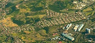
Huntley is a suburb of the City of Wollongong to the west of Dapto. At the 2021 census, it had a population of 66.
Avon is a suburb of the City of Wollongong and Wingecarribee Shire, both in New South Wales, Australia. It is "a locality within Metropolitan Catchment Area on the western side of Illawarra Range about 4km west of Wongawilli and about 5km north west of Avondale". At the 2021 census, it had no population.
Mount Saint Thomas is a suburb of Wollongong in New South Wales, lying east of Figtree and South west of Wollongong. At the 2021 census, it had a population of 1,449.
Haywards Bay is a suburb of the City of Wollongong to the south of Dapto. At the 2021 census, it had a population of 1,280.
Croom is a rural locality of Wollongong in New South Wales, Australia, part of the state suburb of Dunmore. The name has been variously spelled Croomb, Croom and Croome. The locality shares its name with the village of Croom in County Limerick, Ireland – derived from the Irish cromadh, meaning bend.
Brownsville is a suburb of the City of Wollongong.
Lake Heights is a coastal suburb east of Berkeley and south of Cringila in the City of Wollongong. At the 2021 census, it had a population of 4,105.
Kembla Grange is a suburb west of Berkeley, in the City of Wollongong. At the 2021 census, it had a population of 1,452.

Fernhill is a suburb west of Towradgi, in the City of Wollongong. At the 2021 census, it had a population of 987.
North Macquarie is a suburb of Wollongong in the City of Shellharbour in New South Wales, Australia, 4 km west of Albion Park.
Yellow Rock Ridge is a suburb of Wollongong in the City of Shellharbour in New South Wales, Australia.
